Last updated December 2023 | Words and photos by Vietnam Coracle

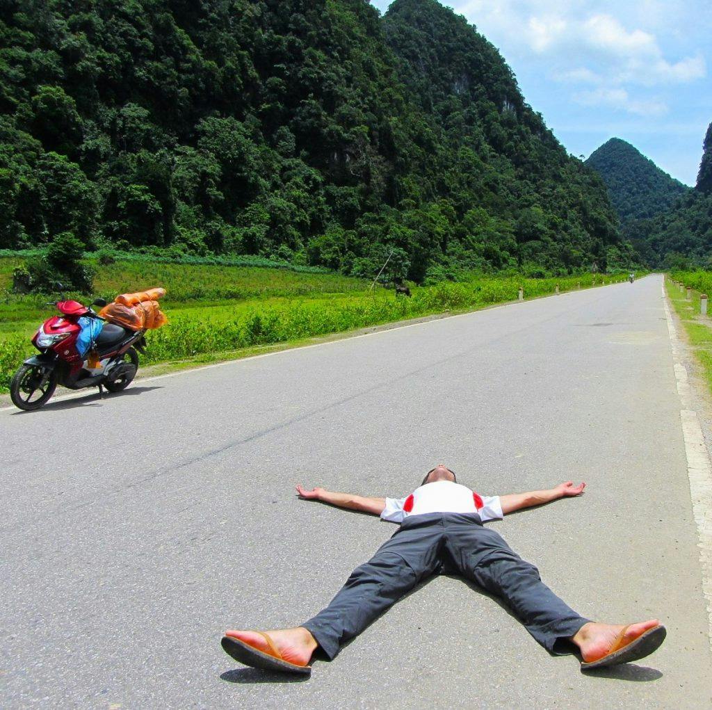
Tom Divers is the founder and creator of Vietnam Coracle. He’s lived, travelled and worked in Vietnam since 2005. Born in London, he travelled from an early age, visiting over 40 countries (he first visited Vietnam in 1999). Now, whenever he has the opportunity to make a trip, he rarely looks beyond Vietnam’s borders and his trusty motorbike, Stavros. Read more about Tom on the About Page, Vietnam Times and ASE Podcast.
Vietnam has some of the best riding roads in the world. This is a subjective statement, but I believe it to be true and I have compiled a list of 30 of the greatest roads in Vietnam for motorbiking to illustrate the point. Although I don’t claim to have ridden all the roads in Vietnam, I’ve spent the best part of the last 15 years riding a quarter of a million kilometres across the nation: always looking for great roads, fantastic scenery, interesting places, good food and engaging people. And still the roads in Vietnam continue to amaze me, surprise me and thrill me. Based on this experience, I’ve mapped, illustrated and described 30 great roads for motorbiking in Vietnam.


[Back Top]
30 GREAT ROADS IN VIETNAM
30 of the Best Paved Roads for Motorbiking in Vietnam
All 30 roads in this list meet the following criteria: smooth surface (no trails or off-road), good condition, great scenery, twists and turns, climbs and descents, meanders and straights, light traffic and decent width. In short, these roads are all enjoyable to ride, relatively safe, and pass through fantastic landscape. I’ve plotted every road on my map, illustrated each one with a photograph, and written a description including direct links to my motorbike guides featuring each road. Neither I nor anyone else can claim to have ridden all of Vietnam’s roads – that would be preposterous. My only qualifications for writing this list are the time I’ve spent on Vietnam’s roads and the distance I’ve covered. I know there are many, many more great riding roads in the nation. The following list is not in order of preference:
*Please note: road conditions in Vietnam are in a constant state of flux: I can’t guarantee that these roads will be forever ‘great’. Check the comments section at the bottom of this page for any updates on road conditions or suggestions of other great riding roads in Vietnam. Thank you.

CONTENTS:
[View Map]
- 1. Tây Nghệ An Road (Mường Xén to Mường Lống) 60km
- 2. National Highway QL279 (Mường Kim to Minh Thắng) 105km
- 3. National Highway QL3 (Cao Bằng to Nà Phặc) 80km
- 4. National Highway QL4H (Chà Cang to Mường Nhé) 80km
- 5. Provincial Road DT520/QL16 (Quan Hóa to Mường Lát) 95km
- 6. National Highway QL55/QL55B (La Gi to Bảo Lộc) 140km
- 7. Western Ho Chi Minh Road (QL15) (Khe Sanh to Khe Gát) 240km
- 8. Trường Sơn Đông Road (Đắk Pơ to Xã Hiếu) 105km
- 9. National Highway QL7A (Anh Sơn to Nậm Cắn) 150km
- 10. Núi Chúa Coast Road (DT702) (Ninh Chữ to Mỹ Thanh) 60km
- 11. National Highway QL32 (Ba Khe to Bình Lư) 230km
- 12. Provincial Road DT725 (Ma Đa Gui to Hoài Đức) 140km
- 13. Đường Ven Biển Ninh Thuận (Cà Ná to Ninh Chữ) 40km
- 14. National Highway QL4D (Sa Pa to Phong Thổ) 100km
- 15. National Highway QL27/QL20 (Tân Sơn to Đà Lạt) 70km
- 16. National Highway AH13/QL6/QL279 (Sơn La to Điện Biên Phủ) 155km
- 17. National Highway DT722 (Suối Vàng Lake to Đưng K’Nớ) 50km
- 18. Provincial Road DT206/QL3 (Cao Bằng to Bản Giốc) 80km
- 19. Ho Chi Minh Road (QL15) (Khe Gát to Tân Ấp) 90km
- 20. Hải Vân Pass (Cu Đê to Lăng Cô) 25km
- 21. National Highway QL27C (Diên Khánh to Đà Lạt) 120km
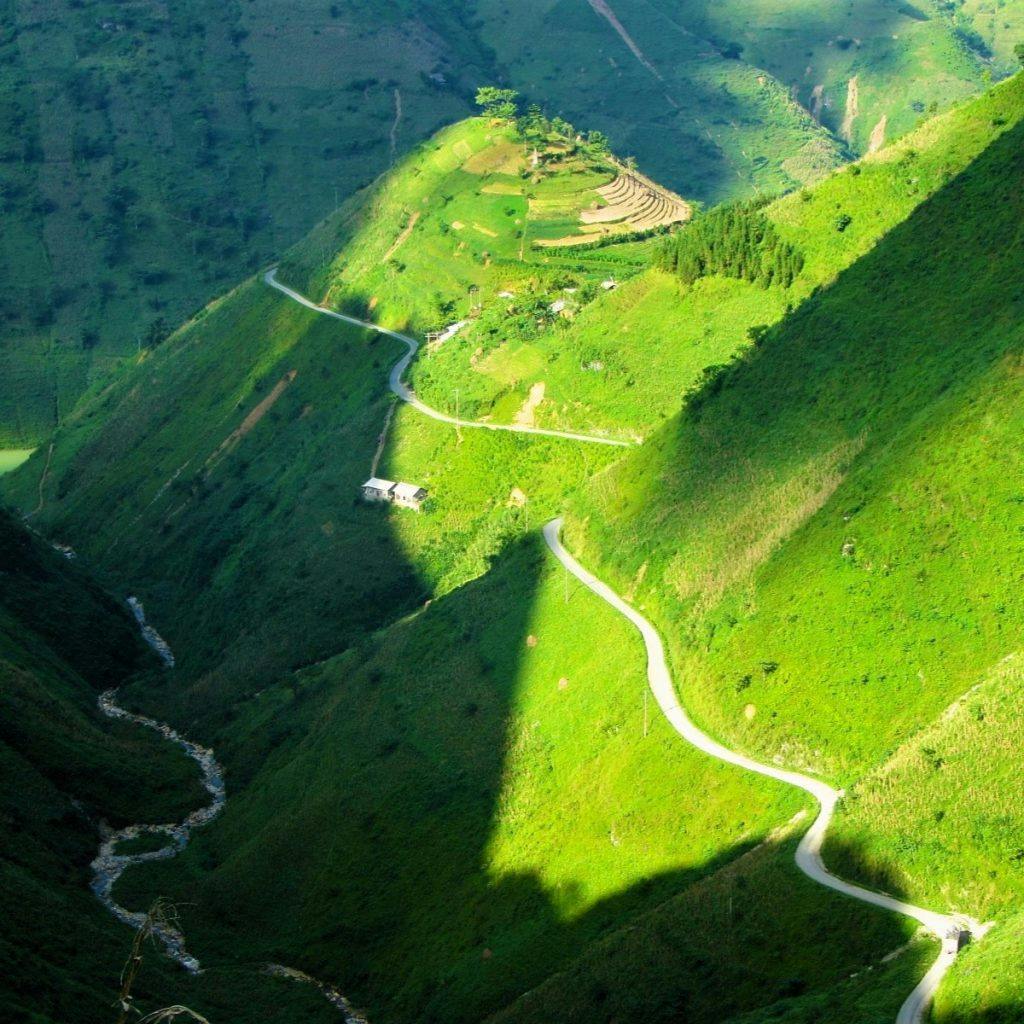
- 22. Mã Pí Lèng Pass (QL4C) (Đồng Văn to Mèo Vạc) 20km
- 23. Provincial Road DT716/DT716B (Phú Hải to Phan Rí Cửa) 60km
- 24. Provincial Road DT128 (Lai Châu to Sìn Hồ) 55km
- 25. Côn Sơn Island Coast Road (National Park HQ to Đầm Trầu) 35km
- 26. Ho Chi Minh Road (QL14) (Thạnh Mỹ to Đa Krông Bridge) 250km
- 27. National Highway QL91B (Đại Ngãi Ferry to Mỏ Ó Beach) 40km
- 28. National Highway QL279 (Chợ Rã to Na Hang) 85km
- 29. Đường Bao Biển Hạ Long-Cẩm Phả (Bãi Cháy Bridge to Cẩm Phả) 30km
- 30. Provincial Road TL48/DT973 (Hàm Ninh to Cửa Cạn) 50km
*Road Safety & Disclaimer: Riding a motorbike in Vietnam – or anywhere in the world – has its dangers. I would hope & expect anyone who chooses to pursue a self-drive road trip based on the information on this website does so with care, respect & due diligence. I encourage careful riding & adherence to road rules, but I am not responsible for the legality or manner in which you ride, nor any negative consequences which may result from your decision to ride a motorbike in Vietnam: you do so at your own risk. Read more >
ROAD MAP:
30 Great Riding Roads in Vietnam
Support My Website
Please donate or become a patron if you enjoy my work. Vietnam Coracle is totally free & independent. I do not receive payment for anything I write.
Thank you, Tom
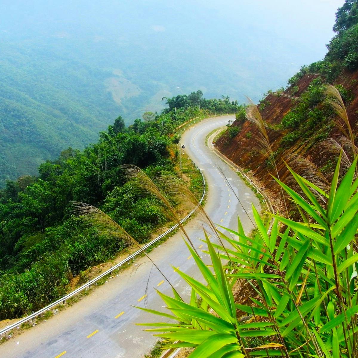
1. Tây Nghệ An Road:
[View Map]
- Route: Mường Xén to Mường Lống
- Distance: 60km
- Province: Nghệ An
- Scenery: huge limestone mountains, deep valleys, minority villages, jungles, rivers, borderlands
- Road conditions: good, two-lane asphalt road, some narrow sections, no traffic
- Best time of year: March to August
- Guide: Mường Lống Loop
Soaring up the sides of mountains, beneath limestone peaks, along deep, dark valleys and roaring rivers, the Tây Nghệ An Road is a glorious stretch of asphalt in a mostly unexplored corner of the nation. Right in the northwestern corner of Nghệ An, Vietnam’s largest province, this road traverses sublime scenery close to a remote Lao border. Despite the excellent road conditions and sensational landscape, traffic is extremely light and visitors are few. This is what Hà Giang was like 15 years ago. Don’t wait: ride it now! This great riding road is featured in my Mường Lống Loop.
Photo: Tây Nghệ An Road between Mường Xén & Mường Lống (60km)

2. National Highway QL279:
[View Map]
- Route: Mường Kim to Minh Thắng
- Distance: 105km
- Province: Sơn La & Điện Biên
- Scenery: massive lakes, limestone karsts, spectacular passes, big rivers, jungle
- Road conditions: good, two-lane tarmac road, no traffic
- Best time of year: March to November
- Guide: Trans-Northern Belt Road (Section 4)
Beginning with a long, snaking path around the perimeter of the enormous Hồ Bản Chắt reservoir, filled with blue water and surrounded by green mountains and limestone overhangs, this section of QL279 is in excellent condition and there’s no traffic at all. After the lake, a series of passes meander down to the Sông Đà (Black River) which, contrary to its name, is a delightful blue backed by limestone pinnacles forming a jagged crest. A long bridge crosses the broad waterway and then a fabulous pass leads up from Hủa Tát with stupendous views back over the Black River Valley. This great riding road is featured in Section 4 of my Trans-Northern Belt Road.
Photo: National Highway QL279 between Mường Kim & Minh Thắng (105km)

3. National Highway QL3:
[View Map]
- Route: Cao Bằng to Nà Phặc
- Distance: 80km
- Province: Cao Bằng & Bắc Kạn
- Scenery: endless mountains & dense forest cover
- Road conditions: good two-lane asphalt road, light traffic, occasional landslides, trucks
- Best time of year: March to October
- Guide: Northeast Routes & Loops (Route 2)
Winding through the mountains of northeast Vietnam, this 80km stretch of National Highway QL3, between Cao Bằng and Nà Phặc, is a dizzying ride on an excellent tarmac road through one of the most sparsely populated regions of the country. After leaving Cao Bằng, there’s hardly a kilometre of straight for the next 2-3 hours, as the road rides over endless mountains blanketed in thick forest. It’s no wonder this area has provided sanctuary for rebels, revolutionaries and bandits throughout the centuries. This great riding road is featured in Route 2 of my Northeast Routes & Loops.
Photo: National Highway QL3 between Cao Bằng & Nà Phặc (80km)

4. National Highway QL4H:
[View Map]
- Route: Chà Cang to Mường Nhé
- Distance: 80km
- Province: Điện Biên
- Scenery: high, treeless mountains, cultivated valleys, minority villages
- Road conditions: excellent two-lane asphalt road, no traffic, occasional landslides
- Best time of year: May to October
- Guide: Extreme Northwest Loop
In the deepest, darkest, and most remote corner of northwest Vietnam, this meandering ribbon of asphalt is in excellent condition and sees hardly any traffic at all. Gliding over mountain ranges and sweeping along river valleys, National Highway QL4H is easy, uninhibited riding through a big landscape close to the Lao border. However, there’s a reason why so few vehicles ply this road: the region is remote and politically sensitive. If you choose to ride QL4H, be aware that the police may turn you back at any time, but particularly if you try to go beyond Mường Nhé. This great riding road is featured in my Extreme Northwest Loop.
Photo: National Highway QL4H between Chà Cang & Mường Nhé (80km)

5. Provincial Road DT520/QL16:
[View Map]
- Route: Quan Hóa to Mường Lát
- Distance: 95km
- Province: Thanh Hóa
- Scenery: remote mountains & forest, ethnic minority villages, cultivated river valleys
- Road conditions: good two-lane asphalt road, light traffic, occasional landslides
- Best time of year: April to October
- Guide: The Limestone Loop
Provincial Road DT520 courses through the dense forests and deep valleys of northwestern Thanh Hóa Province, where foreign visitors rarely set foot. Like many roads along Vietnam’s western edge, DT520 is built to facilitate cross-border trade with Laos. But, in this remote and wooded region, trade is slow and trucks are few: you’re unlikely to encounter any serious traffic as you helter-skelter up and down the multiple mountain passes connecting Quan Hóa with Mường Lát. Take note that foreign visitors are currently not allowed to overnight at Mường Lát. This great riding road is featured in my Limestone Loop.
Photo: Provincial Road DT520/QL16 between Quan Hóa & Mường Lát (95km)

6. National Highway QL55/QL55B:
[View Map]
- Route: La Gi to Bảo Lộc
- Distance: 140km
- Province: Bình Thuận & Lâm Đồng
- Scenery: arid lowlands, wooded midlands, agricultural highlands, coffee farms, rivers
- Road conditions: excellent two-lane asphalt road, light traffic
- Best time of year: December to April
- Guide: Bình Thuận Back-Roads Inland Loop
Leading from the hot, dry beaches of the south coast to the cool, coffee-growing mountains of the Central Highlands, National Highway QL55/QL55B is a rarely used yet well-maintained artery passing through dramatically different climate zones and scenery. Wriggling across arid, burnt-out plains, up to wooded river valleys and cold tea plantations on mountainsides, this route offers 140km of smooth, winding, and practically empty road for almost its entire length. This great riding road is featured in my Bình Thuận Back-Roads Inland Loop.
Photo: National Highway QL55/QL55B between La Gi & Bảo Lộc (140km)

7. Western Ho Chi Minh Road (QL15):
[View Map]
- Route: Khe Sanh to Khe Gát
- Distance: 240km
- Province: Quảng Trị & Quảng Bình
- Scenery: extensive jungle, limestone mountains, caves, blue rivers, remote villages
- Road conditions: good single-lane concrete road, no traffic
- Best time of year: April to September
- Guide: Phong Nha Routes & Loops (Route 4)
Stretching for 240km through some of the most spectacular landscape in Vietnam, the Western Ho Chi Minh Road is many people’s outright favourite riding road in the country. Although it’s only a single-lane route (made up of large concrete slabs for much of its length), the absence of any real traffic makes it extremely good fun to ride: there are countless twists and turns and passes and plateaus. Add to that the constant carousel of jaw-dropping scenery – the kind of storybook Asian landscape that’s not supposed to exist in real life – and you have all the ingredients for a sublime ride. Believe the hype! This great riding road is featured in Route 4 of my Phong Nha Routes & Loops.
Photo: Western Ho Chi Minh Road (QL15) between Khe Sanh & Khe Gát (240km)

8. Trường Sơn Đông Road:
[View Map]
- Route: Đắk Pơ to Xã Hiếu
- Distance: 105km
- Province: Gia Lai & Quảng Ngãi
- Scenery: extensive farmland, plateaus, mountains, jungle, minority villages
- Road conditions: good two-lane tarmac road, no traffic
- Best time of year: April to September
- Guide: Trường Sơn Đông Road
A romp through the Central Highlands, the Trường Sơn Đông Road is a ride to be savoured, both for scenery and for sheer riding pleasure. Many sections are brand new and in excellent condition as they meander through dense jungle and rolling farmland, like a river of asphalt. And yet, traffic is light and the land sparsely populated, with minority towns with strange and exotic sounding names, like Ayun Pa, K’Bang, and Ea Ly. The Trường Sơn Đông Road is long and some parts remain unfinished, but the section between the Đắk Pơ crossroads and the Xã Hiếu junction is terrific. This great riding road is featured in my Trường Sơn Đông Road guide.
Photo: Trường Sơn Đông Road between Đắk Pơ & Xã Hiếu (105km)

9. National Highway QL7A:
[View Map]
- Route: Anh Sơn to Nậm Cắn
- Distance: 150km
- Province: Nghệ An
- Scenery: wide, agricultural river valleys, limestone mountains, jungle
- Road conditions: good two-lane tarmac road, light traffic, some trucks
- Best time of year: April to September
- Guide: Mường Lống Loop
Spreading west from the Ho Chi Minh Road, National Highway QL7A follows the course of the Lam River (also called the Cả River) as it ploughs its muddy course through the rich agricultural landscape of Nghệ An Province. The section from Anh Sơn leading 150km upstream to the Lao border gate of Nậm Cắn, is in good condition and traffic is light. The road echoes the river as it curls deeper into the jungled mountains near the Lao border, skirting the fringes of the lush and haunting hills of Pù Mát National Park. Rarely travelled and highly scenic, this an easy, pleasurable ride. This great riding road is featured in my Mường Lống Loop.
Photo: National Highway QL7A between Anh Sơn & Nậm Cắn (150km)

10. Núi Chúa Coast Road (D702):
[View Map]
- Route: Ninh Chữ to Mỹ Thanh
- Distance: 60km
- Province: Ninh Thuận & Khánh Hòa
- Scenery: stunning coast, sandy beaches, arid hills, lush mountains
- Road conditions: good two-lane tarmac road, light traffic
- Best time of year: January to October
- Guide: Núi Chúa Coast Road
A spectacular coast road draped along the rugged and strikingly beautiful coastline of Ninh Thuận Province, the Núi Chúa Coast Road (DT702) passes some of Vietnam’s best beaches and bluest seas. Only completed a few years ago, the road surface is smooth asphalt for most of its 60km distance. Despite a surge in popularity, traffic remains pretty light, allowing riders to enjoy the sweeping corners and cliff-edge switchbacks high above the ocean in relative safety. This great riding road is featured in my Núi Chúa Coast Road guide.
Photo: Núi Chúa Coast Road (DT702) between Ninh Chữ & Mỹ Thanh (60km)

11. National Highway QL32:
[View Map]
- Route: Ba Khe to Bình Lư
- Distance: 230km
- Province: Yên Bái & Lai Châu
- Scenery: lush valleys, high mountains, rice terraces, mountain rivers
- Road conditions: good two-lane tarmac road, mostly light traffic
- Best time of year: April to October
- Guide: Harvest Route: Mù Cang Chải
A fabulous ride from the midlands to the highlands, National Highway QL32 is a swerving, snaking, wiggling, weaving route along the spine of Vietnam’s highest mountain range, the Hoàng Liên Sơn. Recently upgraded, it’s currently in excellent condition. Beautifully smooth and undulating, riding this road lulls you into a hypnotic trance as you glide through the corners along river valleys and swerve through the switchbacks on mountain passes. The Khau Phạ Pass is a highlight and so too is the absurdly pretty ride to Mù Cang Chải, famous for its steep valleys of terraced rice fields. This great riding road is featured in my Harvest Route.
Photo: National Highway QL32 between Ba Khe & Bình Lư (230km)

12. Provincial Road DT725:
[View Map]
- Route: Ma Đa Gui to Hoài Đức
- Distance: 140km
- Province: Lâm Đồng
- Scenery: forests, mountains, coffee & tea plantations, agricultural plateaus
- Road conditions: good two-lane tarmac road, some potholed sections, light traffic
- Best time of year: December to April
- Guide: Saigon to Dalat: the Back Ways
From the lush jungles near Cát Tiên National Park to the heavily cultivated plateaus near Bảo Lộc and Di Linh, Provincial Road DT725 slices through the heart of the Central Highlands. Much of the route is newly surfaced and traffic is very light. The lowlands are characterized by dense forest, but, as the road climbs higher, the landscape is given over entirely to the area’s most precious crop: coffee. This great riding road is featured in my Saigon to Dalat: the Back Ways.
Photo: Provincial Road DT725 between Ma Đa Gui & Hoài Đức (140km)

13. Đường Ven Biển Ninh Thuận:
[View Map]
- Route: Cà Ná to Ninh Chữ
- Distance: 40km
- Province: Ninh Thuận
- Scenery: sheer cliffs, rocky, arid headlands, sand dunes, beaches, big seascapes
- Road conditions: good two-lane tarmac road, some potholes, very light traffic
- Best time of year: January to October
- Guide: Dragons’ Graveyard Coast Road
From the fishing village of Cà Ná on the south-central coast, the Đường Ven Biển Ninh Thuận crawls around a spectacular rocky headland. Literally translated as ‘Road along the Ninh Thuan Coastline’, this route was blasted out of the sheer cliff-face just a few years ago. The result is an unbelievable ride on a near-deserted road soaring high above the turquoise swell of the East Sea as it smashes against colossal boulders hundreds of feet below the tarmac. The scenery is fabulous: the rocky promontory has an arid, desert-like quality reminiscent of southern Spain. Unsurprisingly, boulders loosened during the construction of the road regularly roll off the mountainside and damage the road surface, but in general it’s a smooth ride. This great riding road is featured in my Dragons’ Graveyard Coast Road.
Photo: Đường Ven Biển Ninh Thuận between Cà Ná & Ninh Chữ (40km)

14. National Highway QL4D:
[View Map]
- Route: Sa Pa to Phong Thổ
- Distance: 100km
- Province: Lào Cai & Lai Châu
- Scenery: soaring mountains, plunging valleys, rivers, rice terraces, minority villages
- Road conditions: good two-lane tarmac road, light traffic, some trucks, landslides are common
- Best time of year: March to October
- Guide: Sapa-Sin Ho Scenic Loop
Carving its way through the highest mountain range in Vietnam, National Highway QL4D used to be one of the most remote and unpredictable roads in the country. These days, however, thanks to a massive road building project, this route is a crisp new two-lane asphalt road riding high above plunging valleys and far below the jagged peak of Mount Fansipan (3,143m), the ‘Roof of Indochina’. The scenery is sublime: the bare slopes of the Hoàng Liên Sơn Range (known to the French colonials as the ‘Tonkinese Alps’) fall into gaping valleys of terraced rice fields where ethnic minority villages perch next to cobalt-blue rivers. As the tarmac unfurls around the mountainsides – climbing to 1,900m at the Ô Quy Hồ Pass (the highest road in Vietnam) – there are countless switchbacks threading through the valleys all the way from Sa Pa to Phong Thổ, creating 100km of great riding. Traffic is still quite light and road conditions are excellent, although landslides are common after heavy rains. This great riding road is featured in my Sapa-Sin Ho Scenic Loop.
Photo: National Highway QL4D between Sa Pa & Phong Thổ (100km)

15. National Highway QL27/QL20:
[View Map]
- Route: Tân Sơn to Đà Lạt
- Distance: 70km
- Province: Ninh Thuận & Lâm Đồng
- Scenery: jungled foothills, mountains, agricultural plateaus, pine forests, tea plantations
- Road conditions: good two-lane tarmac road, light traffic
- Best time of year: December to April
- Guide: Dalat Routes & Loops (Route 3)
Ascending from the fiercely hot, arid foothills of the Trường Sơn Mountains, National Highway QL27 and QL20 climb sharply into the cool, pine-scented air of the Central Highlands. In French colonial days, this was the main route between the coast and the mountains, connecting Phan Rang with the hill station of Dalat. But the road fell into disrepair: initially from overuse, then from neglect as new roads opened better connections between the mountains and the sea. But recently, the entire 70km stretch from Tân Sơn, in the burning midlands, to Dalat, in the cold highlands, has been repaved and revitalized. Today, it’s a swift and glorious ride: climbing from near sea-level to 1,500m in a relatively short distance. The road meanders up steep mountain passes and skates over flat, agricultural plateaus. What’s more, traffic is much lighter than it was in the past, allowing you to enjoy the riding and the scenery like never before. This great riding road is featured in Route 3 of my Dalat Routes & Loops.
Photo: National Highway QL27/QL20 between Tân Sơn & Đà Lạt (70km)

16. National Highway AH13/QL6/QL279:
[View Map]
- Route: Sơn La to Điện Biên Phủ
- Distance: 155km
- Province: Sơn La & Điện Biên
- Scenery: high mountains, jungles, rivers, rice fields, limestone karsts, rural communities
- Road conditions: good two-lane tarmac road, fairly light traffic
- Best time of year: April to October
- Guide: Trans-Northern Belt Road (Section 4)
Traditionally Vietnam’s road to the Wild West, National Highways QL6 and QL279 combine to form Asian Highway AH13, a long and twisting tangle of mountain passes and meandering valley roads, plugging straight into the far reaches of Vietnam’s remote northwest. Road conditions have improved markedly in recent years, and traffic is still fairly light. Long, empty stretches of smooth asphalt plough through a verdant and majestic landscape, culminating in the Pha Đin Pass and the descent into the famous Mường Thanh Valley, which was the dramatic setting, in 1954, for colonial France’s last stand against the ultimately victorious Vietnamese, who hauled the machinery of war by foot and on bicycles across the rugged landscape which we now glide across on our motorbikes. This great riding road is featured in Section 4 of my Trans-Northern Belt Road.
Photo: National Highway AH13/QL6/QL279 between Sơn La & Điện Biên Phủ (155km)

17. Provincial Road DT722:
[View Map]
- Route: Suối Vàng Lake to Đưng K’Nớ
- Distance: 50km
- Province: Lâm Đồng
- Scenery: pine forests, jungle, mountains, coffee farms, remote ethnic minority hamlets
- Road conditions: excellent two-lane tarmac road, very light traffic
- Best time of year: December to April
- Guide: The Pine Tree Road
A crisp new road through miles and miles of pine forests and jungle, Provincial Road DT722 glides over undulating highlands just north of Dalat. The road is in fabulous condition for its 50km length and sees hardly any traffic at all. The reason for this, however, is that it’s not finished yet: at the Krông Nô River the tarmac comes to an abrupt end. Eventually, the road will continue over the river to Yang Mao and connect with the Trường Sơn Đông Road, but for now this is the end of the line. However, it’s well worth the one-way ride because the scenery is good, the road surface is smooth, and the riding is excellent as the seam of asphalt weaves through the pine-scented forests in the cool mountain air. This great riding road is featured in my Pine Tree Road guide.
Photo: Provincial Road DT722 between Suối Vàng Lake & Đưng K’Nớ (50km)

18. Provincial Road DT206/QL3:
[View Map]
- Route: Cao Bằng to Bản Giốc
- Distance: 80km
- Province: Cao Bằng
- Scenery: limestone pillars, jungle, agricultural valleys, rice fields, waterfalls
- Road conditions: good two-lane tarmac road, light traffic, some trucks
- Best time of year: April to October
- Guide: Northeast Routes & Loops (Route 1)
Swerving between limestone pillars into Vietnam’s remote northeastern corner, Provincial Road DT206 picks up where National Highway QL3 left off: through a splendid pastoral landscape along the Chinese border, culminating in the sublime falls at Bản Giốc. After years of upgrades, the road is now in great condition, allowing bikers to eat up the corners (including the famous Mã Phục Pass) whilst admiring the scenery, which is among the prettiest in Vietnam. From a rider’s perspective, there is one drawback: booming trade with China has led to an increase in container trucks plying this route to and from remote border crossings in the northeast. However, the general volume of traffic is still very light, and even the presence of articulated lorries can’t detract from the joy of riding this excellent road through such superlative scenery. This great riding road is featured in Route 1 of my Northeast Routes & Loops.
Photo: Provincial Road DT206/QL3 between Cao Bằng & Bản Giốc (80km)

19. Ho Chi Minh Road (QL15):
[View Map]
- Route: Khe Gát to Tân Ấp
- Distance: 90km
- Province: Quảng Bình & Hà Tĩnh
- Scenery: jungle, limestone karsts, blue rivers, mountains, rural hamlets
- Road conditions: good two-lane tarmac road, light traffic
- Best time of year: April to September
- Guide: Ho Chi Minh Road (Section 6)
This section of the Ho Chi Minh Road is a meandering river of asphalt blazing through soaring limestone pinnacles and across jade-blue rivers straddling the Lao border. A good, wide, smooth, two-lane road, QL15 between Khe Gát and Tân Ấp is an impressive engineering feat. During the ‘Vietnam War’, the Ho Chi Minh Trail passed west of here, crawling through the dense Lao jungle to supply the southern territories with soldiers and military equipment. In those days, it took months to reach the south, but today, riders can sweep through this difficult terrain with ease thanks to this amazing road. The scenery is fantastic and the riding is pure pleasure. Traffic is light, but trucks are increasingly choosing this road over the clogged artery of Highway 1, so expect at least some heavy goods vehicles, especially struggling up the steep and spectacular Đá Đẽo Pass. This great riding road is featured in Section 6 of my Ho Chi Minh Road guide.
Photo: The Ho Chi Minh Road (QL15) between Khe Gát & Tân Ấp (90km)

20. Hải Vân Pass:
[View Map]
- Route: Cu Đê River to Lăng Cô
- Distance: 25km
- Province: Đà Nẵng & Thừa Thiên Huế
- Scenery: stunning coastal views, beaches, coves, lush mountains, city skylines
- Road conditions: good two-lane tarmac road, light traffic
- Best time of year: April to September
- Guide: Hải Vân Pass
One of the most famous roads in Vietnam, the Hải Vân Pass curls around a mountainous spur of the Annamite Range as it meets the sea, between Đà Nẵng and Huế, in Central Vietnam. Famous down the centuries as s barrier between kingdoms and peoples, the Hải Vân Pass reached a global audience in 2008, when the Top Gear Vietnam Special was aired on the BBC. The presenters’ awed response to the majesty of this scenic route and the joy of riding the deserted hairpin bends, encouraged a generation of travellers to follow in their tyre tracks. Despite being only a short stretch of road, the views over the ocean and mountains are excellent and, because a tunnel takes the lion’s share of heavy traffic, the Hải Vân Pass is relatively quiet. The great, looping switchbacks, for which the pass is famous, are wide and smooth, allowing riders to lean in and enjoy the corners. This great riding road is featured in my Hải Vân Pass guide.
Photo: Hải Vân Pass between the Cu Đê River & Lăng Cô (25km)

21. National Highway QL27C:
[View Map]
- Route: Diên Khánh to Đà Lạt
- Distance: 120km
- Province: Khánh Hòa & Lâm Đồng
- Scenery: low & highland farming, mountains, rivers, deep valleys, pine forests, jungle
- Road conditions: good two-lane tarmac road, fairly light traffic
- Best time of year: January to September
- Guide: The Classic Route
Forging a path from sea level to 1,700m at its highest point, National Highway QL27C is a relatively new route, linking the hot and sunny beach town of Nha Trang with the cool and misty mountain retreat of Dalat. I’m told that some kind of roadway existed along this route during French colonial times, but it was only recently that the road was upgraded to a National Highway. Now days, QL27C is the preferred route from coast to mountains. The road is wide and smooth for the majority of its length, including the 37km Khánh Lê Pass, a thrilling ascent from peaceful, agricultural valleys to cold, misty mountains cloaked in jungle. After reaching the Central Highlands, the road sweeps over a pine-studded plateau covered in coffee plantations. Although a popular route, traffic is still light enough (particularly on weekdays) to enjoy the ride unimpeded by cars and trucks. This great riding road is featured in my Classic Route: Saigon to Hanoi.
Photo: National Highway QL27C between Diên Khánh & Đà Lạt (120km)

22. Mã Pí Lèng Pass (QL4C):
[View Map]
- Route: Đồng Văn to Mèo Vạc
- Distance: 20km
- Province: Hà Giang
- Scenery: stunning limestone landscape of peaks & troughs, steep river valleys & gorges
- Road conditions: good single-lane tarmac road, light traffic
- Best time of year: March to October
- Guide: Hà Giang Extreme North Loop
The Mã Pí Lèng Pass is located in Vietnam’s northernmost province, abutting China, and is a serious contender for the most spectacular road in the country. The short but utterly jaw-dropping stretch between the market towns of Đồng Văn and Mèo Vạc hugs the edges of a steep, treeless valley, hundreds of feet above the Nho Quế River. Limestone pinnacles tower over the valley, casting long shadows across the haunting – almost martian – landscape. The road is knotted: curling in on itself and then unwinding, like a tangled thread of string draped across the landscape. But, while there’s no doubting the scenic qualities of this road, it is quite narrow and potentially very dangerous. Fortunately, there’s still not much traffic, but as the region (Hà Giang Province) begins to attract more and more travellers, the number of motorbikes and vehicles is increasing. This is not a road for speed, but the soaring switchbacks and mythical scenery make it feel like flying, even when you’re only riding at 30kmph. No list of great roads in Vietnam would be complete without it. This great riding road is featured in my Hà Giang Extreme North Loop.
Photo: Mã Pí Lèng Pass (QL4C) between Đồng Văn & Mèo Vạc (20km)

23. Provincial Road DT716/DT716B:
[View Map]
- Route: Phú Hải to Phan Rí Cửa
- Distance: 60km
- Province: Bình Thuận
- Scenery: long, empty beaches, sand dunes, seascapes, red earth ‘deserts’
- Road conditions: excellent two-lane tarmac road, light traffic
- Best time of year: January to October
- Guide: Sand Dune Highway
Completed a few years ago, this road begins behind the famous beach resort of Mũi Né. A fresh, wide and empty bypass (Võ Nguyên Giáp Street) glides over the arid but attractive Mũi Né hills, looking down over the curving, blue bay below. The bypass meets the ocean (Road DT716) and skirts along miles of deserted coast, backed by red sand dunes. Traffic is light and the riding is excellent. However, this road runs straight through an infamous so-called ‘police trap’, where foreign riders are invariably pulled over. But, there’s an easy and effective workaround for this by taking a back-road behind the coast (see this guide for more details). Bearing east, the road joins DT716B, a super-smooth, straight but undulating seam of asphalt that was recently laid over the great White Sand Dunes, known as Vietnam’s Desert. This is a road to eat up all the way to the fishing town of Phan Rí Cửa. This great riding road is featured in my Sand Dune Highway.
Photo: Provincial Road DT716/DT716B between Phú Hải & Phan Rí Cửa (60km)

24. Provincial Road DT128:
[View Map]
- Route: Lai Châu to Sìn Hồ
- Distance: 55km
- Province: Lai Châu
- Scenery: limestone karsts, high mountains, jungle, wide valleys, rice terraces
- Road conditions: good two-lane tarmac road, some rough patches, light traffic
- Best time of year: March to October
- Guide: Sapa-Sin Ho Scenic Loop
Climbing steeply from Lai Châu city to the mountaintop village of Sìn Hồ, Provincial Road DT128 swirls around the jungle-clad mountainsides as if following the contour lines on a map. Going from a warm, agricultural valley into a mist-shrouded alpine landscape, where the temperature can drop to freezing, this route offers extraordinary views over oceans of mountains, stretching all the way to the Chinese border. The majority of the road has recently been resurfaced and widened so that it’s now in excellent condition with practically no traffic at all. There are countless corners and switchbacks snaking through the mountains. However, there are still roadworks for the last 15km up to Sìn Hồ, and this section can be quite difficult, especially in bad weather. But, before long, the road will be completed and the whole 55km stretch will be a sublime ride. This great riding road is featured in my Sapa-Sin Ho Scenic Loop.
Photo: Provincial Road DT128 between Lai Châu & Sìn Hồ (55km)

25. Côn Sơn Island Coast Road:
[View Map]
- Route: National Park HQ to Đầm Trầu
- Distance: 35km
- Province: Bà Rịa-Vũng Tàu
- Scenery: wild, empty beaches, rocky cliffs, dramatic coastline, forests, colonial-era town
- Road conditions: good, two-lane tarmac road, strong winds, no traffic
- Best time of year: March to August
- Guide: Côn Đảo Islands
Way out in the East Sea, 80km off the coast of the Mekong Delta, Côn Sơn is a remote and beautiful island in the Côn Đảo Archipelago. Winding around its windswept and utterly beguiling eastern and southern seaboard is the Côn Sơn Coast Road. Leading from the spectacularly situated port of Bến Đầm in the south of the island, to the tiny airport and gorgeous beach of Đầm Trầu in the north, this coastal road is only 35km long but is almost entirely deserted and exceptionally scenic. The riding is glorious, but you may find it difficult to keep going, because the coastal vistas are so stunning that you’ll want to stop and take it all in. Also, be careful of strong winds as you round the exposed capes at either end of the island. This great riding road is featured in my Côn Đảo Islands guide.
Photo: Côn Sơn Coast Road between National Park HQ & Đầm Trầu (35km)

26. Ho Chi Minh Road (QL14):
[View Map]
- Route: Thạnh Mỹ to Đa Krông Bridge
- Distance: 250km
- Province: Quảng Nam, Thừa Thiên Huế, Quảng Trị
- Scenery: jungle, mountains, rivers, ethnic minority villages, agricultural valleys
- Road conditions: good two-lane tarmac road, some concrete slab sections, light traffic
- Best time of year: March to September
- Guide: Ho Chi Minh Road (Section 4)
Yet another extraordinary section of the long and fabulous Ho Chi Minh Road, this part romps through the remote and, at one time, war-scarred spine of Central Vietnam. Although there are poignant echoes of ‘The American War’ throughout this section – Hamburger Hill, A Shau Valley, Khe Sanh – it is the scale and beauty of nature which makes the biggest impact on riders who pass through here today. From Thạnh Mỹ, the Ho Chi Minh Road corkscrews up multiple passes via a series of dizzying switchbacks, first to the little village of Prao and next to A Lưới. Misty mountains covered in a fleece of thick tropical jungle, where wild animals such as the Saola (Asian Unicorn) live, stretch to the horizon and continue into Laos. It’s not uncommon to have the road completely to yourself: not one vehicle for over 100km. Next, the Ho Chi Minh Road breezes along several river valleys, where the road is smooth and wide, and the riding is excellent. This great riding road is featured in Section 4 of my Ho Chi Minh Road guide.
Photo: Ho Chi Minh Road (QL14) between Thạnh Mỹ & Đa Krông Bridge (250km)

27. National Highway QL91B:
[View Map]
- Route: Đại Ngãi Ferry to Mỏ Ó Beach
- Distance: 40km
- Province: Sóc Trăng
- Scenery: rice paddies, fruit orchards, Mekong River, fishing villages, vegetable gardens
- Road conditions: good two-lane tarmac road, light traffic
- Best time of year: November to June
- Guide: Khmer Temple-Hopping Loop
The Mekong Delta is very flat, so the roads are mostly arrow-straight: more like extended drag-racing tracks than great riding roads. But it seems rude not to include a Mekong Delta road in this list, and of all the roads I’ve ridden in the Delta, Highway QL91B between the Đại Ngãi ferry crossing and the remote Mekong beach resort of Mỏ Ó is the most enjoyable to ride. Bending around the southern banks of the Hậu River (the southernmost arm of the great Mekong River Delta) as it pours into the East Sea, Highway QL91B was recently upgraded. Road conditions are good and traffic is light: this part of the Delta, Sóc Trăng Province, isn’t really on the tourist trail. Yet, the agricultural landscape is fascinating and, in the soft low light of the mornings and late afternoons, very beautiful. Tropical fruits grow in riverside orchards, vegetable gardens line the canals, and busy little fishing villages dot the coast. The riding is easy and smooth, so you can sit back and cruise through the Delta, watching the pastoral scenes slide by. This great riding road can be an extension of my Khmer Temple-Hopping Loop.
Photo: National Highway QL91B between Đại Ngãi Ferry & Mỏ Ó Beach (40km)

28. National Highway QL279:
[View Map]
- Route: Chợ Rã to Na Hang
- Distance: 85km
- Province: Bắc Kạn & Tuyên Quang
- Scenery: jungles, lakes, rivers, limestone karsts, mountains, villages, agricultural valleys
- Road conditions: good, two-lane tarmac road, no traffic
- Best time of year: March to Novmeber
- Guide: Trans-Northern Belt Road (Section 2)
A superlative section of QL279 climbs into the limestone mountains behind Ba Bể Lake and into the jungles which appear to melt over the conical peaks like wax down the side of a candle. The road is in excellent condition and totally empty as it soars and swirls from peak to peak, valley to valley, lake to lake. It’s an immersive ride through wonderful scenery all the way to Na Hang. This great riding road is featured in Section 2 of my Trans-Northern Belt Road.
Photo: National Highway QL279 between Chơ Rã & Na Hang (85km)

29. Đường Bao Biển Hạ Long-Cẩm Phả:
[View Map]
- Route: Bãi Cháy Bridge to Cẩm Phả
- Distance: 30km
- Province: Quảng Ninh
- Scenery: ocean vistas, limestone islands, big bridges, cityscapes, beaches
- Road conditions: excellent dual carriageway, light traffic
- Best time of year: March to November
- Guide: Trans-Northern Belt Road (Section 1)
One of many impressive new infrastructure projects in the region, this coast road begins by crossing the gigantic Bãi Cháy Bridge with great views over the increasingly modern, affluent-looking and Miami-esque city of Hạ Long. Much of the rest of the 30km-long stretch of ocean road is built out over the water, connecting a series of limestone karsts that are emblematic of the region’s most famous attraction: Hạ Long Bay. As well as the smooth riding and great ocean views, the road passes some intriguing modern municipal structures, such as museums, aquariums and convention centres, that dot the quayside like a parade of sculptures. This great riding road is featured in Section 1 of my Trans-Northern Belt Road.
Photo: Đường Bao Biển Hạ Long-Cẩm Phả between Bãi Cháy Bridge & Cẩm Phả (30km)

30. Provincial Road TL48/DT973:
[View Map]
- Route: Hàm Ninh to Cửa Cạn
- Distance: 50km
- Province: Kiên Giang
- Scenery: bays, beaches, ocean views, jungles, sleepy fishing villages, beachside seafood restaurants
- Road conditions: good two-lane road, very light traffic
- Best time of year: October to August
- Guide: Phu Quoc Island
Stretching along the east coast of Phú Quốc Island, this road was paved only a few years ago. Conditions are good and traffic is light as the road passes long, quiet, undeveloped sections of coast and sleepy fishing villages, some with excellent local seafood restaurants. At the north end, the road veers west and meanders through thick jungle on the cusp of the island’s national park. The riding is great, the air is fresh and the opportunities to stop and explore the coast are many. This great riding road is featured in my Phú Quốc Island: Beach Guide.
Photo: Provincial Road TL48/DT973 between Hàm Ninh & Cửa Cạn (50km)

*Disclosure: I never receive payment for anything I write: my content is always free and independent. I’ve written this guide because I want to: I like these roads and I want my readers to know about them. For more details, see my Disclosure & Disclaimer statements and my About Page
Hey Tom,
I plan on exploring Phong Nha before I do a visa run at the Lao Bao border. Are there any beautiful routes or destinations between Phong Nha and Ninh Binh ( or pu luong on the west side) you recommend? Or should I go North towards Hanoi as fast as possible after Lao Bao so I have more time to explore there?
Im assuming taking hcmr to hanoi or ninh binh would be slower than a coast route like ql1 right?
Thanks 🙂
Hi Neal,
If you’re travelling between Lao Bao and Hanoi, definitely don’t take QL1, take the Ho Chi Minh Road instead.
Nghe An is a great province to explore by motorbike – I’m writing a guide to that right now.
You could also do the Limestone Loop which is in Thanh Hoa Province.
Best,
Tom
Hello,
There are so many good ideas in this article!
I’m in the Mekong Delta and I’m thinking of doing the QL91C, but I was wondering about Mo O. Do you know if there’s anything to do there/ if it’s worth staying overnight?
Thanks!
Hi Jess,
Sorry, I don’t know it well enough – however, in the Mekong Delta it’s almost always worth staying overnight in places that are off the beaten path; it’s usually a good experience.
Best,
Tom
Hey I noticed the first road you listed, the QL3 between Cao Bang and Na Phac, is actually not in your Northeast Loop. Is there a reason for leaving it out of the recommended loop? Thanks!
Hi Sarah,
No, there’s no particular reason for that – you can easily include QL3 in the Northeast Loop instead of QL34 (either road is very scenic).
Please note that my Northeast Loop guide is due an update.
Tom
Hi, I’ll be cycletouring and am wondering which you think would be a good combination of cycling and beauty?
Thanks I’m traveling now. Finished the Mekong and parked inDaLat to rest yp..
Robert
Hi Robert,
Well, all these roads are good for scenery and riding – that’s what makes them Great Riding Roads 🙂 But, of course, on a bicycle many of them are very challenging because of the steep ascents.
The Western Ho Chi Minh Road is particularly scenic and although it’s very undulating, it’s still good for cycling because there’s so little traffic.
Tom
Hi Tom
What an amazing job you have done! It’s pure pleasure spending hours and looking for info. We (group of 6 friends) will be in Vietnam at the end of November and beginning of December. We will have around 2 weeks to ride through this fantastic country. Considering the weather conditions and this 2 week period, what are your suggestions about the itinerary? Do we have different options? Also, do you have any suggestions concerning agencies who rent bikes and eventually organise trips like that? Thank you in advance
Michalis
Hi Michalis,
At that time of year, it’s best to stay in most places south of Danang, because the weather north of there can be quite bad. You can read more about weather in Vietnam here.
With two weeks I would suggests any (or a mixture) of the following routes: the Coast Road, the Road East of the Long Mountains, the Ho Chi Minh Road. Also, just browse my archive for Southern Routes for many more options.
For bike rental, try contacting the reputable rental companies that I list here, some of them can arrange tours as well if you want, but in my opinion it’s much more fun to do it independently.
I hope this helps,
Tom
Hi Tom
I had the absolute pleasure of riding the routes out of Saigon around the South Central Highlands & coastline. As a 1st time rider/visitor, I found your road recommendations & observations of areas superb, poetic. Beautifully diverse scenes, people. Your guides – Midnight Loop, Bike on Train, Food & Accommodation options (to name a few!) – all utilised. Initially it was your Ferry to Vung Tau write-up that hooked me. Every tourist biker met along the way knew of your site. Very grateful this end. Long live the Coracle. Thanks Tom.
Hi Aina,
Thanks so much. It’s really great to hear that you enjoyed your trip and that my guides helped along the way. Glad to hear also that other travellers you met knew it and used it – I don’t advertise so it’s down to word of mouth from people like you, which I’m very grateful for.
Thanks,
Tom
Hi Tom ,
I really motivate when I read your post on my mail box . When I came in Vietnam 2years and half ago I used a bycicle . Now I use Honda Lead , confortable motorbike i’m Impressed on my self what I did since
I love Dalat , route Mimosa ( old road)
I want to go also to Ha Giang province
Thank you so much for your site . I followed some road
Hi Marie,
Thanks. It’s good to hear you’re enjoying riding around Vietnam. I hope you get a chance to ride in Ha Giang soon – it’s a spectacular area.
Tom
Yo Tom,
I was driving the QL49 from Hue to the west and you should include it. It was nicer than some marked roads of you and really nice to drive. I can send u some images if u want.
But thanks for your work
I really appreciate it.
Hi Nik,
Yes, thanks for the recommendation. I also enjoy taking QL49, it just didn’t make it into this top 25 list. But, as I’m sure you know, road conditions are changing all the time: so roads that are good one year and not necessarily good the next year, and so on.
Best,
Tom
I did 15 of them 🙂 – Good to know still some nice rides remain
I would personally add few more in the North (which is my favourite part of Vietnam)
Hi Antoni,
Glad to hear that.
If you like, you can let me and the other readers know which other roads in the north you particularly like.
Thanks,
Tom
I would definitely add Y Ty loop (except for part along the river)
Later DT153 (part of Sapa – Ha Giang route, day 2) was really impressive
Those two roads are maybe not in the brilliant condition so maybe that’s why they weren’t included, but I also wouldn’t call them offroad by any mean 🙂
Later: first 40-50 km of QL4C after Meo Vac (until you go down the valley) and also part of QL34 from Thin Tuc village to Nguyen Bihn (near Cao Bang) – those were very impressive rides
And maybe QL279 near Bac Son / Lang Son (when it crosses through kart landscape) – smooth but very impressive road (other roads in the area are similarly beautiful, have less traffic but are in worse conditions)
And maybe minor contender but I enjoyed a lot DT238B as an alternative to very crowded QL279 – it’s brand new road, wide and completely empty, passing through some nice landscape (not as impressive as more to the north, but comparable with those from central/souther Vietnam)
Hi Antoni,
Yes, those are all very scenic roads, but yes the reason I didn’t include the Y Ty road and DT153 and QL34 is because of unreliable road conditions. But I’m sure they’ll slowly be upgraded over time and then will certainly be worth adding to this list.
I agree, QL279 in that area is a great road. And DT238 is a good choice too.
Thanks,
Tom
Thanks to you Tom, I have been motivated to ride solo twice, 8 weeks saddle time, covering almost every road mentioned here, using your maps and suggestions, adding a few detours of my own, getting lost but only briefly. I now love Vietnam and the Vietnamese people a good deal more then any other place I’ve experienced. Itching to return. Thanks bud for your comprehensive and accurate travel guide you’ve painstakingly compiled. It really is the best! I’ve steered many friends to Vietnam Coracle when they have asked me for advice on riding Vietnam, as you cover the lot. I also like the way you encourage non-motorcycle fanatics to give it a go. I met many, mainly young couples, with zero bike experience, traveling by bike with nothing but their phone GPS and your guides/maps/info. You’re a legend mate! Well done
Thanks, Mick.
It’s great to hear you’ve enjoyed riding these roads too and fallen for Vietnam in the process. I hope you get more chances for road trips here in the future. And thanks for spreading the word about my site – I really appreciate it, and that’s how the whole thing works.
Tom
Hi there…..can anyone tell me if there is a GPS OR SOME KIND OF APP for the Ha Giang motorbike loop?
Hi Mike,
Not as far as I know, but you can take a look at my Ha Giang Loop guide and export the map to KML then upload it to the maps.me app and follow the route using your GPS location on your phone.
I hope this helps,
Tom