
First published April 2025 | Words and photos by Vietnam Coracle

Tom Divers is the founder and creator of Vietnam Coracle. He’s lived, travelled and worked in Vietnam since 2005. Born in London, he travelled from an early age, visiting over 40 countries (he first visited Vietnam in 1999). Now, whenever he has the opportunity to make a trip, he rarely looks beyond Vietnam’s borders and his trusty motorbike, Stavros. Read more about Tom on the About Page, Vietnam Times and ASE Podcast.
There is something of the Mediterranean about Ninh Thuận Province in south-central Vietnam. With its stark, rugged coastline abutting a deep blue sea and its arid, rocky interior rising quickly to hills, mountains, streams and green forests, the entire province feels like it could be a Greek Island lying somewhere in the Aegean Sea. Despite boasting two of the best coast roads in Vietnam (Núi Chúa and Dragons’ Graveyard), Ninh Thuận is another of those provinces that goes under the radar of most travellers, much like Quảng Ngãi and Nghệ An. People pass through it while linking the neighbouring – and much more popular – coastal provinces of Bình Thuận (home to Mũi Né beach) to the south and Khánh Hòa (home to Nha Trang beach) to the north. But for the adventurous, independent traveller on two wheels, skipping Ninh Thuận is a mistake: the province has a lot to offer motorbikers and cyclists, not just along its dramatic coastline, but also inland where new roads lead along lush river valleys and over high, empty passes to freshwater springs, not to mention the ruined towers of centuries-old Cham temples hidden down sand-swept back-roads. The Ninh Thuận Loop makes the most of both the coast and the interior of this very likeable province.


Support My Site
Free | Independent | No Sponsored Content
“Hello, if you enjoy my website, please support it.
Thank you.” Tom
[Back Top]
NINH THUAN LOOP
Riding the Coastline & Interior of Vietnam’s ‘Mediterranean’ Province
This route explores most of Ninh Thuận Province – from the coast to the valleys to the mountains – via some excellent riding roads with very light traffic. A relatively short loop, it can easily be ridden in 2 days (or more if you prefer) and is suitable for any bike model. See my route map below or purchase the How-To Guide for Using Maps Offline ($5), and please read the About this Route section for more detailed information, such as distance, duration, accommodation, weather, itineraries, and much more. (For similar guides, see Related Routes, and if you like this guide, please support my website.)
CONTENTS:

Using Maps Offline
Includes:
✅ PDF how-to guide for using maps offline
✅ Step-by-step instructions with screenshots
✅ KMZ map file for the Ninh Thuan Loop
✅ Follow the map at all times, even offline
More details > This PDF guide explains how to use & follow my route maps on your phone at all times, even offline, by using a combination of free apps. The PDF guide uses text & screenshots to walk you through the process step-by-step. You can then apply this process to any other map on my website. Note that you can’t get turn-by-turn navigation offline, but you can follow your GPS location on the route map at all times, so navigation should be easy. We have produced this PDF guide to help riders get the best possible experience when using Vietnam Coracle maps. But, if you prefer, you can probably find out how to do it by googling.
ROUTE MAP:
Ninh Thuận Loop | 375km
Blue Line: Main Loop | Red Lines: Side Routes
*Road Safety & Disclaimer: Riding a motorbike in Vietnam – or anywhere in the world – has its dangers. I would hope & expect anyone who chooses to pursue a self-drive road trip based on the information on this website does so with care, respect & due diligence. I encourage careful riding & adherence to road rules, but I am not responsible for the legality or manner in which you ride, nor any negative consequences which may result from your decision to ride a motorbike in Vietnam: you do so at your own risk. Read more >


Overview & Details:
Below is a brief at-a-glance overview of the Ninh Thuận Loop. For more specific details about important details, such as accommodation, weather conditions, duration, traffic, how to get to/from Ninh Thuận and much more, see About this Route.
QUICK DETAILS:
- Route: combining the arid coastline & rugged interior of Ninh Thuận Province in south-central Vietnam
- Distance: 375km (complete loop)
- Duration: 2-4 days
- Scenery: stunning coastline, lush valleys, rocky mountains, clean rivers, mountain passes, jungles
- Attractions: great riding, river & sea swimming, waterfalls, fishing villages, historic sites, kitesurfing, camping
- Road Conditions: good paved roads, some narrow sections, very light traffic
- Best Time: January-May

About this Route:
Below I’ve addressed some important details concerning the Ninh Thuận Loop that should help riders get the most out of this route. Click an item from the list below to read more and then use the ‘Back’ buttons to get back to this list. (All the photos are from the loop and have captions explaining where on the route they were taken.)

- Using the Map
- Start/End & Itineraries
- Distance & Duration
- Getting to/from Ninh Thuận
- Detours & Connecting Routes
- Weather & Time of Year
- Traffic, Road Conditions, Gas Stations
- Accommodation, Food & Drink

[Back]
Using the Map:
My route map shows the main Ninh Thuận Loop with a blue line and a few side routes or detours with red lines. I have marked some places with specific icons, such as sights, villages, places of interest and accommodation. You can use and follow the map however you like, or you can purchase our How-To Guide for Using Maps Offline ($5), which explains step-by-step how to follow the Ninh Thuận Loop on your phone at all times, even with no internet connection.

[Back]
Start/End & Itineraries:
You can potentially start and end the Ninh Thuận Loop anywhere you like along the route. However, it makes most sense to start/end at Ninh Chữ beach near the twin cities of Phan Rang-Tháp Chàm where there’s plenty of accommodation, food, drink, a great beach and places to rent motorbikes if you don’t already have one with you. From Ninh Chữ beach you can ride the Ninh Thuận Loop in either direction: clockwise or anti-clockwise on the loop. However, I would personally recommend going clockwise on the loop: starting at Ninh Chữ beach and heading due south on the coastal road to Cà Ná before turning due north to the ancient towers at Tháp Chàm, and then heading inland due west on the mountain roads eventually leading back to the coast for the final stretch of ocean road returning to Ninh Chữ beach. This makes the loop a kind of figure-of-eight with the inland section in the middle nicely balanced by the two coastal sections; one at the beginning, the other at the end.

[Back]
Distance & Duration:
The total distance of the Ninh Thuận Loop is 375km. This can easily be completed in 2 days on the road. However, it’s much more rewarding to take your time on the loop over 3 or 4 days. This will give you enough time to really appreciate the landscape, stay in a couple of nice places overnight (even try camping), stop at some of the springs and waterfalls for a swim, explore the beaches, try kitesurfing at Mỹ Hòa, visit the Chàm temples, take some detours and really get a feel for what makes this province so attractive.

[Back]
Getting to/from Ninh Thuận:
The transportation hub for Ninh Thuận Province is the twin city of Phan Rang-Tháp Chàm, located just about in the middle of the province’s stretch of coastline. Trains and buses arrive and depart all day, every day to/from Phan Rang-Tháp Chàm, it is a major stop for all north-south transportation. This means that transportation links to all cities along the coast and in the Central Highlands are good, easy and regular. To give some examples, at least 6 trains come and go to Tháp Chàm station every day in both directions: from Ho Chi Minh City and Hanoi; comfortable sleeper buses depart at least every hour to popular destinations, such as Phan Thiết, Nha Trang, Quy Nhơn, Ho Chi Minh City, and Dalat to name just a few. However, the nearest civilian airport is Cam Ranh (near Nha Trang). Phan Rang-Tháp Chàm does have an airport but it is for military use only. The bottom line is that getting to/from Ninh Thuận Province is very easy. You can search all kinds of transportation connections and book tickets directly through Baolau.com.

[Back]
Detours & Connecting Routes:
On my route map I’ve included a few potential detours (see the red lines) leading off the main Ninh Thuận Loop to particular sights. These include waterfalls, springs, rivers and beaches, as well as one stretch of new road leading deep into the southwestern corner of the province that, for now, dead-ends in the mountains, but is still worth exploring if you have the time.
There are many ways to connect to the Ninh Thuận Loop from other routes in the region or to incorporate the loop into a much larger road trip itinerary. For example, you can easily combine QL27 and QL20 heading west of the loop to get to Dalat; or you can continue south of the loop from Cà Ná to Mũi Né beach and Phan Thiết by taking the Sand Dune Highway along the coast; or you can continue north of the loop to Nha Trang via the coast road (DT6571) passing by Cam Ranh Airport; and, perhaps most obvious of all, you can include the Ninh Thuận Loop as part of my Beach Bum route. In addition, there are several other guides on my website that focus on specific parts of the Ninh Thuận Loop that may be useful. These are: Dragons’ Graveyard Coast Road | Núi Chúa Coast Road | Wild Camping in Ninh Thuận | Three Springs Silent Retreat.

[Back]
Weather & Time of Year:
Ninh Thuận is one of the driest, hottest and windiest provinces in Vietnam. That’s why it’s Vietnam’s renewable energy powerhouse: you’ll see dozens of wind turbines and solar farms throughout the loop. The route can be ridden at any time of year, but the best window for weather is January-April, when conditions are mostly dry, sunny and clear with cool evenings. Bear in mind that it can get very windy along the coast from December-February, and the rivers and springs can become flooded form September-November.

[Back]
Traffic, Road Conditions, Gas Stations:
In general, road conditions on the Ninh Thuận Loop are very good, even the back-roads. It may be a little bumpy or sandy here and there, but there shouldn’t be any conditions bad enough to concern riders on any kind of bike model. Traffic is very light on most of the loop, the only exceptions being the brief stints on Highway QL1A. Also, during public holidays, parts of the coast road around Vĩnh Hy can get busy with domestic travellers. There are gas stations at fairly regular intervals on the Ninh Thuận Loop, even inland, so filling up shouldn’t be a problem: just don’t let your gauge get too low before looking for fuel.

[Back]
Accommodation, Food & Drink:
There are several hotspots for accommodation on the loop, the most obvious being the twin city of Phan Rang-Tháp Chàm and the nearby beach of Ninh Chữ (check what’s available on Agoda.com). Apart from that, there are some decent places to stay on Cà Ná beach, Mỹ Hòa beach, Vĩnh Hy fishing village, and Bình Lập/Cam Lập promontory. Away from the coast, options are limited: Tân Sơn, Khánh Sơn and Cam Ranh have some mini-hotels and nhà nghỉ (local guest houses). Inland, camping by the streams is a great experience, if you have your own equipment.
When it comes to food, along the coast you’ll find good, fresh, local seafood at many of the quán hải sản (seafood restaurants). Phan Rang-Tháp Chàm has lots of dining options – from street food to restaurants to coffee shops to bars. Vĩnh Hy is especially famous for seafood. Inland, most villages have at least a few cơm-phở (rice and noodle) eateries to satisfy your hunger.

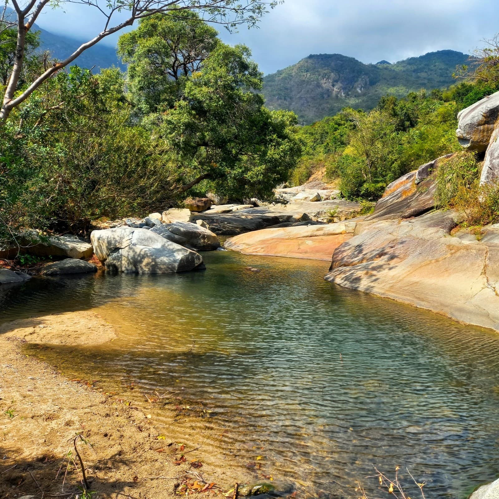
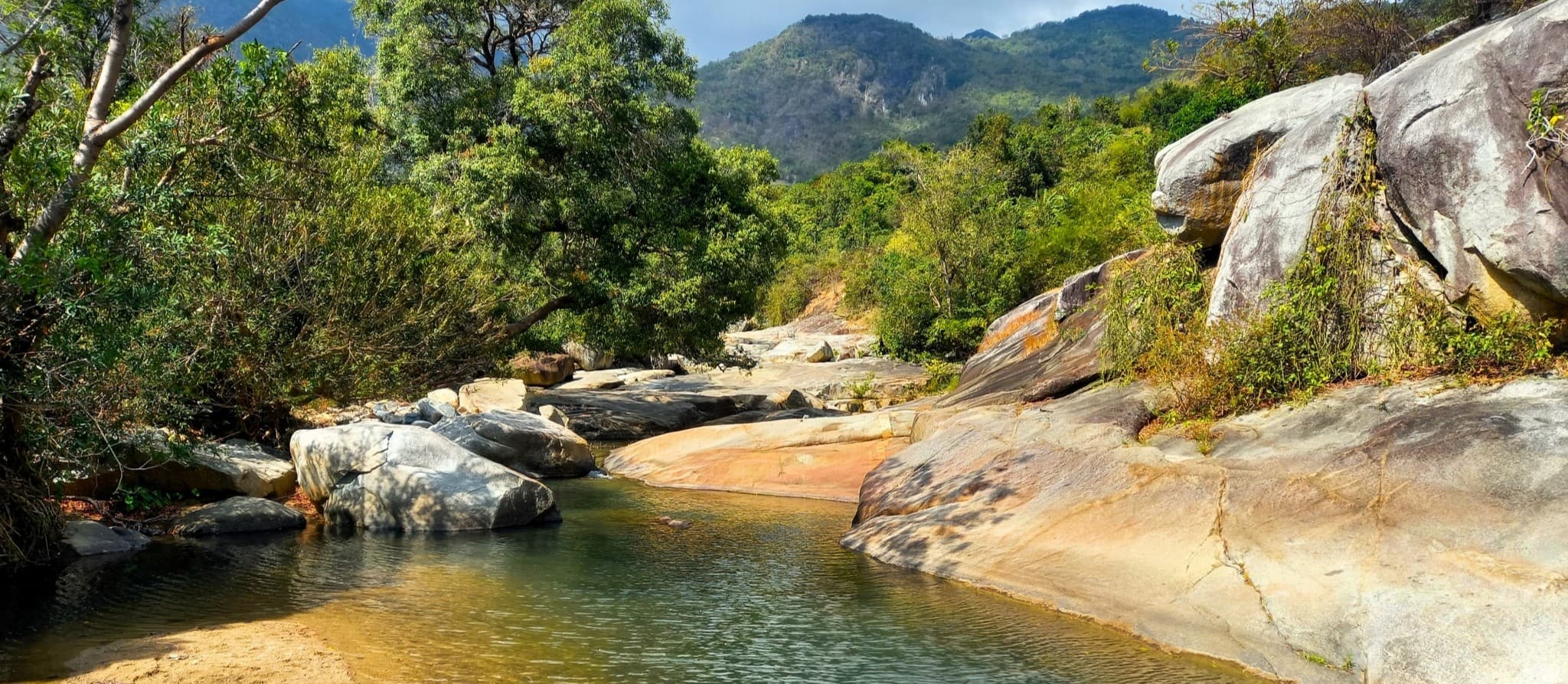
Photos of the Route:
Below is a collection of additional photos taken at various points on the Ninh Thuận Loop. Each image is captioned, including its location on the loop and a link to the route map. This photo gallery should give you an idea of the kind of landscape, scenery and roads you can expect on the Ninh Thuận Loop.


*Disclosure: I never receive payment for anything I write: my content is always free and independent. I’ve written this guide because I want to: I like this loop and I want my readers to know about it. For more details, see my Disclosure & Disclaimer statements and my About Page


