
Last Updated September 2017 | Words and photos by Vietnam Coracle | 46 comments
This post was last updated 7 years ago. Please check the comments section for possible updates, or read more on my Updates & Accuracy page.
INTRODUCTION | MAPS GUIDE | RELATED POSTS
One of the most important resources for a motorbike road trip in Vietnam is a good, reliable map of the country’s roads. Unfortunately, this doesn’t exist. No online map or printed map of Vietnam has all the good roads marked on it. Because Vietnam is such a rapidly developing country, the road network is in a constant state of change: new roads are constructed, old roads are relaid; a good road this year may turn into a muddy track the next due to resurfacing, but the year after it will be a shining blade of smooth asphalt, until it’s wiped out by a landslide and has the be repaired again. No one can keep up to date with road conditions in Vietnam. After years of riding all over the country, I’ve found that the best way to get an accurate picture of the roads in Vietnam is to cross-reference three sources: online maps, printed maps, and local knowledge. By doing this, you’ll be able to find your way from the highest mountains in the north to the most secluded beaches in the south.

Find the good roads: cross-reference online & printed maps with local knowledge

[Back Top]
GUIDE: MAPS FOR A ROAD TRIP
The maps and resources outlined on this page should be used together: don’t rely on just one of them. If a road is marked on one map, check it against the other maps before deciding to take it. Even if a road is marked on all your maps, there’s still the question of condition. Most maps do not indicate if a road is asphalt or dirt, full of potholes or smooth, a treacherous muddy track or a newly laid highway. This is where local knowledge is indispensable: ask a passerby for the most up-to-date road conditions. New roads are being built all the time in Vietnam, but it takes a while before they show up on any map, whether online or printed. Again, always cross-check. On this website, I encourage readers to write road updates in the comments section at the bottom of my motorbike guides so that other readers may benefit from your experience. See below for my tips and advice about which online and printed maps to use and how best to discern the quality of a road before taking it.
CONTENTS:
Cross-reference maps and local knowledge to take you places like these:

Find roads less travelled 
Country lanes lead deep into rural Vietnam 
Climb mountain roads in the far north 
Find your own private beach 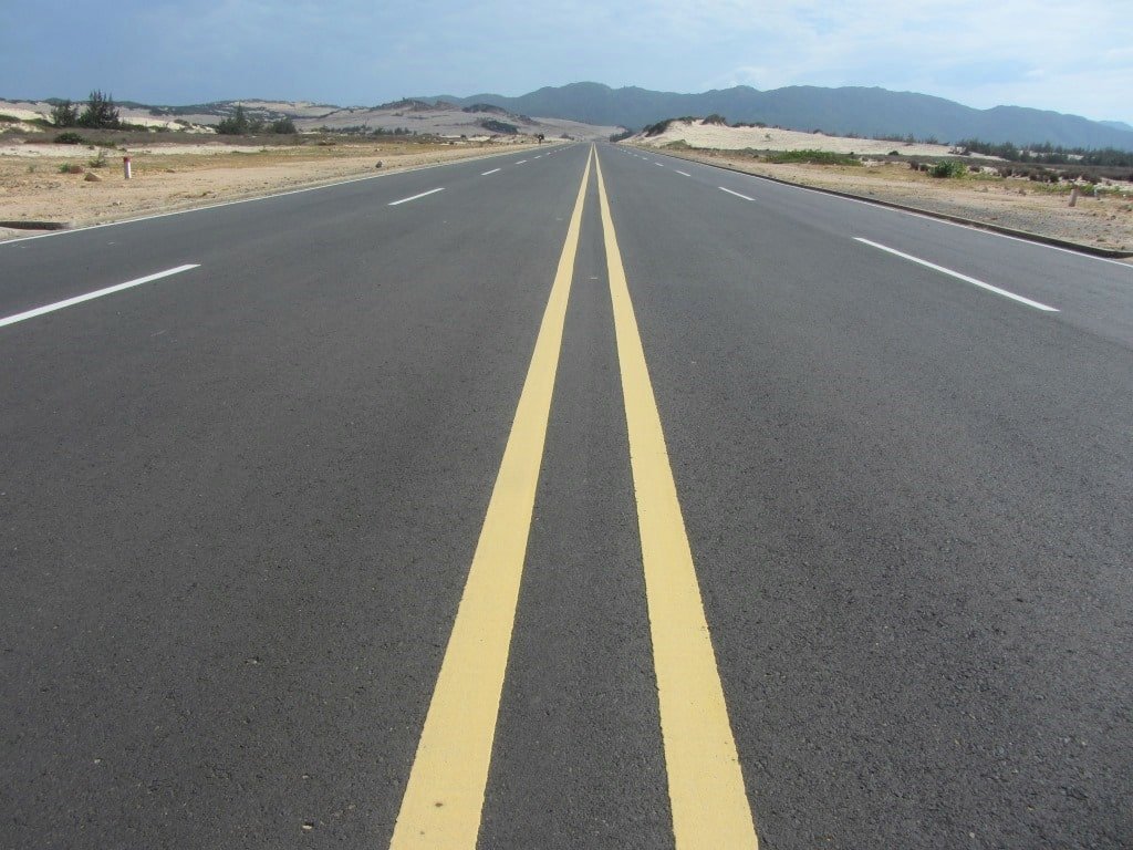
New roads have eased access to remote regions 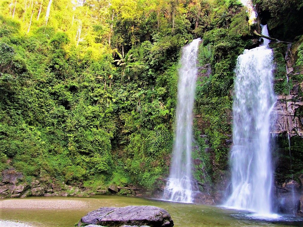
Take back roads & discover sites like this 
This sublime ocean road isn’t marked on some maps! 
Mountain roads suffer from landslides in the wet season 
Take the scenic route: the Ho Chi Minh Road 
Leave the crowds behind 
You won’t be able to find this without a good map!

[Back Top]
PRINTED MAPS:
Although there are many printed maps of Vietnam available, both within Vietnam and abroad, I’m yet to come across one that is wholly accurate, reliable, and regularly and thoroughly updated. Never rely on just one printed map. In my experience, many road maps of Vietnam will not show some of the new and scenic roads – exactly the kind of roads that you most want to be riding – even when the map in question is supposed to be an updated edition. On the other hand, many road maps of Vietnam will show old roads that have either fallen into complete disrepair or have never really been more than a muddy jungle track unsuitable for anything but a 4×4 vehicle or a dirt bike in the first place. However, with a bit of cross-referencing, printed maps can be still be useful. (Note: if you are planning on using either a 4×4 vehicle or a dirt bike in Vietnam, you should be able to handle any of the roads marked on any printed or online map. In this particular review of road maps I am concerned only with riders, like me, who prefer to stay on paved roads and do not have the necessary vehicles to go off-road.)

Choose your maps carefully & always cross-reference, because no map has all the roads on it

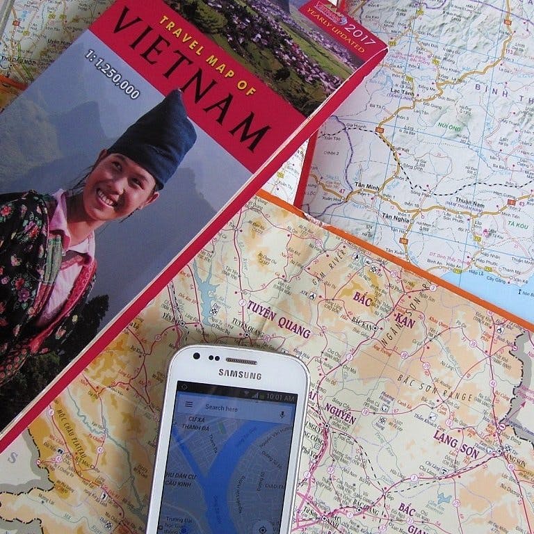
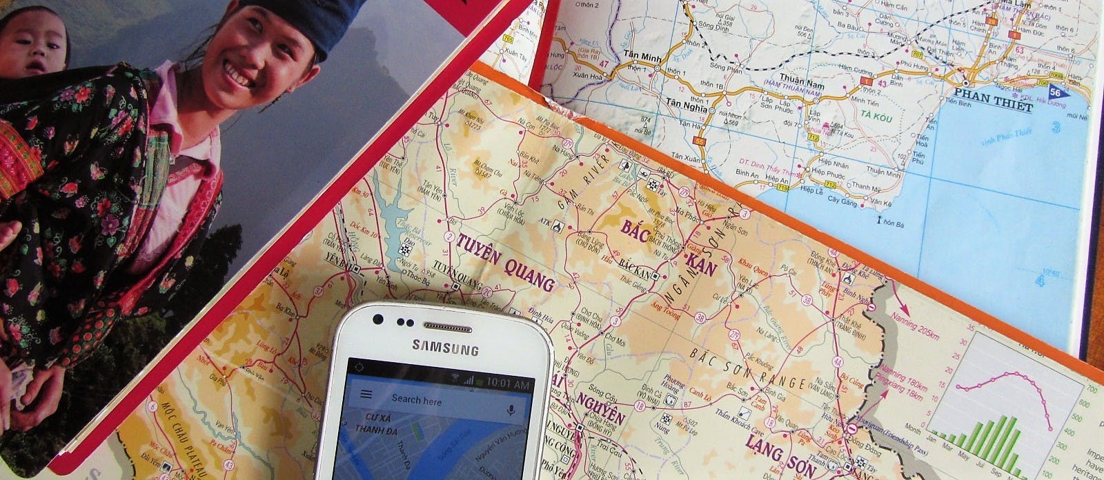
The Travel Map of Vietnam (Vietnam Publishing House of Natural Resources, Environment & Cartography) is nicely and clearly presented, conveniently packaged, and annually updated. At first glance, its lack of detail and fold-out format may seem rather elementary, but, over the years, I’ve found this map to be the only one that does actually add some (but certainly not all) new roads to its content with each new edition. The year of publication is printed in the top right corner of the cover. Other fold-out maps of Vietnam may look more ‘serious’, but in reality they lack a great many good, scenic and important roads, with the notable exception of the Reise Know-How map (a German publisher), which has lots of roads on it, but is a little confusing to follow because of its colour coordination.

The Travel Map of Vietnam is reprinted & updated (mostly) every year
However, the Travel Map of Vietnam is by no means thorough. I was particularly disappointed to find that the ‘new’ 2017 edition does not include a great many new, large, scenic, and major roads, some of which have been in existence for well over a year now. But, as a general overview (particularly because of its fold-out format which makes it really fun to plan your route across the country) this is still a very good map, especially when used in conjunction with online maps. It can be difficult to find a new copy of the Travel Map of Vietnam. You can ask around in the backpacker areas of major cities, such as Saigon, Hanoi, and Nha Trang, or just go straight to the nearest branch of Fahasa Bookstores. The map costs a couple of dollars (40,000-60,000vnd).

The Travel Map of Vietnam is easy to use & has lots of roads that other printed maps don’t
The Road Atlas of Vietnam (also produced by Vietnam Publishing House of Natural Resources, Environment & Cartography) looks and sounds perfect; but it isn’t. A hardback map book with over 50 pages of detailed roads, all colour-coded to indicate whether a road is a national highway, provincial route, or dirt track, this should (and could) be the ultimate riders’ map of Vietnam. Unfortunately, the atlas is rarely (if ever) updated. The first edition I bought was published in 2011, and even then it did not include some major and scenic routes. A couple of years later I bought the 2013 edition, which did include some minor additions. Recently I checked out the ‘new’ 2017 edition: at a glance, the map appears not to have changed at all – no updates, no new roads; nothing.

The Road Atlas of Vietnam looks promising, but it hasn’t been updated for years now
So, although the Road Atlas of Vietnam is still in print and still on the shelves of bookstores throughout the nation, essentially it has not been updated for at least 4 years, and that’s a long time in a country where new roads open each week. It will also set you back between 100,000-300,000vnd (around $10) depending on where you buy it. Personally, I still like to have a copy of the Atlas with me (and I still cling to the hope that, one day, I will pick up a new edition which will have been 100% updated), but if you rely solely on this map to plan your Vietnam road trip, you will be missing out on some of the best roads that the country has to offer.

The Road Atlas of Vietnam is a waste of money, until (if ever) they publish a fully updated version
ONLINE MAPS:
Online maps have, of course, changed the way we travel forever. Google Maps, among others, is an incredibly useful tool to have on a road trip in Vietnam. WiFi and 4G is readily available all over Vietnam, making access to online maps relatively easy. Regardless of connectivity, many of these maps are now available offline too. However, as with printed maps, online maps are not infallible, and even satellite images can’t keep up with the pace of Vietnam’s road building. The same rule applies to online maps as to printed maps: always cross-reference with other sources. The advent of online maps has made many travellers ‘map lazy’, leading people put all their trust in, for example, Google Maps, ignoring their own common sense and losing any sense of direction they may have once had. This is not a smart thing to do, at least for a motorbike road trip in Vietnam.

Google Maps & other online maps are great, but, just like printed maps, they’re not infallible
Google Maps is the obvious and most popular choice for online maps. It’s a fantastic resource for motorbike riders in Vietnam. Many roads that aren’t marked on printed maps are clearly visible on Google Maps, and the GPS function is a great help when you’re on the road. However, Google Maps does not work offline in Vietnam (I am not certain what the reason for this is, but the offline function will not operate within the country). This means that, when you’re out of range of data or WiFi, you can’t follow a pre-drawn route, including my own routes on this website. Also, relying on Google Maps as your sole resource is unwise. Google cannot keep up with the pace of change in Vietnam: I regularly have to manually draw roads onto the Google Maps that I create for my own motorbike guides on this website because, according to Google, they do not exist. Eventually, Google updates its data to include these roads, but the point is that Google does not have all the answers all the time. What’s more, using the ‘Directions’ function on Google Maps in order to find a route between A and B is absurd: in most cases Google will send you on the most direct route, regardless of the condition of the roads or the scenery they pass through. This defeats the whole point of a motorbike road trip through Vietnam: to use good, quiet, scenic roads as much as possible, stay off the main highways and see Vietnam at its best. I use Google Maps to create the route maps for my motorbike guides on this site, and I am in awe of what it does and what it has allowed me to do. But it must still be used in conjunction with other sources of information, including other online maps, printed maps, and local knowledge.

Google Maps is an excellent resource for a road trip, but its offline function doesn’t work in Vietnam
OpenStreetMap has been gaining popularity in recent years, and is looking to rival Google Maps as the world’s go-to online map. Inspired by Wikipedia, OpenStreetMap is crowdsourced, meaning that it can be updated by any of its users at any time. This is perfect for a country like Vietnam, where roads are in a constant state of change. Indeed, OpenStreetMap is largely accurate in mapping Vietnam’s road network, especially when it comes to newly opened roads. Of course, like all other maps listed on this page, it does not have all roads marked on it, and it is only as good, up-to-date, and accurate as the people who contribute information to it. Indeed, we can all help OpenStreetMap to be as good as possible by uploading any new roads to its database. Finally, Maps.me is a mobile app that uses the data collected by OpenStreetMap to create a map that’s available offline, so no matter where you are in Vietnam, you’ll have access to it.

OpenStreetMap is a good alternative to Google Maps, and Maps.me works offline in Vietnam
LOCAL KNOWLEDGE:
No map of Vietnam is 100% reliable. As I mentioned above, road conditions are constantly changing: a quiet, one-lane paved road in the countryside one year, might be a building site full of dust and mud the next year, and a brand new six-lane highway the next. On top of this, severe weather regularly affects Vietnam’s roads: heavy monsoon rains can cause landslides that block and damage roads, and newly laid surfaces can quickly deteriorate into potholed nightmares. Although cross-referencing different printed and online maps will help you establish which roads exist, they will not give you any idea of the current condition of those roads. For this, your best bet is to rely on local knowledge.

Ask a local: for current road conditions, shortcuts & new roads, locals usually know best
Before deciding to take a road that you are unsure of, ask local people for their opinion on the current condition of that route. If you are only in Vietnam for a matter of weeks, the chances are that you won’t speak any Vietnamese. But, you’d be surprised how widespread English is in Vietnam these days. What’s more, Vietnamese people (especially in the countryside) will often go out of their way to help a foreign traveller. Even if the local you are asking does not speak English, they will likely go and fetch a friend who does. Even without any shared language, communication is still possible. As an independent traveller, you’ll no doubt be well-versed in the ways of ‘International Travellers’ Sign Language’, which will help you communicate questions such as, ‘Is this road bumpy and dangerous, or smooth and safe?’, by way of gesticulation and body language. If you want to try practicing your Vietnamese, the following phrases should be useful:
Đường này đẹp hay xấu? (Literally, ‘Is this road beautiful or ugly?’, but the meaning is more like, ‘Is this road in good or bad condition?’)
Đường này dễ đi không? | Đường này đi được không? (Is this road comfortable/easy to ride? | Is it possible to take this road?)
Đường này đi đâu? | Đường này đi (place name) không? (Where does this road go to? | Does this road go to [place name]?)

Even with the language barrier, it’s usually possible to communicate directions with people you meet
However, the same goes for people as for maps: cross-check the information you receive. For example, before taking a road I’m not sure about, I’ll first consult all of my printed and online maps, then I’ll ask a good percentage of the population of the local village for their opinion, in order to get a general consensus about its current condition. In general, this technique has served me well over the years. Not only have local people been able to inform me of road closures due to landslides or major roadworks ahead, they’ve also told me about brand new roads, recently completed and not yet marked on any maps. And, above all, I’ve met some extremely hospitable people in this way.

Asking directions is also a great way to meet people. (Photo by Samuel Mather Photography)
ADDITIONAL RESOURCES:
In addition to printed maps, online maps, and asking locals, there are several websites that are helpful to determine where the best roads are and what condition they are in. Of course, I recommend using my own extensive guides and maps to motorbike routes across the country. Each guide includes a detailed map (designed using Google Maps), on which I’ve marked all roads (even the ones which Google has missed), places of interest, food and accommodation. I try to keep my maps and guides as accurate and up-to-date as possible. I do this by travelling along my routes regularly and updating information as I go. But I also rely on readers, such as yourself, to keep me informed of road conditions and anything that you think is relevant. You can do this either by writing a comment at the bottom of the guide you’re referring to, or by emailing me at vietnamcoracle@gmail.com. Your contribution is a great help to me and to other readers using this website. You can browse all of my motorbike guides in this archive. (Note: if you are using any of my guides and maps to navigate around Vietnam, always check the comment section at the bottom of the guide to see if readers have written any important updates that may affect the route. Also, check the ‘Last updated’ date at the top of each guide, just below the title.)

I try to keep my road trip maps on Vietnam Coracle as accurate and up-to-date as possible
The Vietnam Back Roads Facebook group is a good source of updated information. Many of the people in this group are seasoned riders living in Vietnam with good knowledge of the country’s roads. Either search the group for a particular topic, or post a question to the group to see what advice people can offer. Also, popular travel forums, such as the Lonely Planet Thorn Tree or Travelfish, can be good sources of information.

Choosing the right maps & resources will help ensure you find the best riding roads in Vietnam
RELATED POSTS:
- How to Send a Motorbike on the Train
- Expenses for a Motorbike Road Trip
- Weather in Vietnam: When & Where to Go
- Saigon to Hanoi by Motorbike: 5 Suggested Routes
[Back Top]

I am Bao Lac. Just decided tonight I will ride to Cho Ra. OSM and Google can give you route using the QL34 and 258. Can anybody give me the condition and surface of this road.
other option is QL34 and QL279
thank you
Hi Warrem,
You could take a look at the High Roads guide and also check the comments section in that guide for any updates.
Best,
Tom
Hi Tom, thank you for this guide. I am Japanese.
I am planning to take a bicycle trip from Ho Chi Minh City to Buon Ma Thuot on National Highway 14 in January 2024. I ask you.Are there any dangerous animals along the way and are there any dangerous places to run at night? Also, are there any websites that are useful for finding accommodation?
I have a reise-know-how Vetnam South map. In 2018, I cycled 1,030km from Da Nang to Ho Chi Minh City in 10 days.
thank you
Hi Adachi,
Highway 14 is no more dangerous than other main roads in Vietnam and the animals are the same too 🙂
You could try Agoda for accommodation options – just type in the name of the town/region and the dates and it will give you some choices.
The journey from Ho Chi Minh City to Buon Ma Thuot on Highway 14 is OK, but it’s not one of the most interesting or beautiful roads in Vietnam.
Best,
Tom
I just returned to the US from a 10 day trip on one of Rent-A-Bikes XR150’s to the north eastern portion of Vietnam. I agree with you about Google maps. I’d say that they were 90% reliable but to certainly use common sense. Great website by the way, thanks.
Thanks, Paul. Great to hear you enjoyed your road trip.
Best,
Tom
Hi Tom, I’ll be riding from Hanoi to HCMC in May and taking the beach bum route, however, I’ll be starting the trip a little differently and would appreciate some advice. I intend to make my first stop in Ninh Binh, but I see that the suggested route steers clear. Is there anything I should know about the potential routes between Hanoi and Ninh Binh? I assume I cannot ride on CT01, but would like to know if there are other non-motorbike roads between.
Thanks, Chris
Hi Chris,
Yes, that’s right: motorbikes can’t use any CT roads in Vietnam. The most direct route between Hanoi and Ninh Binh is to take QL1A – it used to be horrible, but perhaps it’s not as bad now that the CT route takes some of the traffic. Otherwise, you could follow the Beach Bum route out of Hanoi as far as Phú Thành then head due southeast on QL21A and DT438 until you reach the general Ninh Binh sightseeing area. But I don’t know that area well enough to be confident of back-roads routes.
Also, bear in mind that whatever route you take, the first hour or so of riding out/into Hanoi and Saigon can be pretty grim.
Best,
Tom
Hi Tom
Thank you very much for a helpful site, make me so excited for my trip that I plan to do late May or early June.
Haven’t a lot of experience with gear bikes, but I’m planning to do the motorbike route Saigon to Hanoi in worst case solo anyway. (thinking of the classic route)
Honda XR 150 L is recommended according to internet, quite unsure still when it comes to choice of bike, any suggestions?
Any advice on how to find a travel buddy, maybe even during some parts along the way? (not so much for Social Media) but is there a special site for this kind of things e.g.?
Thanks in advance
Hi Seth,
The XR is a great bike, but it’s not necessary to use such a bike for the route you’re planning to ride. If you’re unfamiliar with manual gear bikes, I would suggest using an automatic or a semi-auto instead – this will be much easier for you to ride, and unless you are planning on going off-road, you don’t need a manual bike like the XR.
For travel companions you can try the Vietnam Back Roads Facebook group, and you will also probably bump into other riders when you are on the road.
I hope this helps,
Tom
Hi Tom,
I am getting down to the nitty gritty stage of route planning for an upcoming trip to Vietnam in early November – I have been drawing on your informative guides very extensively and have found them to be invaluable. I am came across the Guide to Maps section today which again contains much useful information – for example the Vietnam Back Roads Faccebook page which I have just had a quick look at. I did notice the section on local knowledge and I am thinking at this point you are the most knowledable local that I have access to at the moment so I thought I would shoot you a question about a route from Buon Ma Thuot to Phac Long which runs parallel to the Cambodian border and specifically DT 741 – Is this a road you are familar with and can you shed any light on what condition it is in? https://www.google.co.jp/maps/dir/Buon+Ma+Thuot,+%C4%90%E1%BA%AFk+L%E1%BA%AFk+Province,+Vietnam/Ph%C6%B0%E1%BB%9Bc+Long,+Binh+Phuoc,+Vietnam/@12.1875857,106.9502447,9z/data=!3m1!4b1!4m14!4m13!1m5!1m1!1s0x3171f7d4216cd2fb:0x9f4a5ec2f999fb4!2m2!1d108.0382475!2d12.6661944!1m5!1m1!1s0x3173695fc877ce0b:0x2aa8fc15435d686a!2m2!1d106.9948945!2d11.8337331!3e0?hl=en
Also, I am trying to find information about what the different road designations mean – e.g QL. DT AH – I am sure at one point I saw this on your page somewhere but can’t seem to find it again.
Many thanks
Hi Richard,
That route along the Cambodian border is a mixture of good road conditions and bad road conditions. However, it’s also a ‘sensitive’ area, because it’s a border region, and many riders get turned back by police. I don’t think it’s worth riding it, especially if you have limited time. Just take the Ho Chi Minh Road (QL14) between those points instead.
The road names: QL=national road (usually bigger and well-maintained, but not always), DT or TL=provincial road (mostly pretty good these days, but some can still be no more than muddy tracks), AH=Asian Highway (similar to QL roads but often bigger and busier), finally CT=expressway (big, wide, new roads that almost always are for vehicles only – no motorbikes).
I hope this helps,
Tom
Thanks Tom. Looks like some good advice on both scores.
Hi Tom
Your site is fast becoming my bible to planning our Vietnam trip. It’s awesome. Thank you!
We will be starting in HCMC around early February, heading north. At the moment we are thinking between 4-6 weeks total trip time. My question, is it easy just to plan ahead one or two days at a time? Or do you think we will have to book accommodation further ahead than that?
Any types gratefully received.
Thanks
Julie | 2checkingout
Hi Julie,
Great to hear you’re enjoying the site.
There are two things in particular to be aware of if you’re visiting in February: firstly, the weather anywhere north of Danang at that time of year can be surprisingly chilly and grey, especially in the northern mountains. Meanwhile, the weather everywhere south of Nha Trang should be dry and sunny. I’ve written more about weather here.
Secondly, your trip will probably crossover the Tet Lunar New Year holiday at some point. This is a time of year when all Vietnamese families travel domestically – things can get extremely busy so it’s essential to book hotels and transport in advance. But apart from that you should be able to take it as it comes, except for weekends and maybe particularly popular destinations, such as Sapa or Nha Trang.
I hope this helps,
Tom
Hi Tom!
I use Google Maps a lot when on the motorbike in Vietnam. Planning my road on-line and download the maps onto the iPhone. When on the bike I switch off mobile data – this way the Google woman can not change my route all the time. Never had a problem this way.
I download small portions of the map – avoid Laos and it will work!
Hi Marc,
Thanks. Yes, that sounds like a good system.
Tom
Hello Tom, thanks for the great website. I’m planning to cycle some of the northern provences after crossing the border at Lao Cai and was wondering if you know of anywhere in Lao Cai to buy these maps?
Hi Tom,
As far as I know, the road atlas is now out of print, but the travel map of Vietnam is still updated every year, and is still good. However, I think you’d be better off looking for the map in Sapa than Lao Cai – check out the tourist shops, you should be able to find it in one of those.
I hope this helps,
Tom
Hi tom.
I’m WOOKK.
I work and live in HCM.
anyway… When I was searching “Vietnam Pitch tent avaliable” in Google, I found Your site.
Thank you for Your map “SGN-NHA camping site” It was very helpful post to me.
And I have some question for you.
1. Is it pitching tent in any place(like some beach or forest) possible?
2. Do you have any information camping site from NHA-HAN?
3. How do you think 1 people camping In Your camping sait map?
thank you~have a good day.
Hi WOOKK,
You can pitch your tent in the countryside if there is not a campsite, but you should be as discreet as possible: try to make sure no one sees you pitching your tent; try not to be easily visible from the road; in general, don’t draw attention to yourself; and lastly, make sure you don’t leave any trash behind.
I haven’t written a guide about camping from Nha Trang to Hanoi yet.
I don’t understand your last question: do you mean, is it OK to camp alone at the campsites? If so, then yes it’s fine to camp be yourself at the camping sites along the Ocean Road; you’ll probably meet other campers there anyway.
I hope this helps,
Tom
Hi,
The two maps recommended can you please give me the ISBN number? I live in Thailand and presume they are available here.
I am planning a trip later this year or maybe early next year touring alone the whole country, it would be nice to have maps to route plan alongside your routes.
Many thanks
Chris
Many t
Hi Chris,
The ISBN for the Travel Map of Vietnam is: 978-204-904-589-9
Most people report that the Road Atlas of Vietnam is no longer in print – which doesn’t really matter because it was never thoroughly updated anyway!
I hope you find the Travel Map in Thailand and have fun planning your trip.
Tom
Hi Tom,
Many thanks, i will get it ordered!
I have ridden all around Thailand and always use a map, never GPS, i just prefer it that way. So along with your trip reports this shoul be fun.
I see you recommend Sept for the North East loop, as i prefer mountains i would intend to spend time there and make my way South, how would the weather be usually heading South from there?
Thanks again for your assitance.
Chris
Hi Chris,
Yes, in general I would say the north is best in late spring and early autumn. Once you head south from the mountains the weather can be pretty bad in north-central Vietnam at that time of year. But south of the Hai Van Pass it will be fine. I’ve written more about weather and when to go here.
I hope this helps,
Tom
Hi Tom,
just back from a 3 weeks trip from Saigon to Hanoi.
A map I would recommend is the International Travel Maps Vietnam. I compared it with the map that you recommend in your blog and it seemed pretty much identical.
The great thing about this map is I was able to buy it before my holiday, so I could mark hotels and routes on it.
Make sure you get the latest edition, which at the moment can be found by googling “ITMB Vietnam 2015”
Thanks for your blog. I loved travelling along the “Best section” from Kon Tum to Pho Chau. Other highlights were; the smiling, incredibly freindly Vietnamese people and on our first night off the plane, we did the “Vietnam Vespa Adventures Saigon After Dark Tour”.
Enjoy 🙂 Neil R
Hi Neil,
Great to hear you had such a good road trip. Thanks for recommending the map – I have looked at that map in the past but there were some good roads that it didn’t have marked on it. However, perhaps they’ve updated it now – I’ll have another look the next time I see it.
I’m actually on the ‘Best section’ of the Ho Chi Minh Road right now – it’s fantastic 🙂
I hope you get the chance to come back to Vietnam for another road trip.
Tom
Cheers Tom
You’re welcome 🙂
Hi Tom,
On arrival in HCMC yesterday I proceeded to Fagasa bookstore to purchase the road atlas that you recommend. Unfortunately they didn’t have any in stock. Can you suggest other bookstores I could try to purchase one.
Thanks Heather.
Hi Heather,
I’ve been hearing a lot recently that the road atlas is no longer in print. However, the Travel Map of Vietnam (the smaller map in this post) is definitely available and is updated every year. The new 2016 edition has a picture of an ethnic minority woman and girl on the front cover. You should be able to find this map in bookstores or around the backpacker area in Pham Ngu Lao, Bui Vien and De Tham. It’s an excellent map.
I hope this helps,
Tom
Hi Tom,
Thanks so much for this article! About how much time do you need to motorbike through vietnam? My allotted time is about 4 weeks and I’m unsure if this is enough. I know it can vary by distance, but if I start in Hanoi, how far down do you think I can go while still being able to enjoy each location without having to zoom through it? Thanks!
Hi Nate,
Yes, 4 weeks is a great amount of time to have for a road trip from north to south. For more details about time and routes please take a look at this guide which I have just published, because it deals with these issues in more detail.
I hope this helps,
Tom
Hi,
Im planning to do the mototbike trip in April, which route is the most common? North to south or south to North?
Hi Kristian,
I don’t think either direction is more common. Generally, it depends on personal preference: the south is more about the coast, and the north is more about mountains, so it depends which you want to do first and which you want to save until the end 🙂
Tom
Hi Tom,
I just saw that you had visited Dien Bien Phu on your 2-month trip. We plan to ride out bikes from Ha Noi to DBP before heading south to join the HCM Road that you had recommended. Looking at the maps, we don’t know if we can go from Ha Noi to DBP then “turn south” without having to retrace your steps. We would prefer to not backtrack as it would save us time and also not to travel the same road again. Any suggestions would be greatly appreciated.
Thanks again for being a great resource.
Hieu
Hi Hieu,
Yes, you can do a kind of stunted Northwest loop: from Hanoi head up to Sapa on Road 32 via Nghia Lo and Mu Cang Chai – this will give you the chance to see the rice fields on the Harvest Route. From Sapa head west to Sin Ho on Road 4D and then south to Dien Bien Phu on Road 12 (read more HERE). From Dien Bien Phu take Road 6 all the way to Mai Chau. From Mai Chau head south on Road 15 until you meet the Ho Chi Minh Road at Ngoc Lac.
This is a great loop and very scenic – but remember December is very cold in the north, so just be prepared for that.
Also, the Ho Chi Minh Road is fantastic, but after Kon Tum you should consider dropping down to the coast for the terrific coastal back-roads, which you can read more about HERE
Have a great trip,
Tom
Hi Tom
On a recent trip to Dalat I ran out of 3G on most of the route so could see only major roads.
Is it possible to save areas of google maps beforehand in .pdf or whatever?
The alternative is to take prints of your proposed route at an internet cafe before you set off.
Another option is to download the Vietnam map from MAP.me
Cheers
Alan
Hi Alan,
I would buy one of the maps listed in this post to supplement Google Maps – no 3G needed for those 🙂
Also, be careful – especially around Dalat – when using Google Maps. One or two large roads near Dalat are quite simply not there.
You can open any of my route maps on Google Maps when you have an internet connection and just save them or leave the browser window open on your phone. Then you can look at it even when there’s no 3G. The same goes for any Google Map. Just make sure you zoom in and out a few times so that it remembers the data, otherwise it won’t load when you’re away from internet. At least that works for me.
I hope this works.
Tom
Hi Tom,
As at 24 March, Road Atlas of Vietnam (Tập Bản Đồ Giao Thông Đường Bộ Việt Nam) was easy to find but we couldn’t find the red and yellow Travel Map of Vietnam anywhere in either HCMC or Hanoi.
The Road Atlas along with google maps and the National Geographic Adventure series map of north Vietnam, all used together worked fine.
You’re definitely right – no one map source is perfect.
However the blue and white road signs as you ride out of a town we found to be accurate.
As you ride, the white, rounded concrete roadside distance markers painted with town name and kms are also very useful.
Hi Kez,
Thanks. Yes, the small red and yellow map is quite difficult to find – it often appears in backpacker trinket shops.
Tom
Thanks for a informative read I will be travelling south to north by motorbike on my own. All info will be greatly appreciated.
Hi Neville,
Well, there’s a lot of informative info on this site about motorbiking south to north Vietnam. Browse through my Motorbike Guides Archive to find any articles that are relevant to you.
If you have any specific questions regarding your trip then feel free to email me or leave a comment of the relevant page and I will reply as soon as I can.
Tom
Hi Tom i will be travelling Saigon Mekong delta to Phu Quoch by motorbike 24th Jancould you reccomend the best route as i want to have alook around and take time and with Tet on the horizon the do’s and dont’s your information very much appreciated thanking you .Neville Foley
Hi Neville,
Take a look at my Guide to Driving to Phu Quoc. You can modify the route to take the back road along the Cambodian border to Ha Tien if you like – check the comments at the bottom of the guide for more information.
Roads might be busier with Tết just around the corner, and once you get really close to Tết you may even have trouble getting a boat ticket from Ha Tien or Rach Gia to Phu Quoc.
Tom
Sorry, Neville, I forgot to include the link to the guide! Here it is 🙂