

Last updated May 2025 | Words and photos by Vietnam Coracle | 141 comments

Tom Divers is the founder and creator of Vietnam Coracle. He’s lived, travelled and worked in Vietnam since 2005. Born in London, he travelled from an early age, visiting over 40 countries (he first visited Vietnam in 1999). Now, whenever he has the opportunity to make a trip, he rarely looks beyond Vietnam’s borders and his trusty motorbike, Stavros. Read more about Tom on the About Page, Vietnam Times and ASE Podcast.
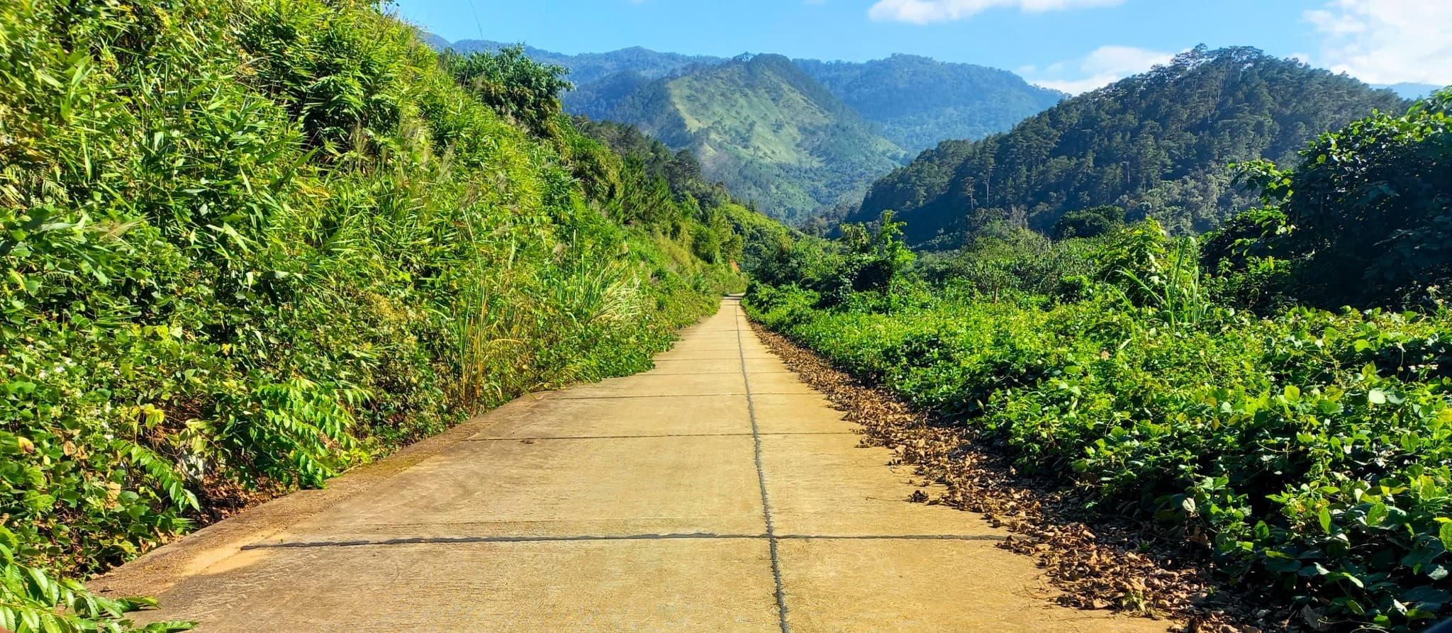
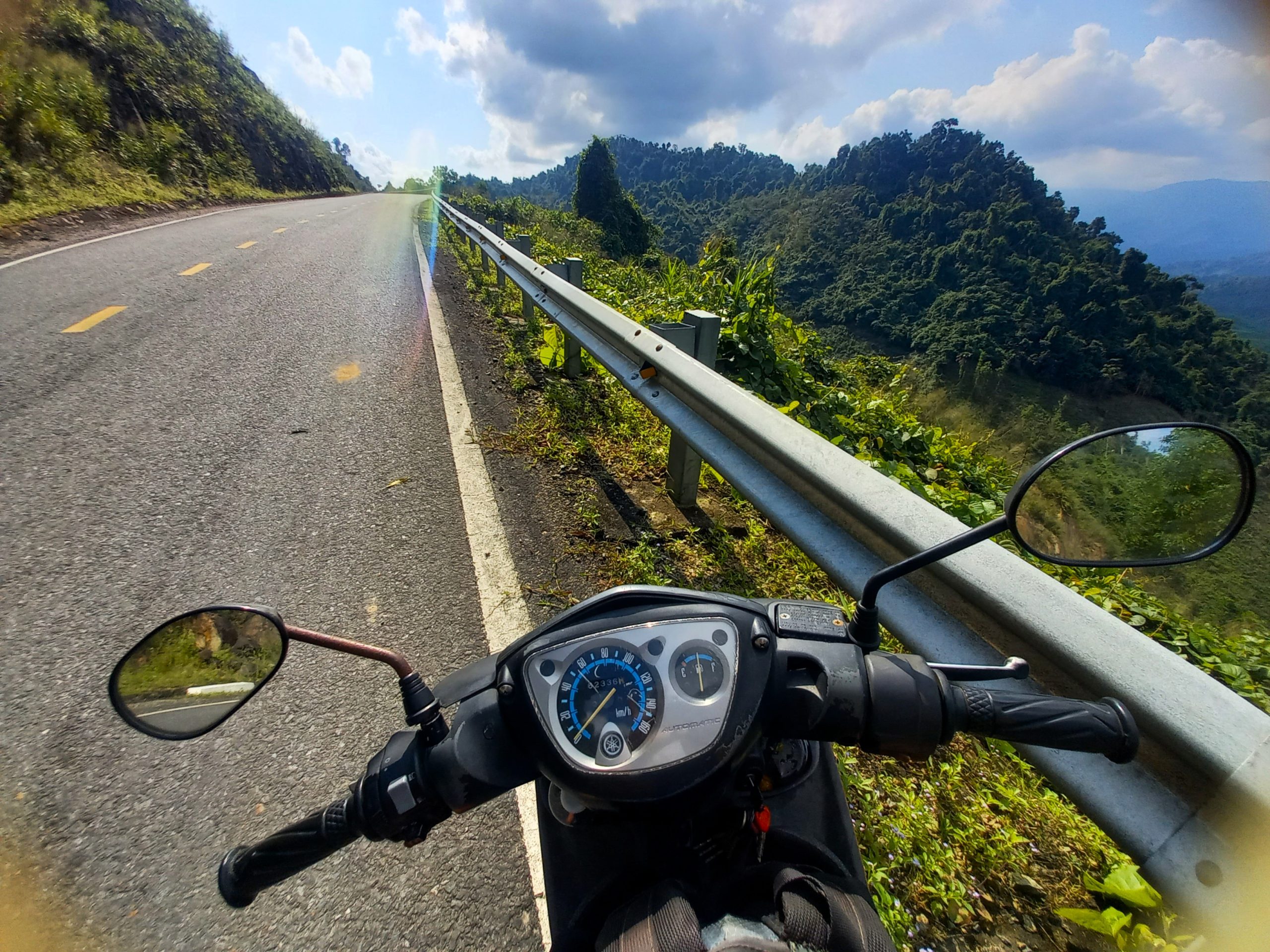
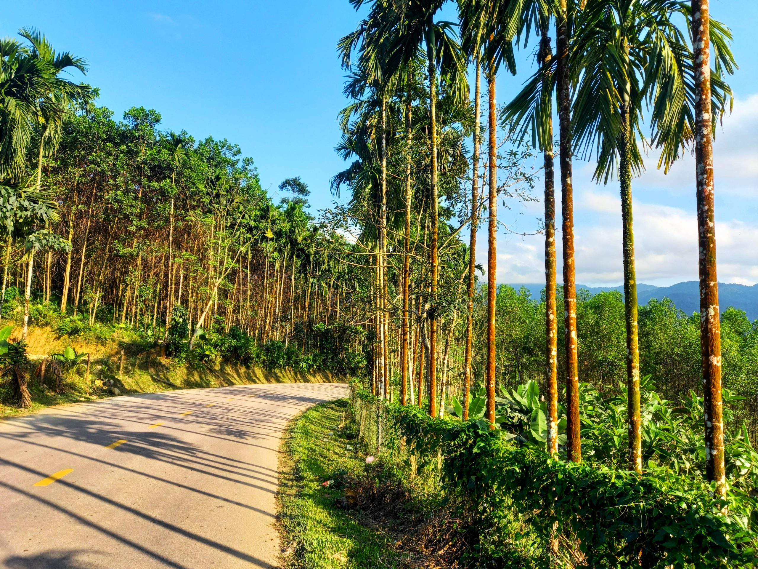
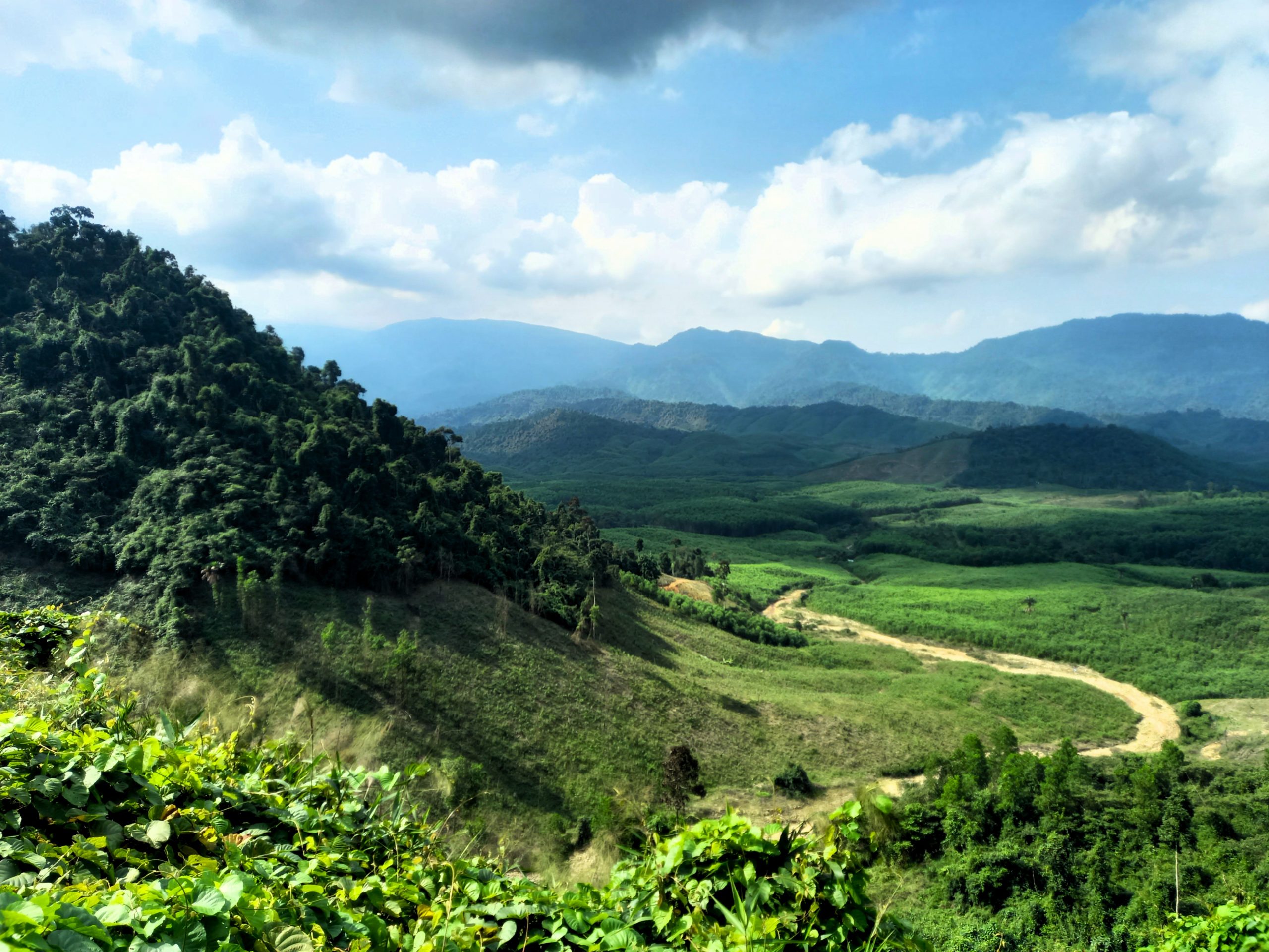
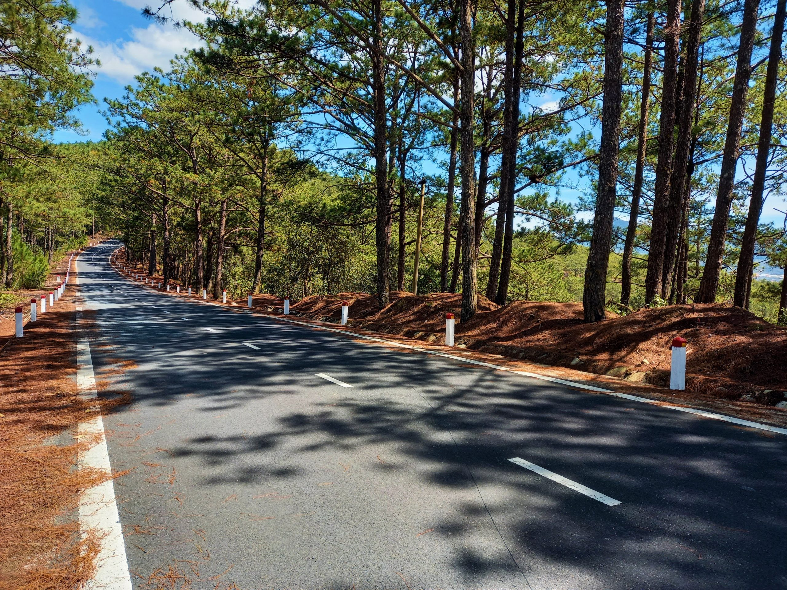
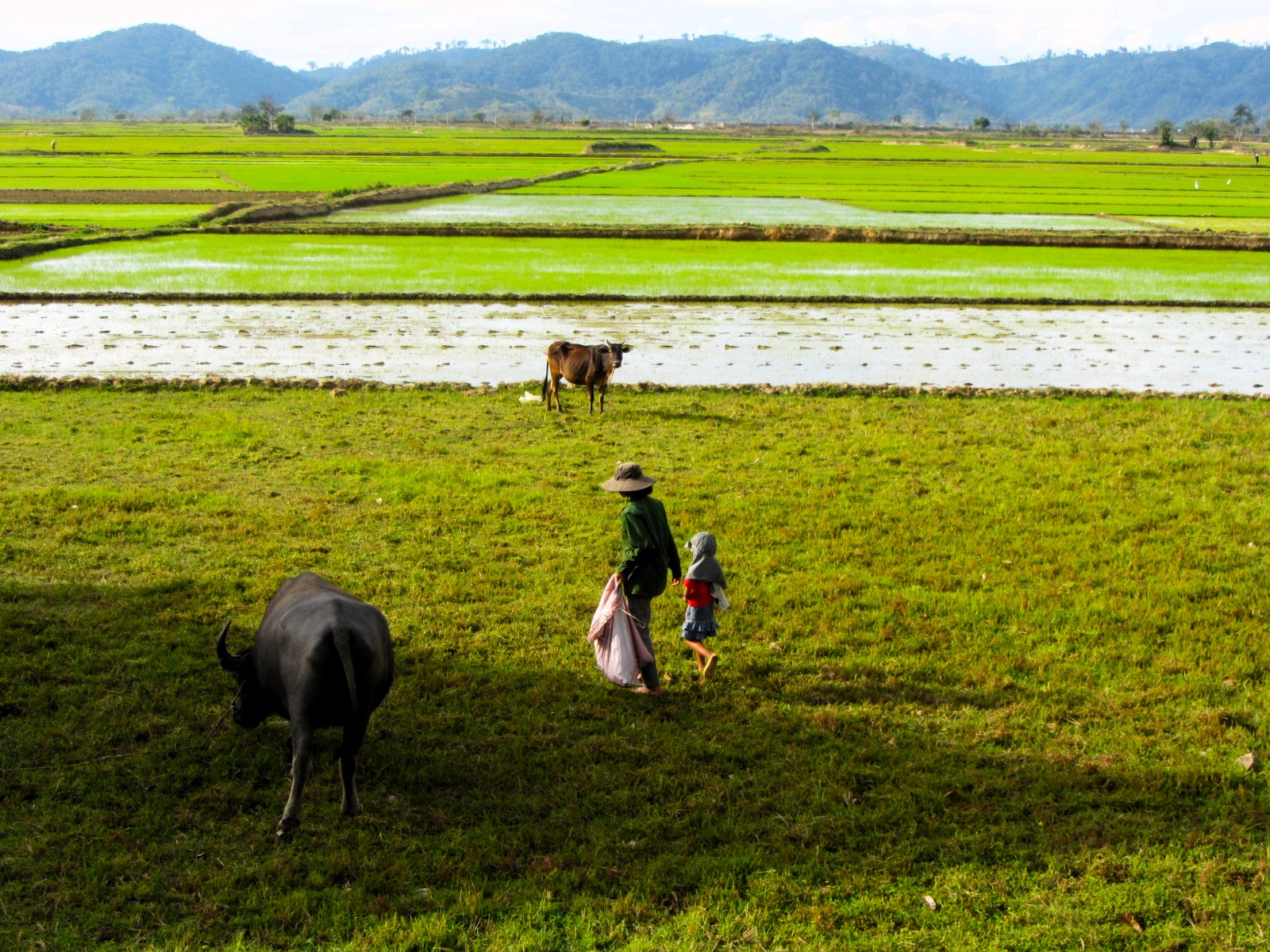
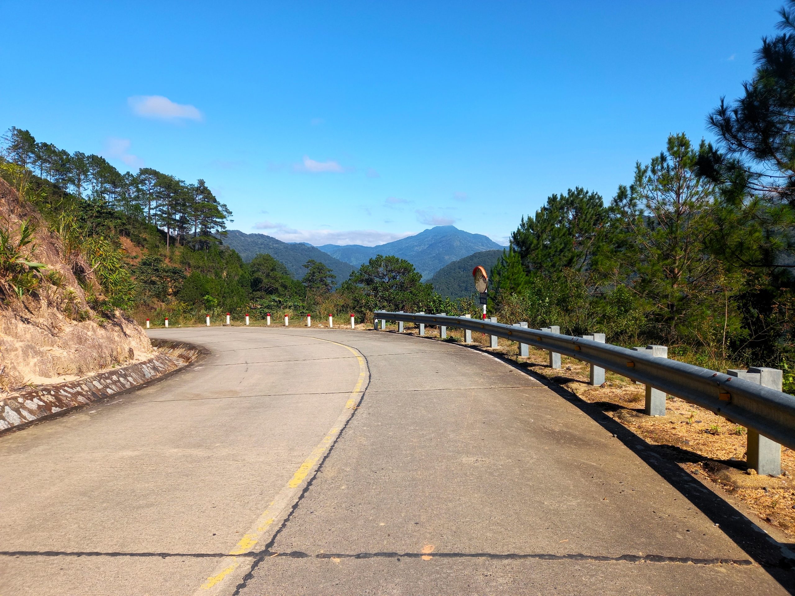
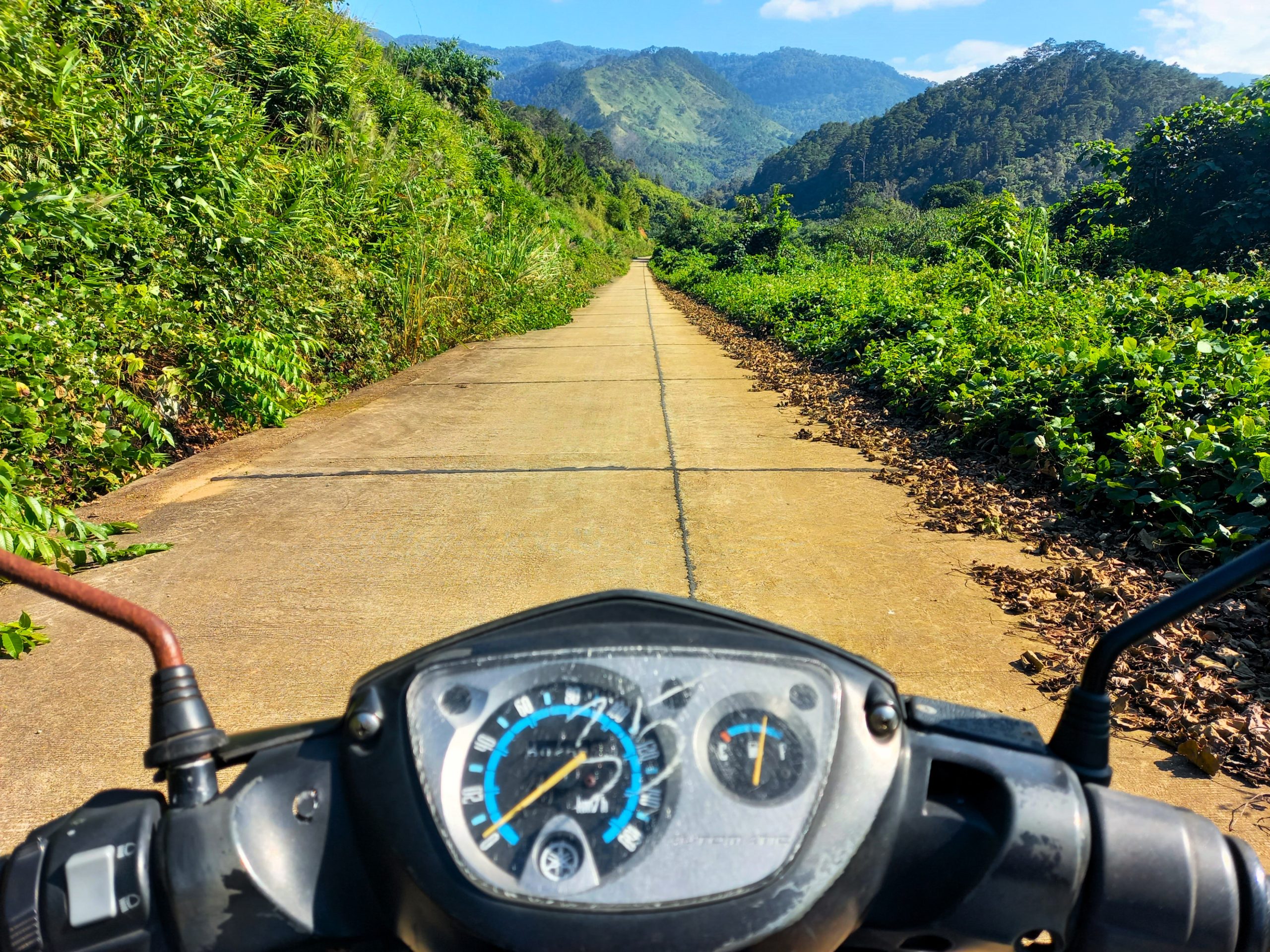
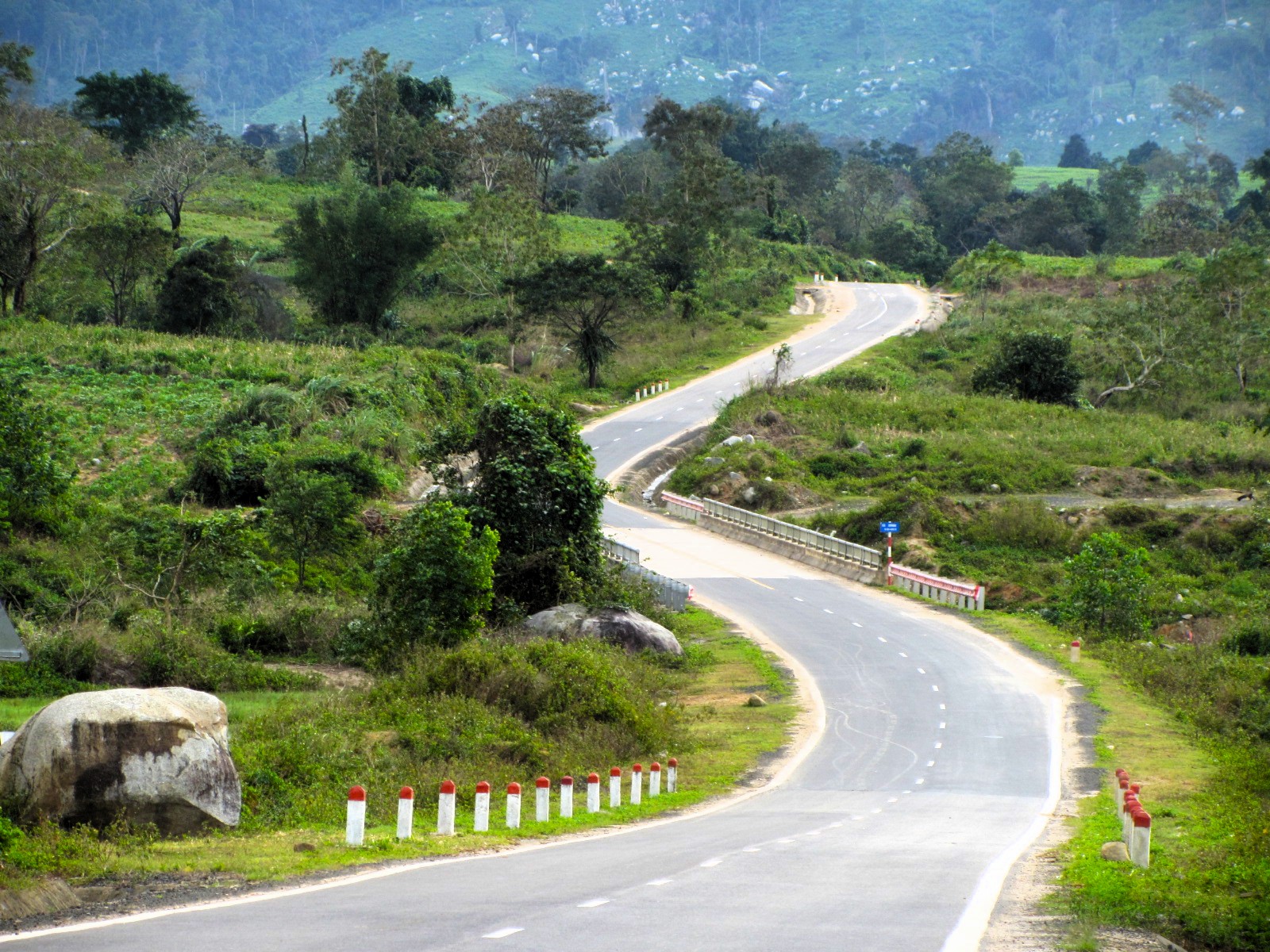
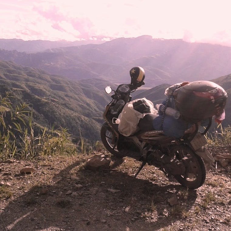
A romp through the heart of the Central Highlands, the Trường Sơn Đông Road is a ride to be savoured, both for scenery and for sheer riding pleasure. Many sections of this 790km-long road are brand new and in excellent condition as they pass through dense jungle, cutting dangerous passes along steep ravines, and meandering like a river of asphalt through rolling farmland. Traffic is light and the land sparsely populated – dotted with highland villages with strange and exotic sounding names, like Ayun Pa, K’Bang, and Ea Ly. The Trường Sơn Đông Road has romantic, poetic and mystical overtones: the Central Highlands has long been a place of spirits and ghosts, of myths and fairy tales, of unknown peoples and wild animals, and of war. The geographical ‘abdomen’ of the nation, control of the Central Highlands has always been strategically important: to the Vietnamese, the French, the Americans. As such, there’s a military undercurrent to this route which, at times, feels like a highway built to facilitate guerrilla warfare. If you haven’t ridden the Trường Sơn Đông Road yet, you’ve got to do it; if you have ridden the Trường Sơn Đông Road already, you’ve got to do it again, because this road keeps getting better, longer and more spectacular with each year.

[Back Top]
TROUNG SON DONG ROAD
A 790km Romp through the Heart of the Central Highlands
On this page, I’ve compiled a detailed guide to riding the entire 790km length of the Trường Sơn Đông Road. This guide includes a route map, an at-a-glance Overview, and an About this Route section with important practical information, such as road conditions, weather, where to start/end, accommodation, and more. I have also organized the route into 4 sections and written a description of each one, including dozens of photos. To get the most out of riding the Trường Sơn Đông Road, please read the practical information in this guide carefully, particularly Section 1. You can also purchase the complete Offline Guide & Map. The full route runs from Dalat to Thạnh Mỹ and can be ridden in 3-6 days depending how far you want to ride each day. I’ve written this guide going from south to north, but you can ride the route in either direction, and you can join the Trường Sơn Đông Road pretty much anywhere along its length. (For similar guides, see Related Routes, and if you like this guide, please support my website.)

CONTENTS:
Section 1:
Dalat→Đạ Rsal→M’Đrắk
Section 2:
M’Đrắk→Ayun Pa→K’Bang
Section 3:
K’Bang→Sơn Tây→Bắc Trà My
Section 4:
Bắc Trà My→Sông Trà→Thạnh Mỹ

Support My Site
Free | Independent | No Sponsored Content
“Hello, if you enjoy my website, please support it.
Thank you.” Tom
ROUTE MAP:
Trường Sơn Đông Road | 790km
- Blue Line: Trường Sơn Đông Road
- Red Line: alternative route (see Section 1)
- Purple Line: alternative route (see Section 1)
- Black Lines: roadworks or unbuilt roads
*Road Safety & Disclaimer: Riding a motorbike in Vietnam – or anywhere in the world – has its dangers. I would hope & expect anyone who chooses to pursue a self-drive road trip based on the information on this website does so with care, respect & due diligence. I encourage careful riding & adherence to road rules, but I am not responsible for the legality or manner in which you ride, nor any negative consequences which may result from your decision to ride a motorbike in Vietnam: you do so at your own risk. Read more >
Overview & Details:
Below is a brief at-a-glance overview of the Trường Sơn Đông Road. For more specific details about practical information, such as road conditions, duration, accommodation, traffic, food and drink, weather conditions, connecting routes and more, see About this Route.
QUICK DETAILS:
- Route: through the heart of the Central Highlands on one, long, amazing, empty road
- Distance: 790km (full route)
- Duration: 3-6 days
- Scenery: mountains, valleys, rivers, agricultural plateaus, jungles, wildlife, wide open spaces
- Attractions: excellent riding roads, waterfalls, historic sites, war vestiges, remote villages, river swimming
- Road Conditions: good paved roads, very light traffic, some unpaved sections & roadworks (see Section 1)
- Best Time: year-round
About this Route:
Below is some important practical information about riding the Trường Sơn Đông Road that should help riders get the most out of this route. Click an item from the list below to read more and then use the ‘Back’ buttons to get back to this list. (For descriptions and photos of each section of the Trường Sơn Đông Road, go back to the main table of contents and follow the links.)
- What is the Trường Sơn Đông Road?
- Using the Map
- Start/End & Connecting Routes
- Distance & Duration
- Weather & Time of Year
- Road Conditions, Traffic & Gas Stations
- Accommodation, Food & Drink
- Things to See & Do
[Back]
What is the Trường Sơn Đông Road?
The Trường Sơn Đông Road is one of the greatest riding roads in Vietnam. The road is essentially a ‘middle way’. It is an attempt by the Vietnamese government to construct a major artery through the middle of the Central Highlands of Vietnam, running parallel to the country’s two other major north-south arteries, Highway QL1A along the coast to the east, and the Ho Chi Minh Road along the mountainous ‘spine’ of Vietnam to the west. The hope is that the Trường Sơn Đông Road will open up previously poor and isolated regions, stimulating growth in agriculture, industry, tourism and trade.
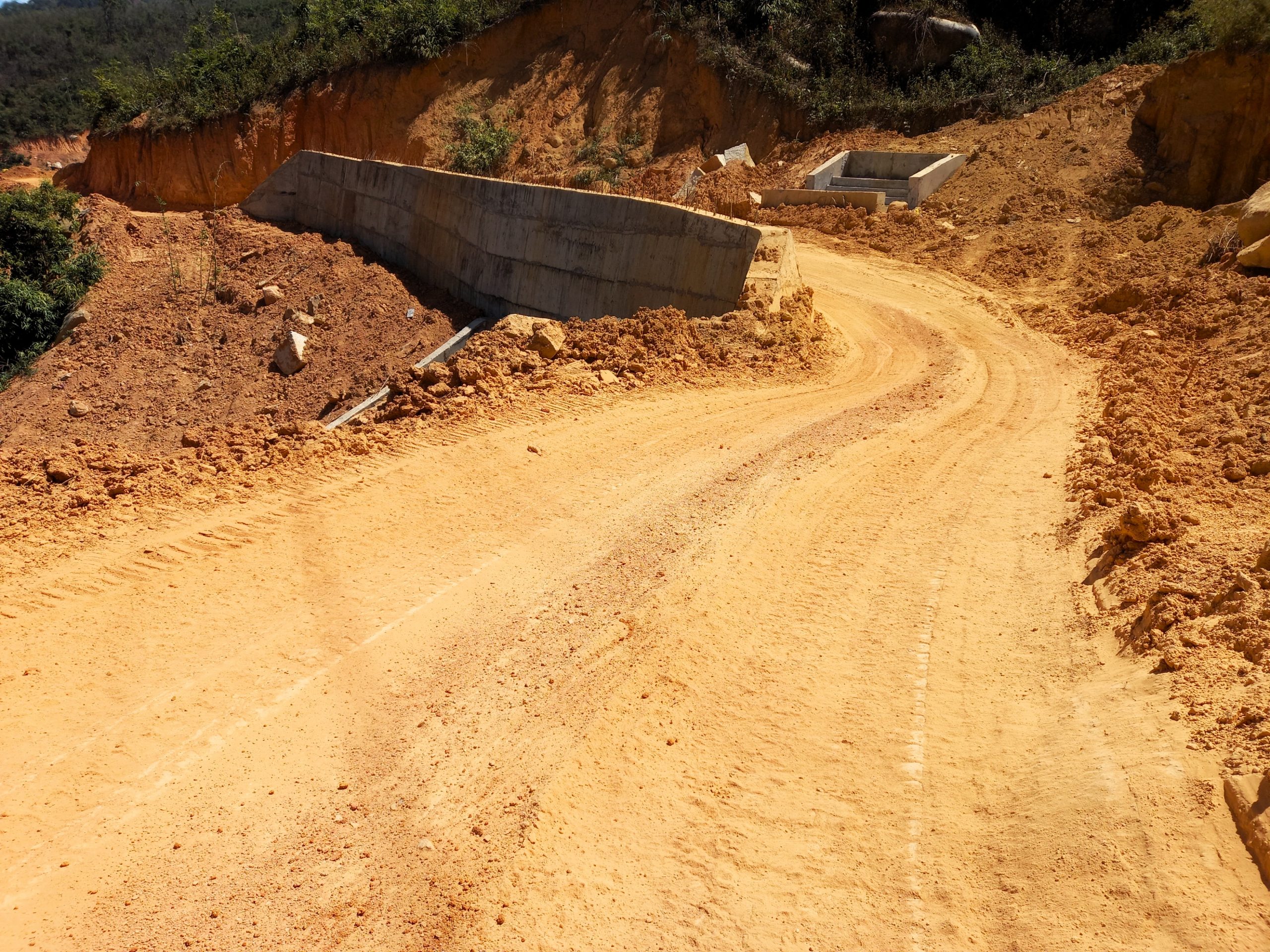
The Trường Sơn Đông Road extends over 700km from Dalat at its southern end to Thạnh Mỹ at its northern end. The majority of the road is already complete and in excellent condition. But, at the time of latest research in April 2025, two short sections remain unfinished. These sections are: Krông Nô River↔Yang Mao (not built yet), and Cư Drăm↔Tách Kai 1 (undergoing major roadworks). I encourage readers to write updates in the comments section at the bottom of this guide, especially about the condition and state of progress of these two as yet unfinished sections of the road.
With a bit of poetic license, the name in Vietnamese – Đường Trường Sơn Đông – translates as ‘Road East of the Long Mountains’. Trường Sơn is the name of the mountain range which runs along most of the western border of the country from north to south. To the best of my knowledge (I am not a scholar of the Vietnamese language), in Sino-Vietnamese trường means ‘long’ and sơn means ‘mountain’. Furthermore, đường means ‘road’ and đông means ‘east’. Thus, there are more prosaic ways to translate the name, such as ‘Eastern Trường Sơn Road’. But personally, I prefer the more poetic interpretation, which I think does both the road and the landscape justice as it evokes the mysterious and enchanting qualities of this region and this route.
[Back]
Using the Map:
My route map covers the entire length of the Trường Sơn Đông Road, from Dalat all the way to Thạnh Mỹ. You can use the map as you like, or you can purchase the complete Offline Guide & Map package ($15) which includes step-by-step instructions to use the map on your phone at all times, even without an internet connection, as well as a full PDF guide to the Trường Sơn Đông Road. It’s advisable to consult the map carefully before riding each section of the route, particularly Section 1 between Dalat and M’Đrắk.
The blue line shows all the completed sections of the Trường Sơn Đông Road. The black lines show sections that are either under heavy construction or as yet unbuilt. The red line represents the alternative route between Dalat and M’Đrắk following main roads. And the purple lines represent the alternative route between Đưng K’Nớ and M’Đrắk following a combination of main roads and back-roads, some of which are unpaved or undergoing roadworks.
The black dots represent significant intersections and/or junctions on the Trường Sơn Đông Road. The black roadwork icons signal bad road conditions. The orange bed icons are accommodation options and the red pins mark villages, towns and cities, all of which have at least some food, drink, gas stations and accommodation. I have also included some sights and attractions along the route.
[Back]
Start/End & Connecting Routes:
In this guide I’ve divided the Trường Sơn Đông Road into 4 sections (see the main table of contents) going from south to north, starting in Dalat and ending in Thạnh Mỹ. But, of course, it’s possible to ride the route north to south instead. It is also possible to join the Trường Sơn Đông Road at many different points along its length via the roads that connect to it from the east (from the coast along the Beach Bum route) and from the west (from the mountains along the Ho Chi Minh Road). For example, there are connections to the Trường Sơn Đông Road from practically every major city along the coast, such as Nha Trang, Tuy Hòa, Quy Nhơn, Quảng Ngãi, Tam Kỳ and Đà Nẵng/Hội An, as well as every major town along the Ho Chi Minh Road, such as Buôn Ma Thuột, Pleiku, Kon Tum and Khâm Đức. This gives riders the freedom to meet the Trường Sơn Đông Road wherever they like along its length.
In addition, riders can extend their Trường Sơn Đông road trip by linking to many other routes on my website. For example, the Đắk Nông Geopark Loop, the Dalat Loops, the Back Ways to Dalat in the south, or the Quảng Ngãi Loop in the centre, or the Golden Loop in the north, or connecting to the Ho Chi Minh Road from Thạnh Mỹ to continue northwards to Prao and beyond. There are many other options too: browse my Motorbike Guides Archive for more.
[Back]
Distance & Duration:
The total distance of the Trường Sơn Đông Road as it appears on my route map is 790km. Because road conditions are generally good and traffic is light, this distance can be comfortably covered in 3 days for most riders on most bike models, covering an average of under 200km per day. However, you could also spend up to a week on the route if you ride at a leisurely pace, stopping to explore sights, such as K50 Waterfall, and staying overnight at interesting accommodation, such as Dak Drinh Lodge. Of course, bad weather conditions could slow you down, particularly if you attempt to ride any of the unfinished stretches of road in Section 1. In my description of the route I have divided the Trường Sơn Đông Road into 4 sections, each of which is rideable in a day. (Go back to the main table of contents to navigate to each section of the route.)
[Back]
Weather & Time of Year:
Because the Trường Sơn Đông Road covers so much distance – passing through six of the nation’s largest provinces, across varying terrain and through different climatic regions of the country – it’s very difficult to determine what the ‘best’ time of year to ride it is. October to January is pretty good, especially for the southern sections of the route; but as you get further north at this time of year, it can become quite cold, grey and drizzly. March to June is also a good window, especially for the central and northern sections, but there’s always the chance of some heavy monsoon rain. In short, there’s no ‘best’ time to ride the Trường Sơn Đông Road. Whenever you go, you’ll encounter some dry, sunny spells, and some cold, wet patches. Ultimately, go at any time of year and you’ll almost certainly enjoy it. Windy.com is a decent weather app which allows you to select the rain/thunder option and run the satellite over several days.
[Back]
Road Conditions, Traffic & Gas Stations:
For the majority of its length, road conditions on the Trường Sơn Đông Road are excellent. At the time of latest research (April 2025), the Trường Sơn Đông Road is fully paved and in good condition from Dalat to the Krông Nô River (70km) and from Tách Kai 1 to Thạnh Mỹ (550km).
However, there are still two small sections that cause problems for riders: one that is undergoing major roadworks, and the other that is not even built yet. The latter is the section of road between the Krông Nô River and Yang Mao. Construction on this short section (only 15km as the crow flies) hasn’t even started yet, so there’s no prospect of it opening in the near future. Unfortunately, this means that all riders must choose an alternative route in order to bypass this section of unbuilt road: there are two options for this (see Section 1). The only other stretch of the Trường Sơn Đông Road that is difficult is the 20km section between Cư Drăm and Tách Kai 1, which is currently undergoing major roadworks. This section will improve with each month as the roadworks progress. But, at the time of writing (April 2025), it is only passable in dry conditions and is an unpleasant, bumpy, dusty ride strewn with construction vehicles. In wet conditions, the dust turns to mud and is treacherous, only passable for riders with appropriate bikes and experience.
For its entire length, traffic on the Trường Sơn Đông Road is very light. Apart from some areas around M’Đrắk and Ayun Pa, the road is practically empty. The only exception is during harvest time for certain crops, such as sugar cane, when trucks ply back and forth from the fields to the factories.
There are gas stations at fairly regular intervals along the Trường Sơn Đông Road, particularly at any of the towns and villages marked on my map with a red pin. However, you should never let your fuel gauge get too low before looking for a gas station to fill up, because the distances between each petrol pump can be significant. In particular, the section between K’Bang and Sơn Tây (135km) only has a couple of gas stations.
[Back]
Accommodation, Food & Drink:
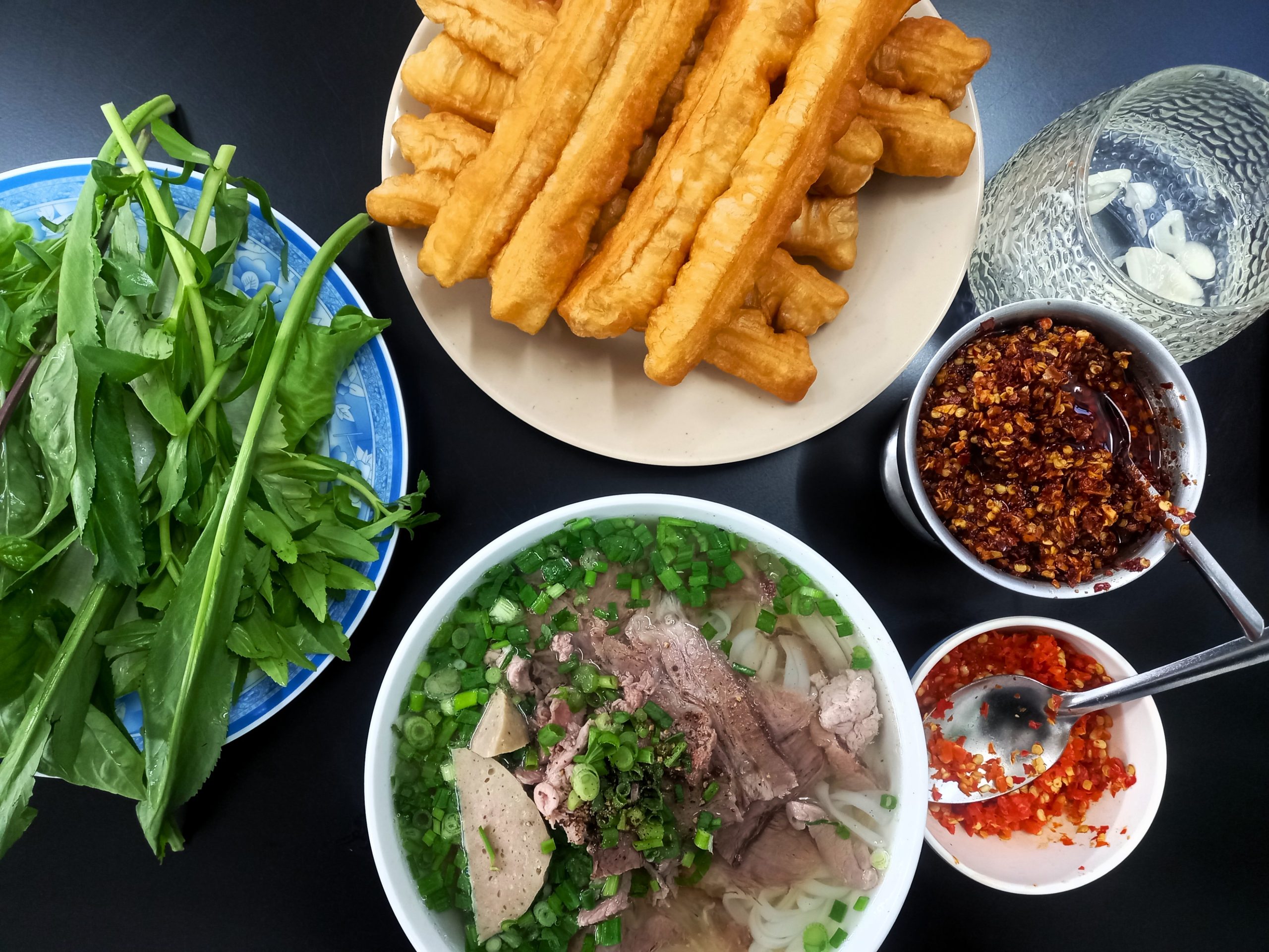
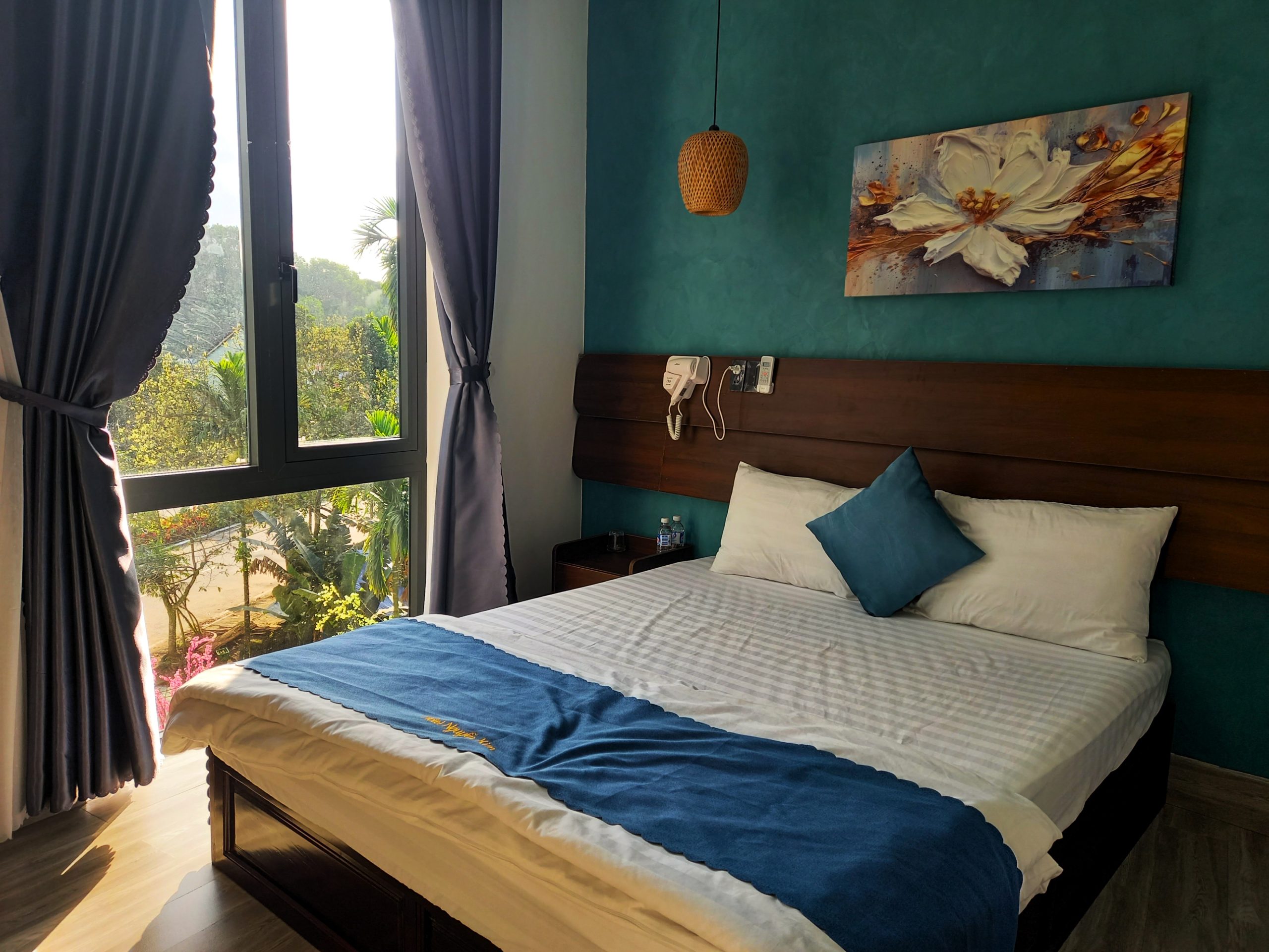
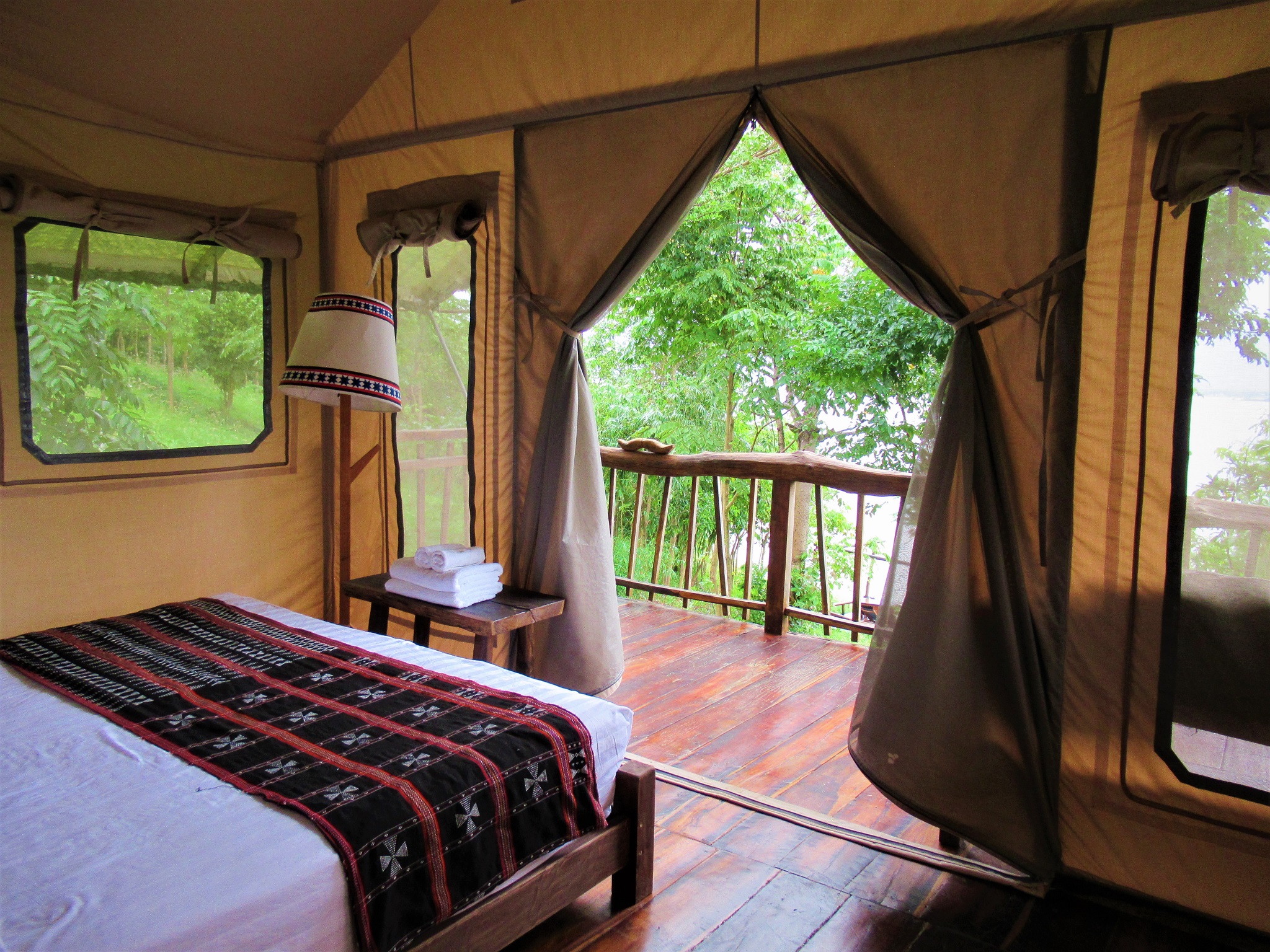
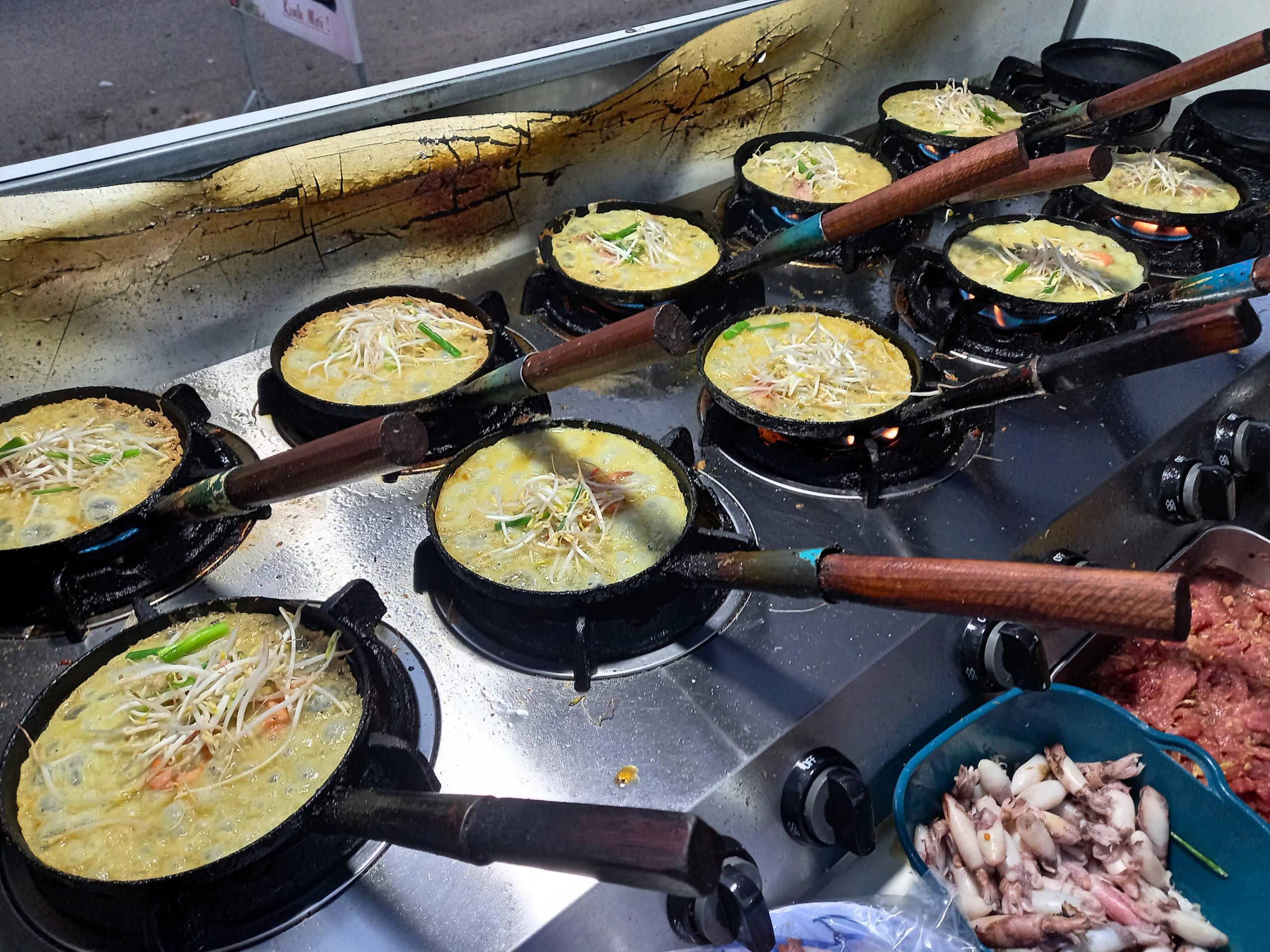
Although some sections of the Trường Sơn Đông Road are isolated and sparsely populated, you’re never too far from the next village or town, where there’ll be at least one accommodation option and places to eat and drink. On my map, I’ve marked all towns and villages on the Trường Sơn Đông Road where you’ll find food, drink and accommodation with a red pin. In some cases, I’ve marked specific accommodation options with an orange bed icon. Some of these places to stay are excellent and even worth more than one night, such as Zen Countryside, Lak Tented Camp, Dak Drink Lodge and Nguyễn Kim Hotel. Other accommodations are far more prosaic: just a bed for the night in the form of local guest houses (known as nhà nghỉ). When it comes to eating and drinking, all settlements on the route have a handful of cơm-phở (rice and noodles) eateries and some local cafes.
[Back]
Things to See & Do:
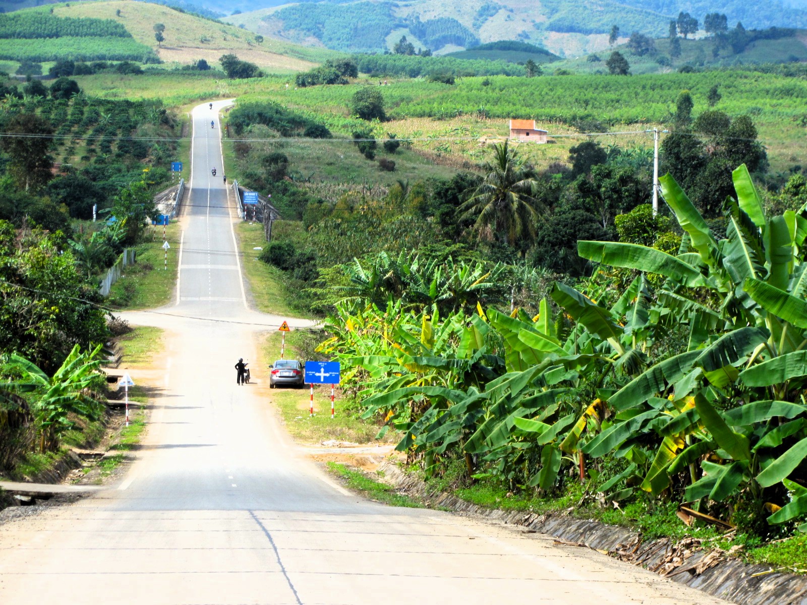
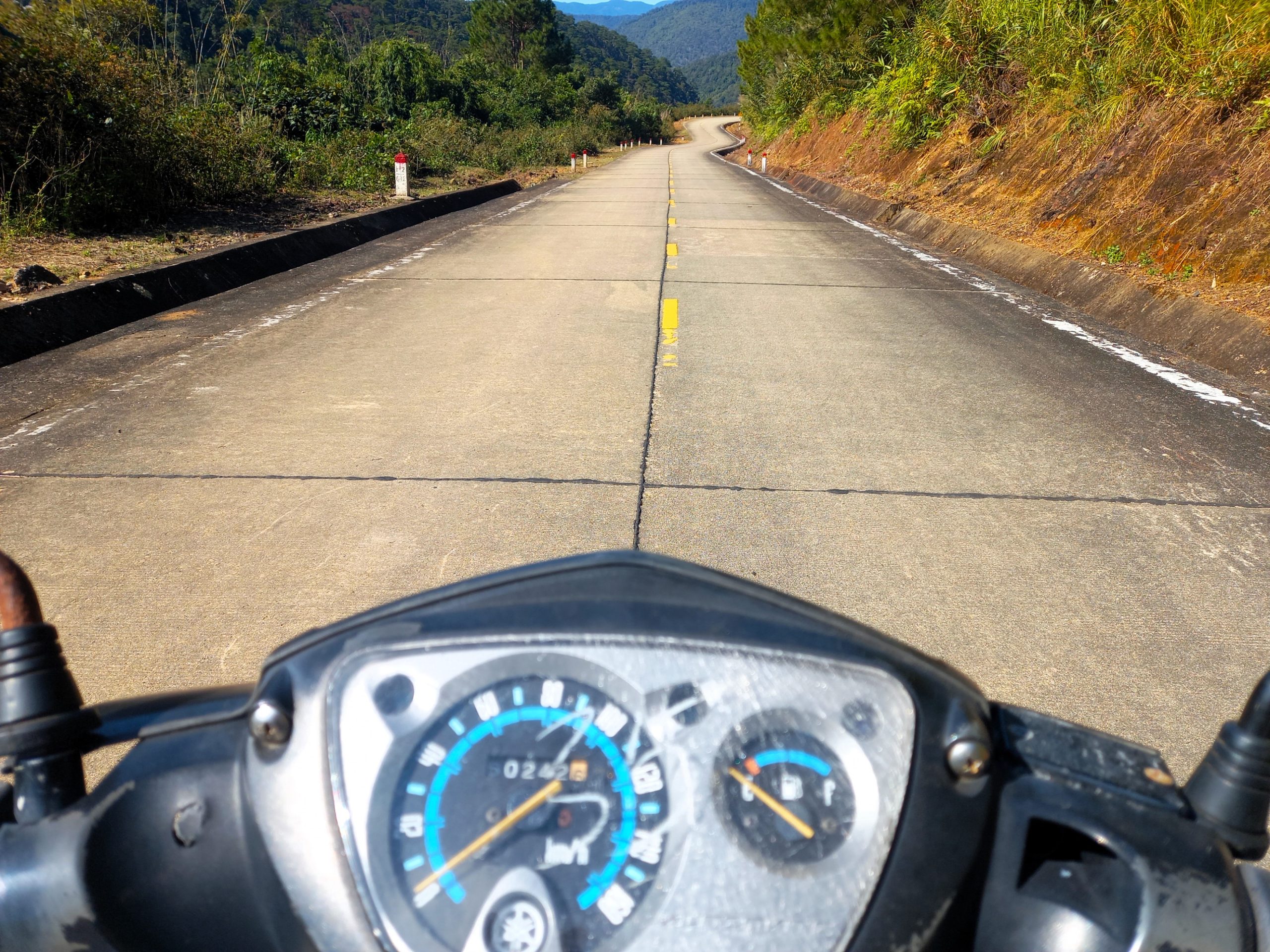
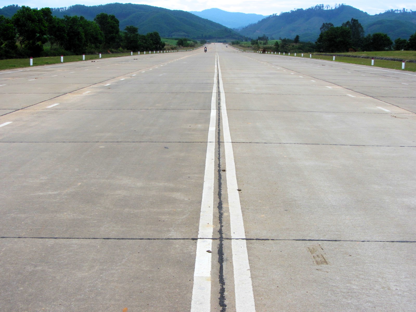
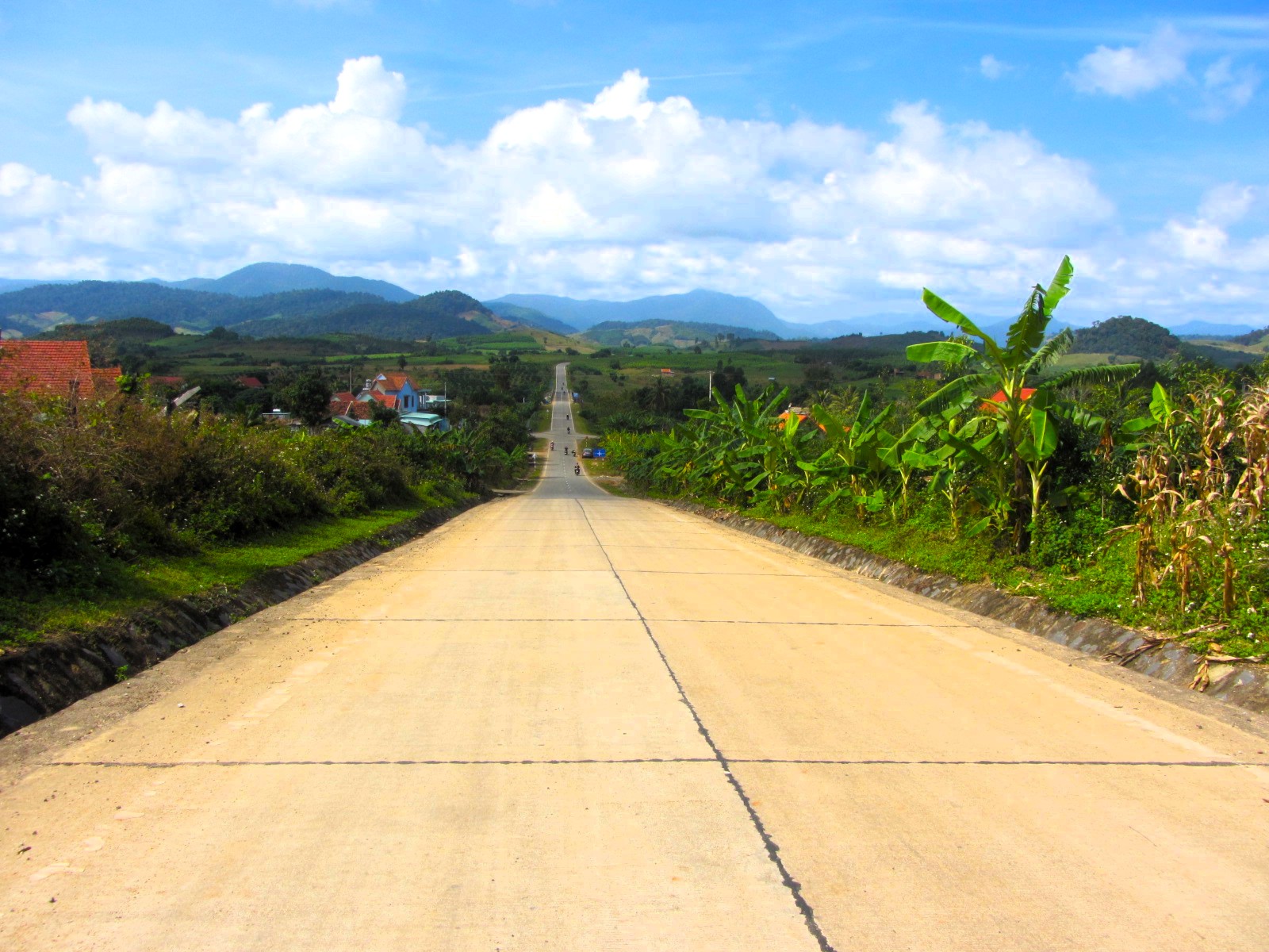
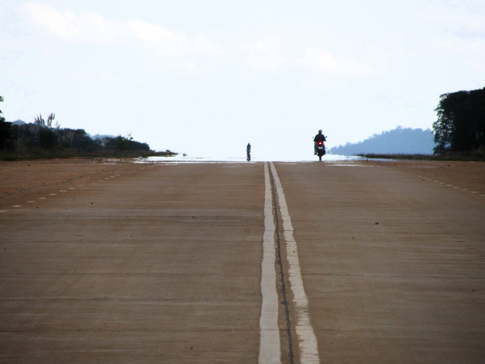
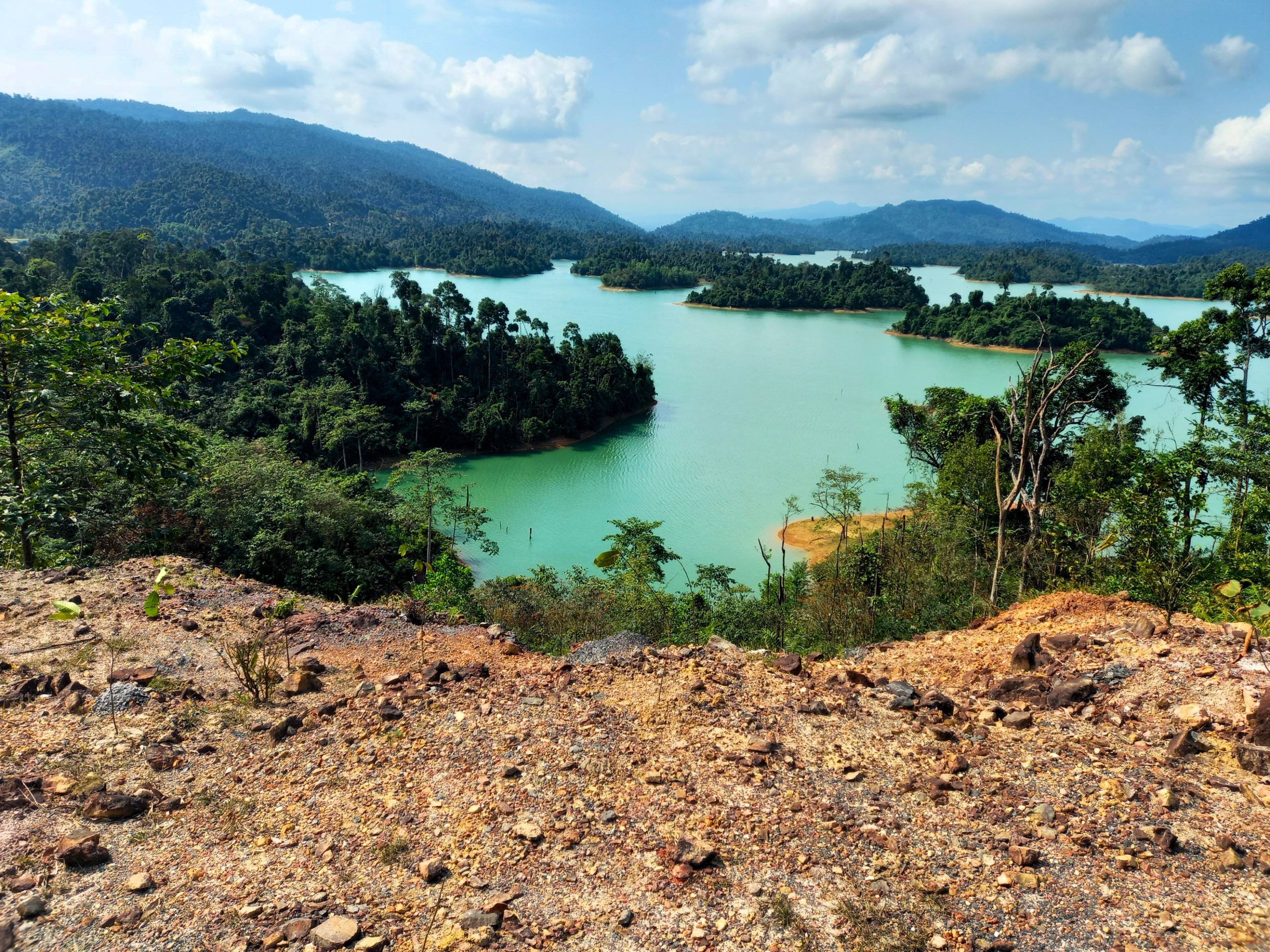
The Trường Sơn Đông Road leads through the heart of the Central Highlands. The riding alone is enough fun to make the trip worthwhile: gliding along good, empty roads, soaring over vast agricultural plateaus, winding up and rolling down lofty mountain passes, weaving through mist-shrouded forests, eating up the miles and feeling Vietnam’s highlands wash over you. Indeed, the road itself is an ‘attraction’ – seeing it snaking through the landscape, at times so animated and agitated that it appears to be alive. At two separate points, the road widens into multiple lanes and becomes an airstrip, capable of landing large aircraft. These two locations are the airstrip south of M’Đrắk and the airstrip north of K’Bang. Both are surreal, and strangely haunting, sights.
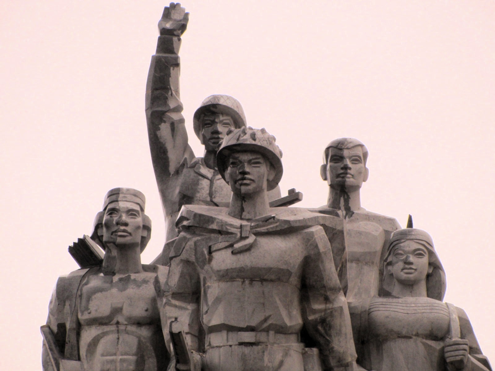
But there are other sights and activities, too, some of which I’ve marked on my map. Lots of waterfalls line the route, including a trek to K50 and K40, which are among the most impressive and isolated falls in Vietnam. In order to get there, you’ll need to arrange a half-day tour, either at the Kon Chư Răng Nature Reserve HQ or one of the guest houses in the area. The Central Highlands was a major staging point for the US during the ‘American War’. There are several old airbases along the route, now overgrown and inactive, such as Cheo Reo, in Ayun Pa, as well as many Soviet-style monuments and memorials to major battles and victories.
Section 1:
Dalat→Đạ Rsal→M’Đrắk | 260km (Option 1) or 255km (Option 2)
[View Map]
The first section of the Trường Sơn Đông Road, between Dalat and M’Đrắk, is a little complicated. One short section of the road (Krông Nô River→Yang Mao) isn’t built yet, and another short section (Cư Drăm→Tách Kai 1) is undergoing heavy roadworks at the time of research (April 2025). This means that riders must make a westerly detour in order to get around the unbuilt section of road, and then decide whether or not to attempt to ride the section of road that’s undergoing roadworks. Furthermore, there are two potential routes for the westerly detour around the unbuilt section of road: one route stays on main roads (Option 1), the other route uses back-roads (Option 2), but one of the back-roads is under construction – passable in dry conditions, but treacherous when wet. Therefore, all riders must make a decision before riding Section 1 of the Trường Sơn Đông Road: Option 1 or Option 2:
- Option 1: Dalat→Đạ Rsal→M’Đrắk on main roads (260km): red line on my map
- Option 2: Dalat→Đưng K’Nớ→Đạ Rsal→M’Đrắk on back-roads (255km) black & purple lines on my map
*
[Back]
Option 1: The easiest way to ride between Dalat and M’Đrắk, this route stays on good, paved, main roads through pleasant countryside and, for the most part, with very light traffic. At 260km the ride takes the best part of a full day. Alternatively, you could break the journey by stopping for a night at Liên Sơn, on the shores of Lake Lắk, where there are some good accommodation options, such as Lak Tented Camp, among others.
The route starts by heading due southwest out of Dalat on Road DT725, down a good mountain pass, through the village of Tà Nung with its acres of surrounding coffee farms, and then turning due west at the impressive Elephant Waterfall (worth a stop, if it’s open) on a good road eventually leading to a junction with QL27. Turn north on QL27 and continue on this meandering main road through pine forests, jungles, misty mountains, cultivated valleys, enormous artificial lakes and zig-zagging passes all the way to Đạ Rsal and beyond to Liên Sơn on the banks of Lake Lắk.
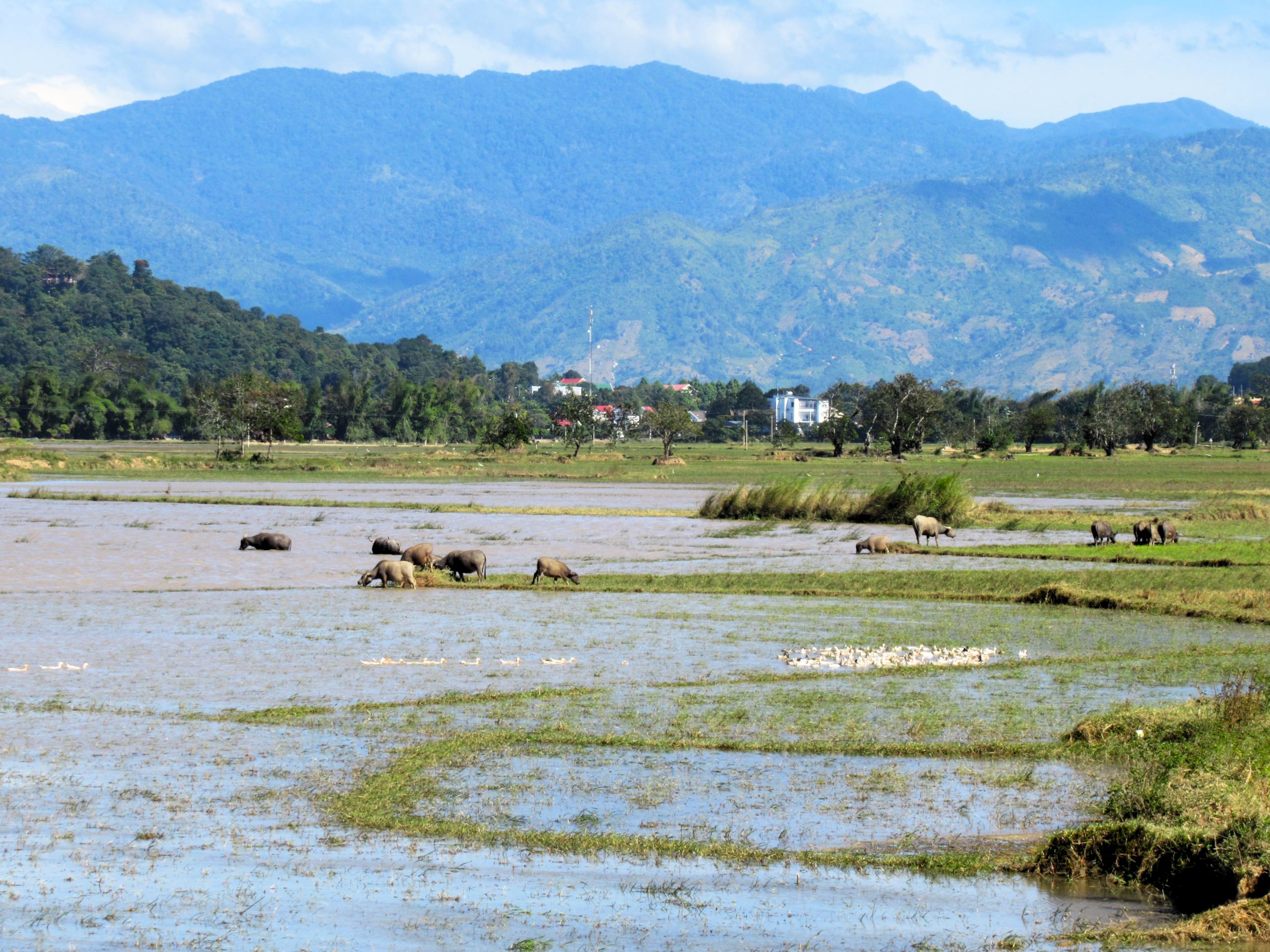
A small, friendly village with plenty of food, drink and accommodation, Liên Sơn is surrounded by mountains, rice fields and ethnic minority hamlets, some with traditional wooden longhouses. Lake Lắk (Hồ Lắk) is a large natural body of water filling a wide valley. It makes a scenic night stop if you’re tired or have run out of daylight.
A little while north of Lake Lắk turn due east on road DT12 and take it as far as Krông Kmar before turning north on road DT9. Leading through a flat, farmed landscape, this road eventually hits QL26. Turn due east and follow this main road across an undulating and fairly featureless landscape to M’Đrắk. Although the town of M’Đrắk is not a place to linger, it is an obvious overnight halt at an important crossroads on the Trường Sơn Đông Road. There are a couple of OK guest houses (nhà nghỉ), including Tây Nguyên, with simple but clean(-ish) rooms for around 200,000vnđ. Plenty of food and drink options line the main road passing through town.
*
[Back]
Option 2: This route option between Dalat and M’Đrắk is technically more ‘correct’ because it follows the actual Trường Sơn Đông Road as much as possible. However, the route also requires negotiating two potentially difficult sections of dirt road. At 255km it is only a few clicks shorter than Option 1 but is likely to take more time because of those tricky dirt road sections. The bottom line is: if the weather is dry, you have a decent motorbike and are a reasonably confident rider, there’s no reason not to attempt this route. But, if conditions are wet and you don’t have much riding experience, it’s a better to stick to Option 1.
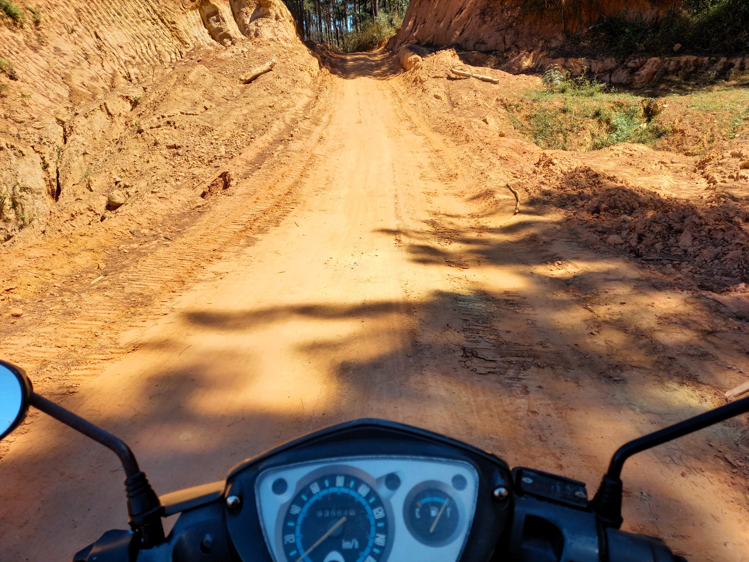
Head north from Dalat on road DT722. The scenery quickly becomes very alpine, with pine trees, lakes and wooden cabins dotting the hillsides. Although not labelled as such, this is in fact the beginning of the Trường Sơn Đông Road proper. The riding, road quality and scenery are fabulous as you head further north, deeper into the pine forests and higher into the mountains, accompanied by a chill highland air. After 50km, the dusty hamlet of Đưng K’Nớ appears on the edge of a precipice. From here, the Trường Sơn Đông Road continues due north for another 30km to the banks of the Krông Nô River. This is a highly scenic ride, but the road simply dead-ends at the river. The bridge has not been constructed yet and there’s no other way across. Therefore, the only option is to head back to Đưng K’Nớ and turn due west on the road to Đạ Rsal (also labelled DT722). This detour would be fine, but unfortunately the first 10km of road is still under construction. The terrain is very rugged so the road has taken years to build. At the time of latest update (April 2025) conditions were dusty and sandy with some quite narrow sections and some very wide parts. In dry weather, the road is totally passable (with caution), but in wet conditions the mud would be slippery and treacherous. Each rider will need to decide for themselves whether or not to attempt this.
The dirt road section ends at Đạ Long, after which conditions are mostly fine all the way to Đạ Rsal (although some parts are still in the final stages of being upgraded). Turn due north on QL27 at Đạ Rsal, heading towards Liên Sơn and Lake Lắk. Continue to the junction with road DT12 and turn due east all the way to Cư Drăm (note that conditions on DT12 are mixed). At Cư Drăm, a short section of the Trường Sơn Đông Road leads due south to Yang Mao and beyond along a pretty valley before dead-ending in the jungle, but it’s fun to ride it if you have time to spare. If not, then continue due east from Cư Drăm to Tách Kai 1. This short section of road is currently (April 2025) undergoing major roadworks. It’s littered with construction vehicles and becomes very muddy when wet. Note that it can be hazardous to ride, especially on a ‘normal’ motorbike. From Tách Kai 1, a brand new section of the Trường Sơn Đông Road heads due north around a flooded, spooky landscape all the way to M’Đrắk. It’s a fantastic ride, including the airstrip section just south of M’Đrắk, where the road widens into multiple lanes and runs arrow-straight for several kilometres.
Section 2:
M’Đrắk→Ayun Pa→K’Bang | 215km
[View Map]
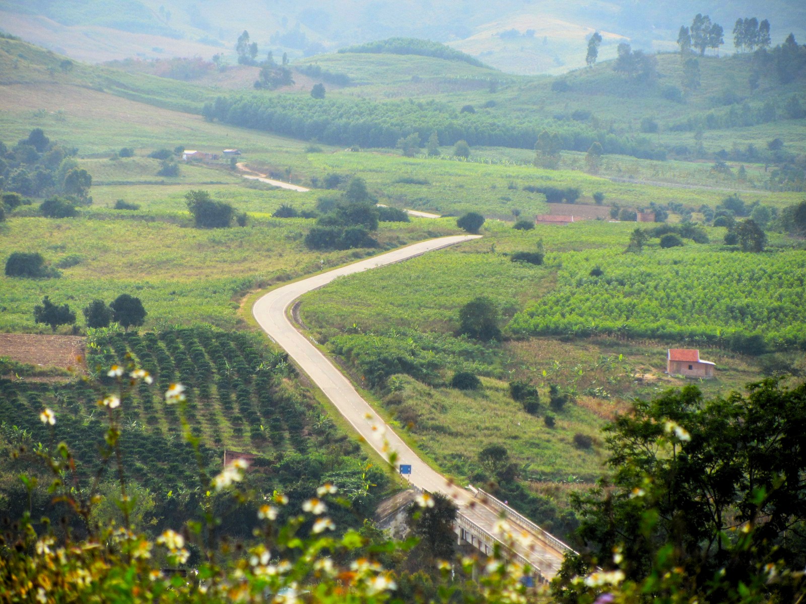
From M’Đrắk the Trường Sơn Đông Road ploughs northwards across the vast agricultural plateaus of the Central Highlands. From here, the road runs continuously for over 500km, all the way to the end point at Thạnh Mỹ. Road conditions are good for the entire length and traffic is very light: for long stretches you might not even see another vehicle. What’s more, navigation is fairly straightforward.
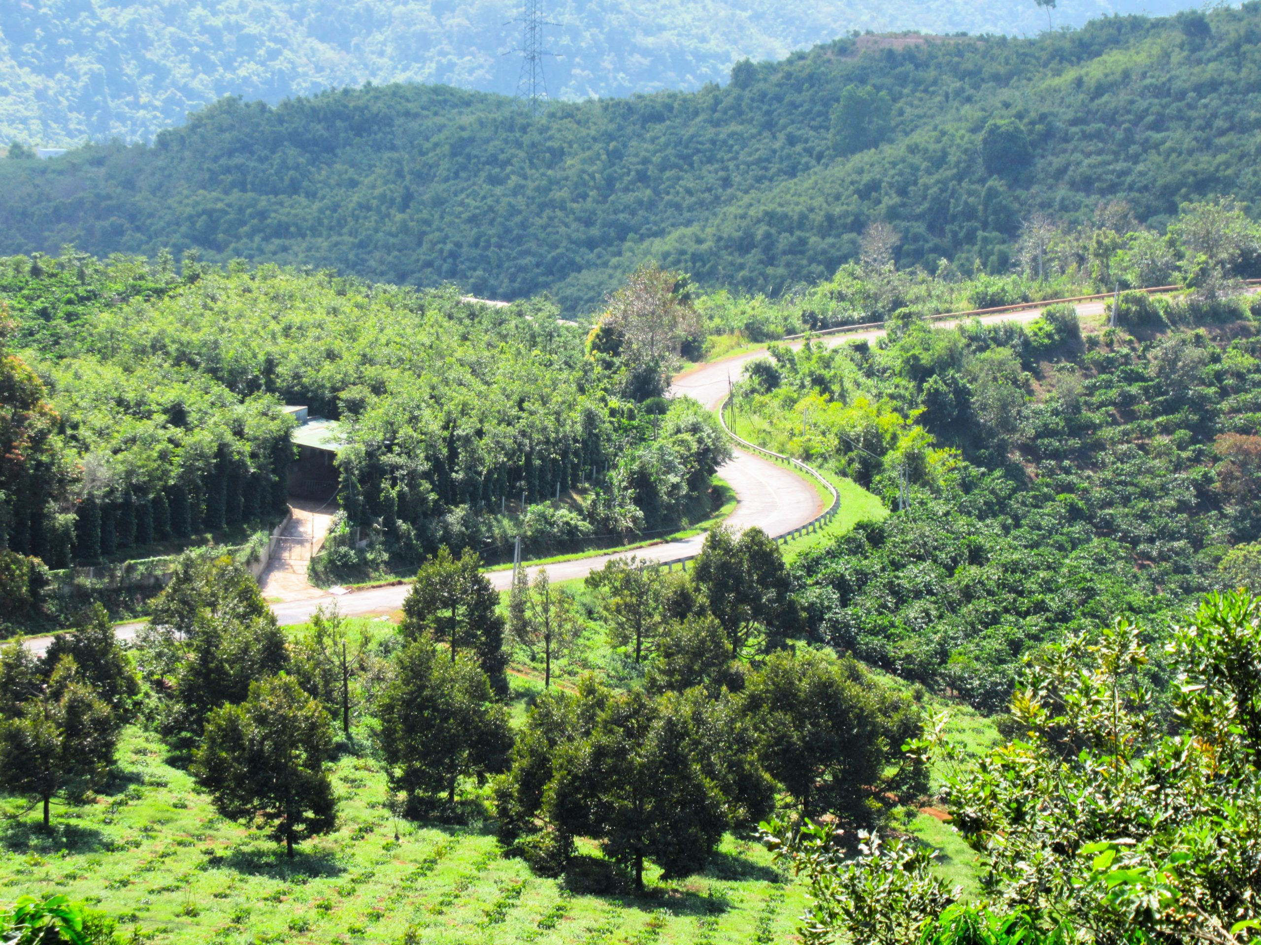
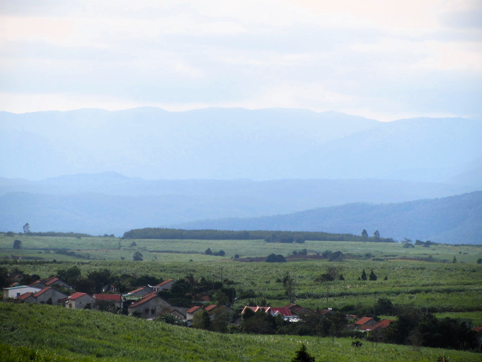
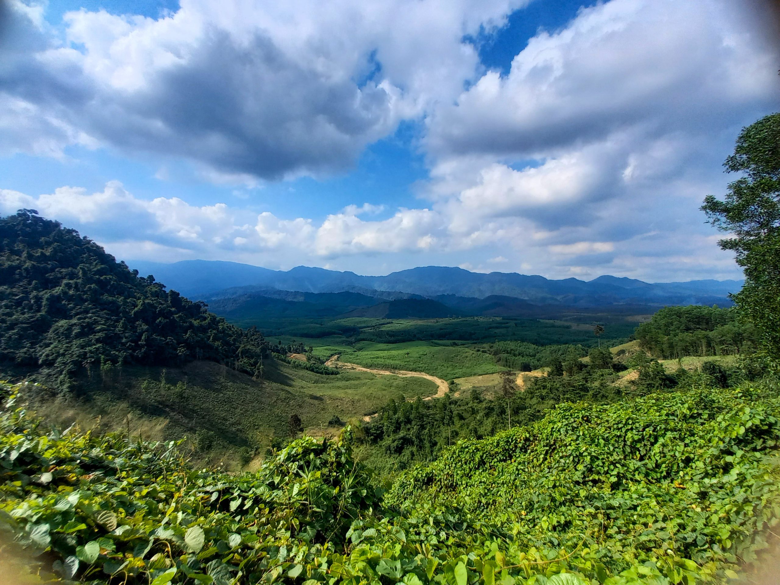
The first stretch north of M’Đrắk is an undulating route on smooth tarmac, rolling up and down gentle slopes covered in coffee bushes, sugar cane, eucalyptus and rubber trees. The riding is excellent and the scenery is pretty as the road soars around the boundaries of Ea Sô Nature Reserve. But this isn’t wild nature. This is a productive and plundered landscape. Much of the land you see from the road was primary forest just a few decades ago, before Vietnam’s agricultural boom. Now, there’s barely an old-growth tree left standing for all the thousands of coffee bushes that have been planted in their place.
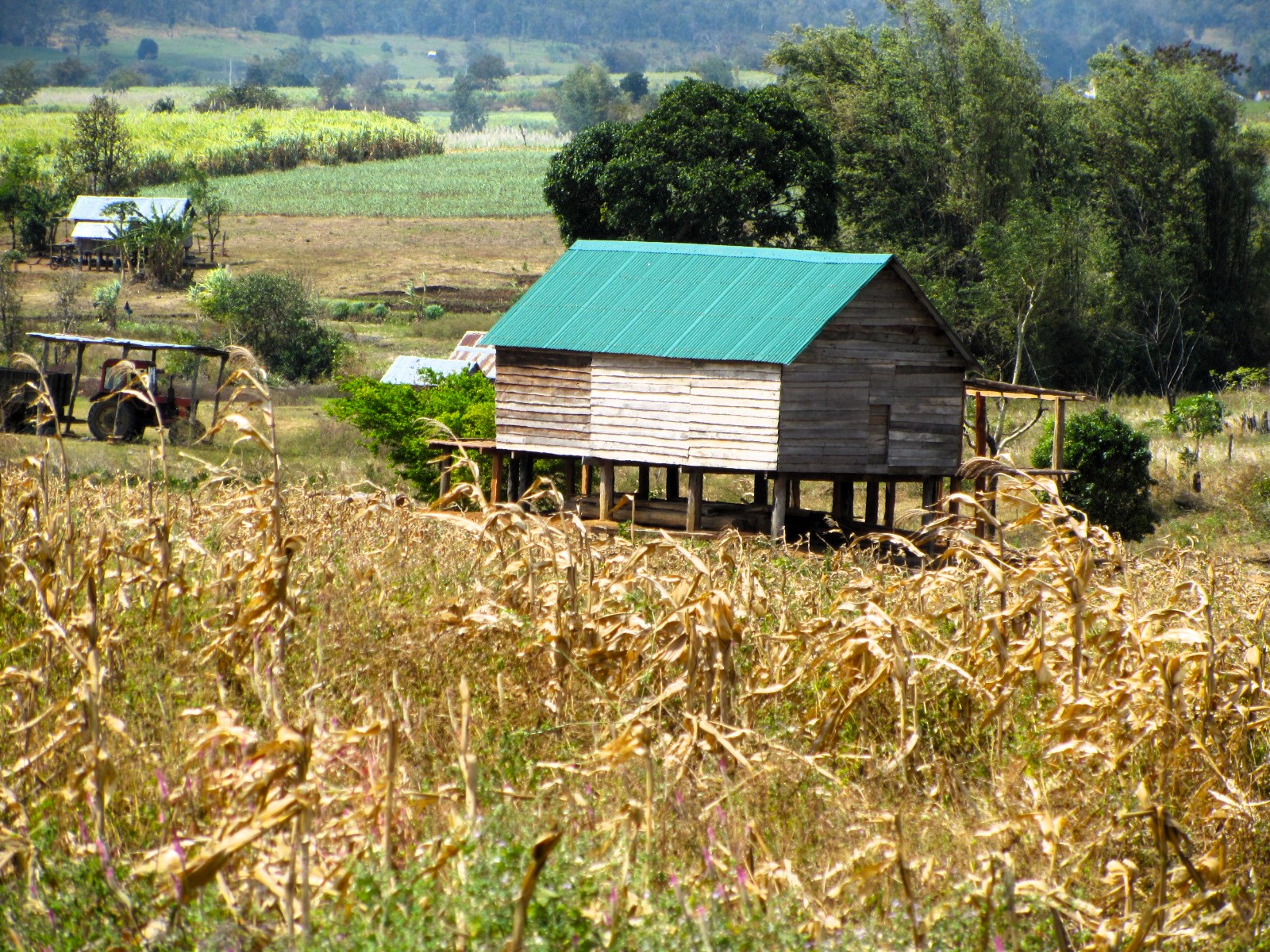
Turn due east at the junction with QL29 and then head north a few minutes later, back on the Trường Sơn Đông Road, just after the village of Ea Ly. Switching from freshly laid asphalt to large concrete slabs, the road blazes up hillsides, across farmland, over rivers and lakes until it meets QL25. Mango, cashew and cassava plantations decorate this flat basin, surrounded on all sides by forested mountains. The only traffic are goats, cattle, pigs and chickens. Minority villages, consisting of wooden plank homes raised on stilts a metre above the dirt, are scattered across the landscape. Many of the women and girls wear their colourful, highly decorative traditional dress. But it looks like a rough, tough existence here. The daily work is physically demanding and starts from a very early age: young girls carry wicker baskets full of wood on their backs.
At the Cầu Lệ Bắc junction, turn due northwest on QL25 for a brief stint up a pass to the exotic-sounding town of Ayun Pa. This settlement makes for a convenient lunch stop at any of the rice eateries and cafes, and there are some guest houses too, such as Phúc Khánh and Anh Nguyên, if you need to overnight. Also of interest is Cheo Reo, an old US airbase just west of town. The runway is now used by locals to dry their crops on.
Leave Ayun Pa via its bypass along a dyke across a sea of rice paddies and then turn due north back on the Trường Sơn Đông Road (labelled DT622). This stretch of road is a smooth, easy ride across a gaping agricultural plateau dominated by sugar cane plantations, which cover the landscape like a green-beige quilt. If it’s harvest time, then trucks will be plying back and forth from the plantations to the factories. At the Đắk Pơ crossroads with QL19, continue straight across the intersection, heading north towards K’Bang. This pleasant section of road rolls through a rural landscape dotted with red-tile-roofed farmhouses. The lower slopes are cultivated with banana, sugar cane, eucalyptus and cassava, but the higher slopes are still cloaked in dark green jungle.
The likable little town of K’Bang (which sounds like an onomatopoeia used in comic books when a superhero punches a villain: K-Bang!) is a friendly place with a couple of good guesthouses and local food joints, as well as a nearby waterfall. K’Bang is good night stop on the Trường Sơn Đông Road. Hoàng Long and Ngọc Linh are both decent hotels for a night. Several places to eat are scattered along the main street – try the bánh xèo at Bếp Cô Sự – and a few coffee shops serve good espresso, such as An Cafe.
Section 3:
K’Bang→Sơn Tây→Bắc Trà My | 215km
[View Map]
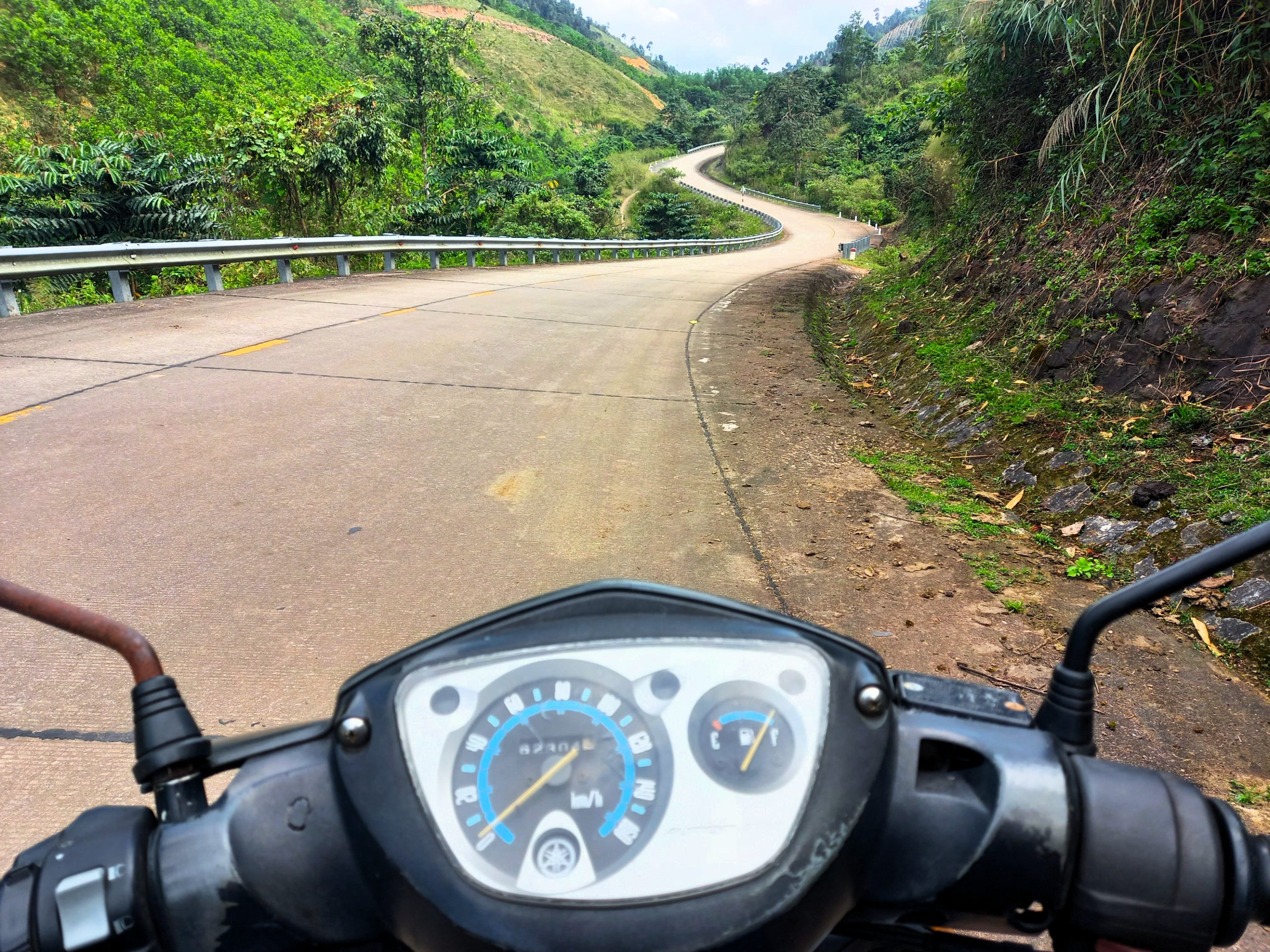
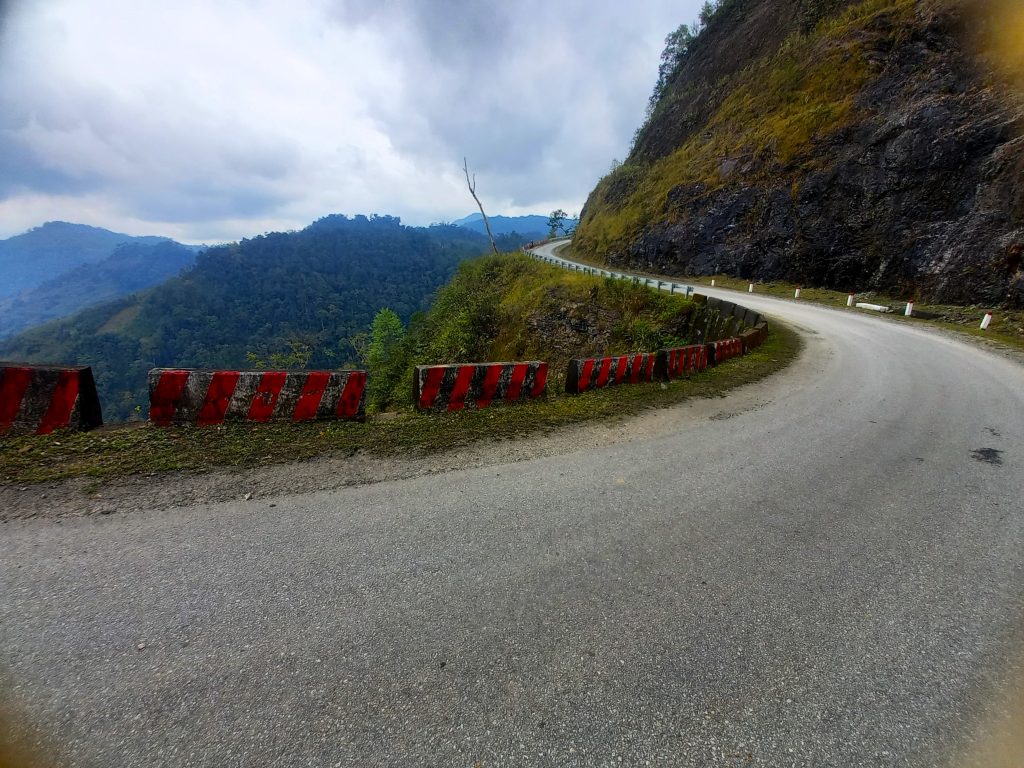
North of K’Bang is where the wilderness begins. Remember to fill up with petrol in town before you leave, because there are precious few gas stations on the next stretch of road. Just 10 minutes north of K’Bang, the Trường Sơn Đông Road turns into concrete slabs, like a giant pack of dominoes laid on their sides on a rolling path through the jungle. The scruffy patchwork of highland farmland fades away, as towering tropical trees close in on the road. Not long after leaving town, the road widens into a straight, multi-lane, deserted airstrip, the second such section of road on this route. It’s a surreal and strangely haunting sight. Apparently, parts of the U.S road network were designed in a similar fashion, with long, wide, straight sections purposely built to double as landing strips in remote areas to facilitate military and civilian aircraft in the event of war.
After the airstrip, all people and traffic disappear as the road plugs you deeper and deeper into a rich seam of highland forest. The riding is excellent. The road is in good condition with multiple switch-backs, long meandering stretches and fast straights. It’s as if a Moto GP race track has been laid in the middle of the Vietnamese jungle. Deep within this jungle, east of the road, is K50 Waterfall, one of the most impressive cascades in Vietnam. Within the protected confines of the Kon Chư Răng Nature Reserve, the falls can only be accessed on foot via a long guided hike through the jungle, starting from the nature reserve HQ, located down a lane off the Trường Sơn Đông Road. Arrangements for the hike can be made at HQ or via a handful of guesthouses in the area.
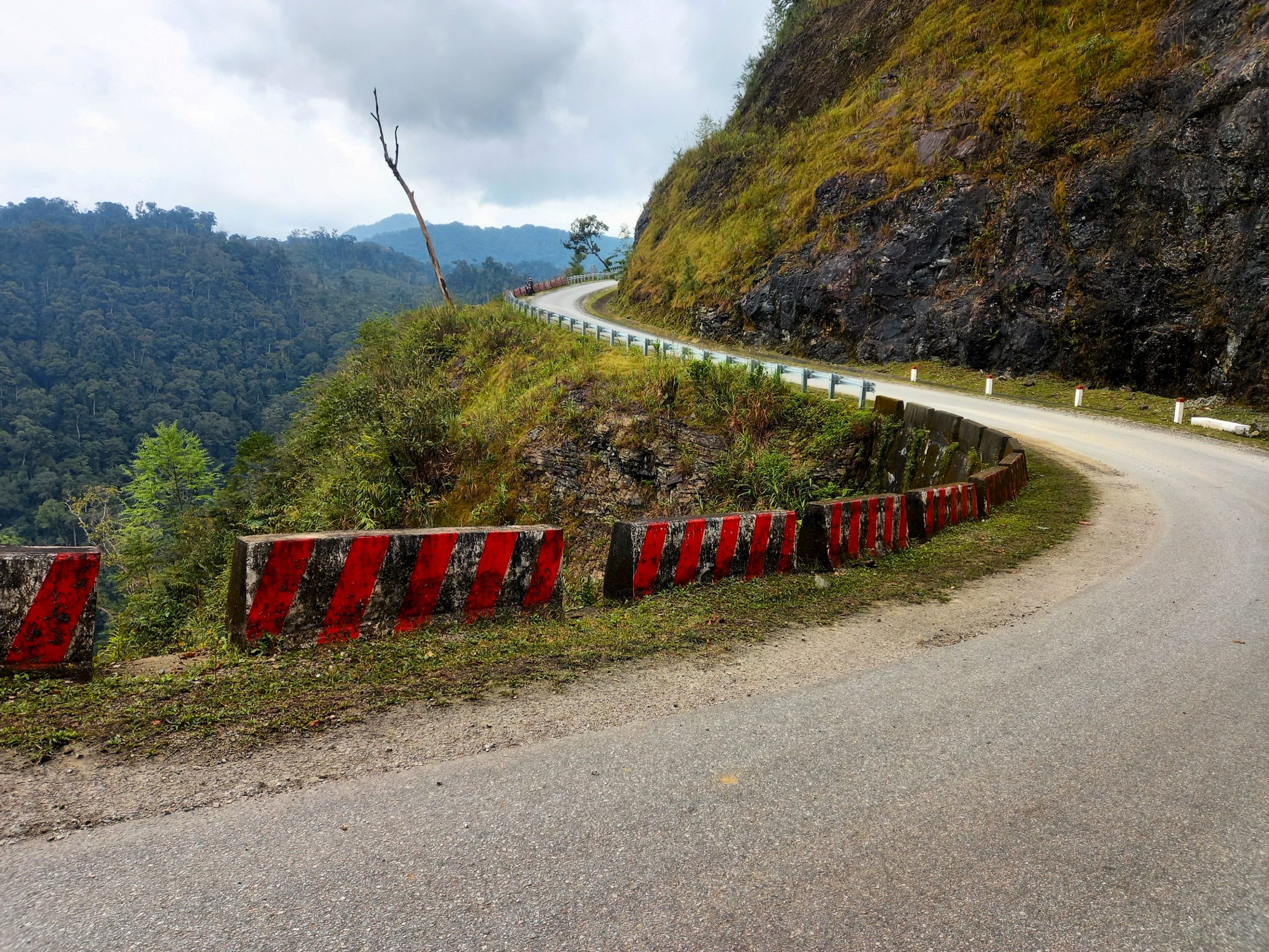
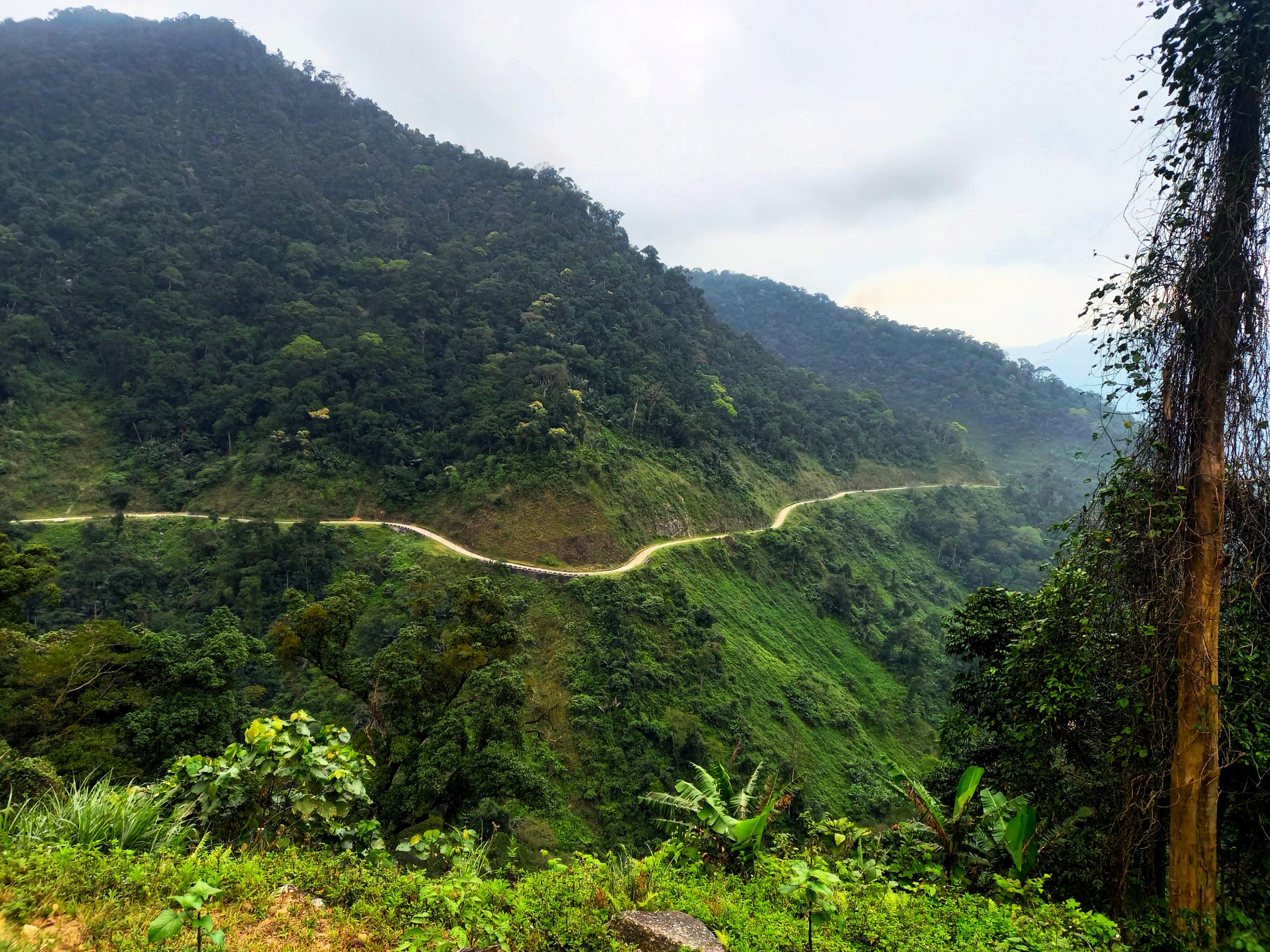
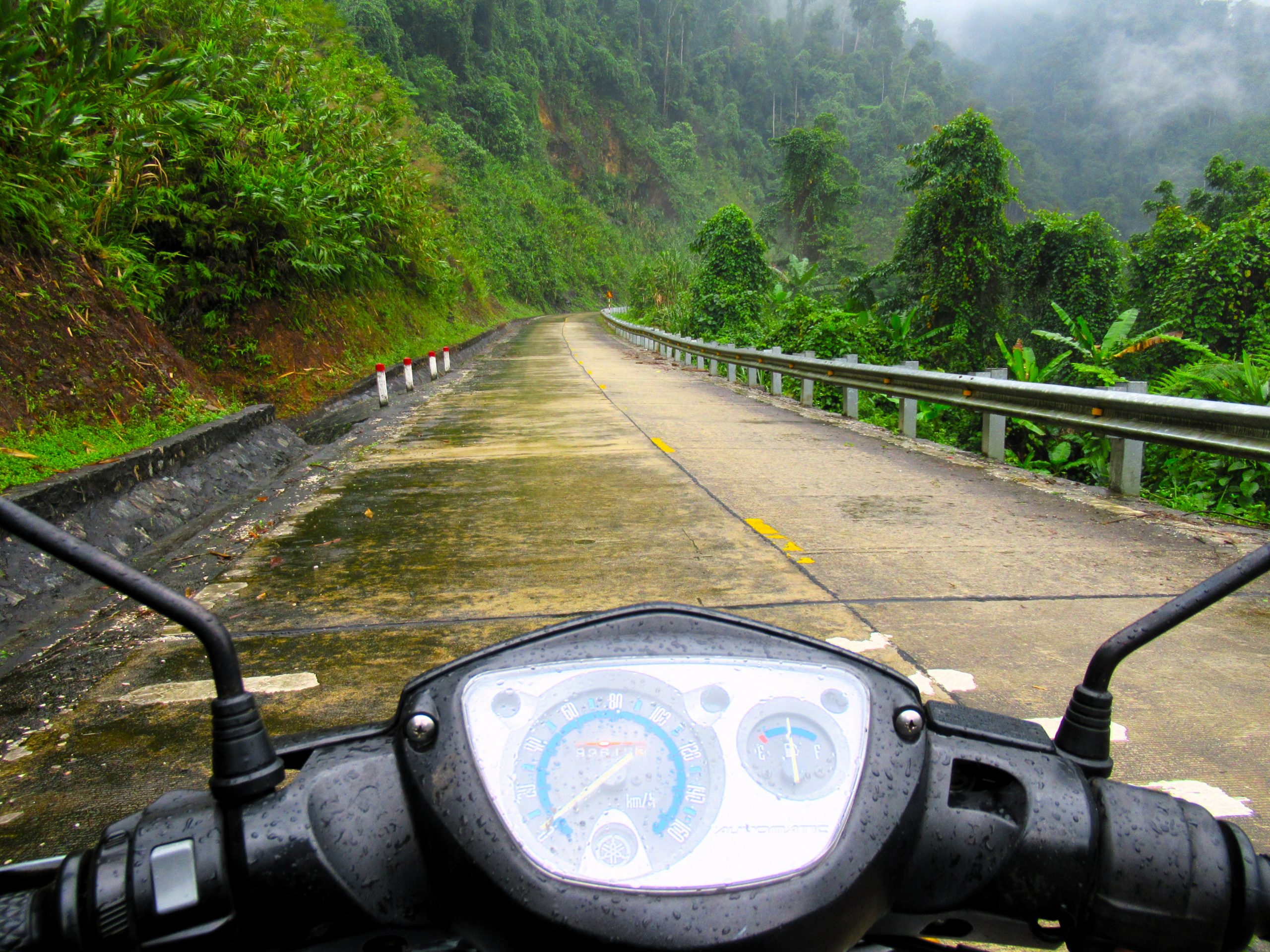
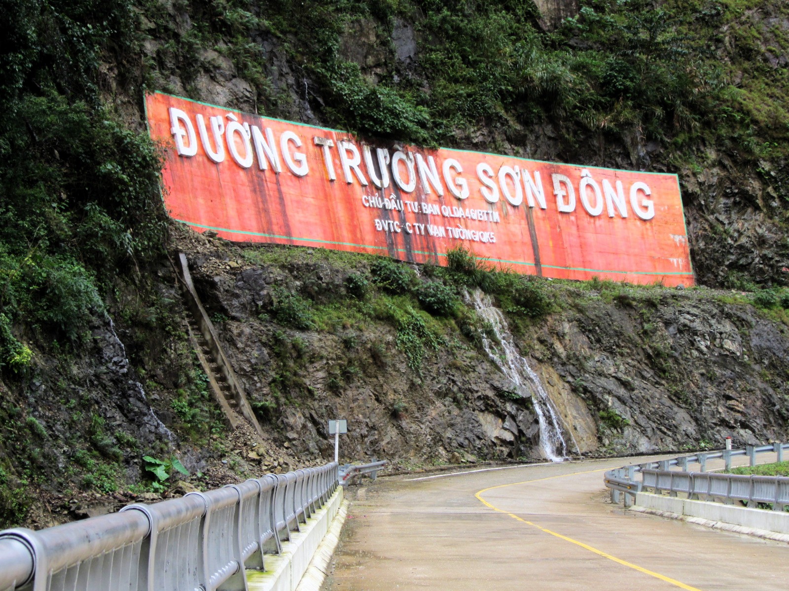
Over 80km north of K’Bang, the Trường Sơn Đông Road meets a remote intersection with QL24 (also labelled AH132) at the Xã Hiếu crossroads. If you’re tired or running out of daylight, you can head west on QL24 up to Măng Đen, a mountain resort village in the pine forests with some good accommodation, dining and drinking options. Otherwise, head straight over the crossroads, continuing due north on yet another superb section of the Trường Sơn Đông Road towards Sơn Tây. This is one of the wildest and most scenic stretches of the entire route, especially the first 10-20km after the Xã Hiếu crossroads, featuring a recently completed, death-defying pass crawling along a mountainside draped in dense jungle, high above a raging river. In bad weather, when visibility is sometimes less than a few feet, this can be a terrifying ride, with landslides, mudslides and rockfalls sending whole trees tumbling down the cliff. But, in good weather, it’s an extremely beautiful section of mountain road through alpine scenery laced with pretty rivers and waterfalls. Either way, it’s important to ride carefully and make sure you bring a jacket, because it can get chilly on this pass. Next to one of the roadside cascades is a bold, proud sign reading ‘Đường Trường Sơn Đông‘ – a monument to this feat of engineering (and a good photo opportunity).
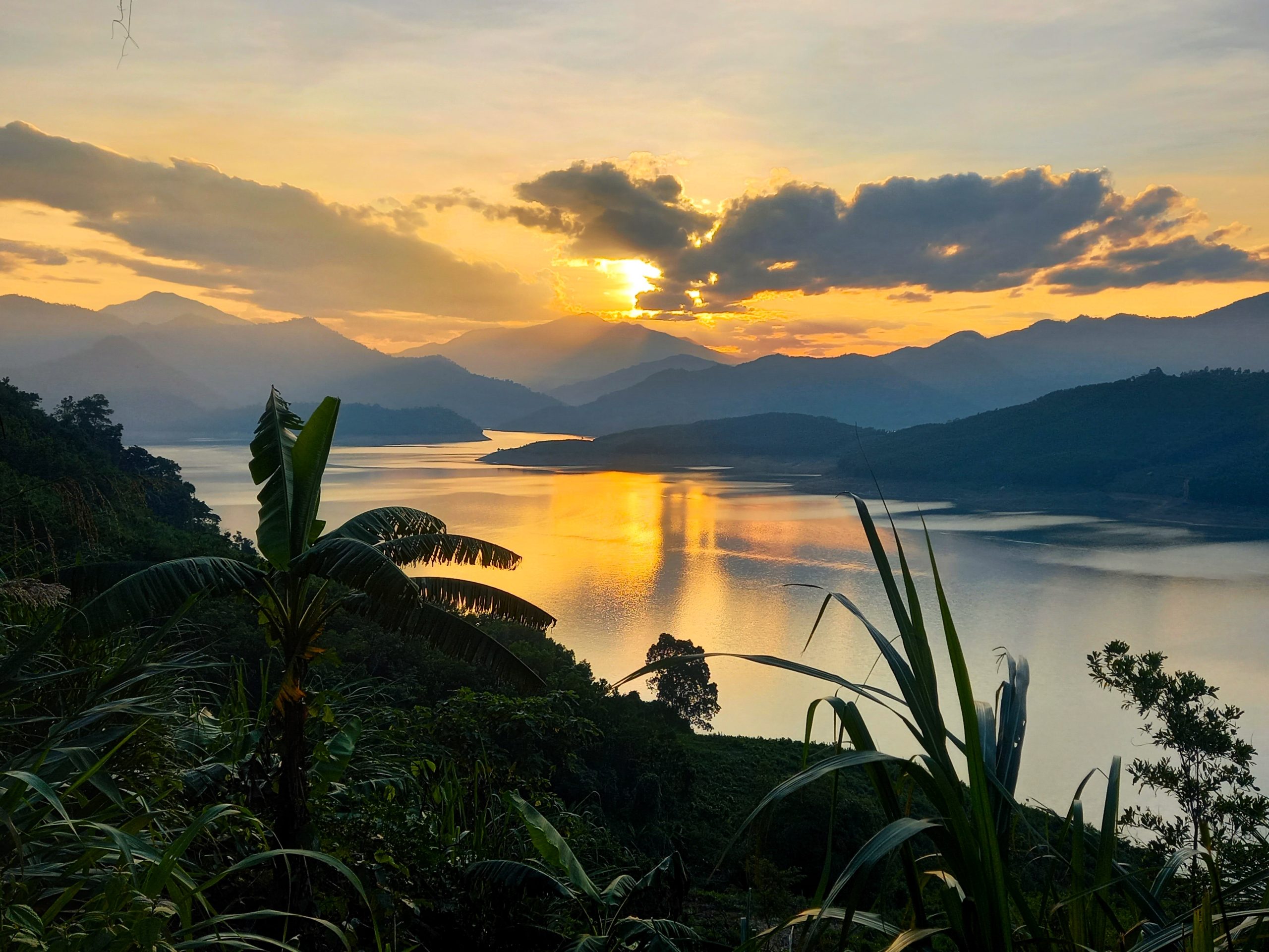
The road continues to helter-skelter up and down mountainsides and along riverbanks with high peaks looming in the distance, one of which is Ngọc Linh (2,598m), the highest mountain in all of central and southern Vietnam. The air is cooler here and the valleys are steep and tight, planted with cinnamon and eucalyptus. Road conditions are good all the way to Sơn Tây village. Clinging to the banks of a great river tamed by a hydroelectric dam, Sơn Tây is a small, quiet place in a magical position that is a logical night stop on the Trường Sơn Đông Road. However, accommodation options in the village are very limited. Châu Phong Guesthouse (also called Diễm Châu) is basic and cheap and passable for a night. But it’s a much better idea to ride up to Dak Drinh Lodge, just west of Sơn Tây on the banks of a scenic lake. The accommodation and setting are atmospheric and there are plenty of activities, including kayaking on the lake.
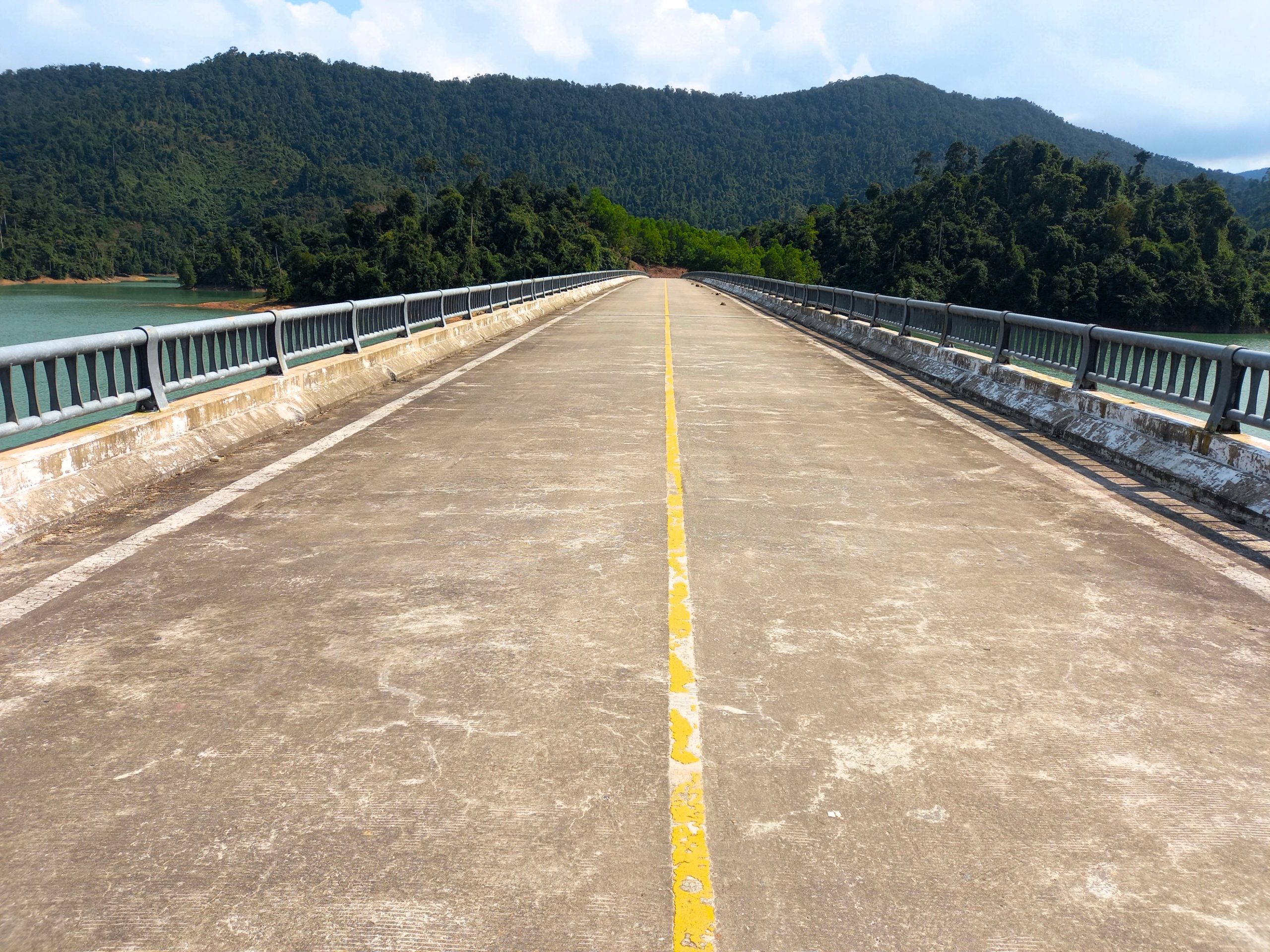
Head due north out of Sơn Tây, past a large hydroelectricity project before climbing steadily into the hills. This is the beginning of another wonderful stretch of road over mountains bursting with tropical foliage, affording excellent views over valleys and villages tucked into the folds of misty mountains. Many sections of the road are new and wide, twisting through the jungles and carving a route into the rockface, hugging the precipice with the river valley hundreds of feet below. This is a remote stretch of the Trường Sơn Đông with hardly any traffic whatsoever for 50km until it meets QL40B (also labelled DT616) at the Trà Giác intersection.
Join QL40B going north and follow it as it veers due east around a spectacular hydroelectricity lake to Sông Tranh Bridge. From here, turn due north across the bridge to continue on Section 4 of the Trường Sơn Đông Road. However, for a good overnight stop, continue east on QL40B for a few kilometres to Bắc Trà My, a likeable town on a river. There are a couple of good hotels here – Nguyên Kim has clean rooms and a decent swimming pool, and Anh Tuấn is a solid mini-hotel – as well as plenty of local food and cafes (dinner at Quán Ven Sông is recommended).
Section 4:
Bắc Trà My→Sông Trà→Thạnh Mỹ | 100km
[View Map]
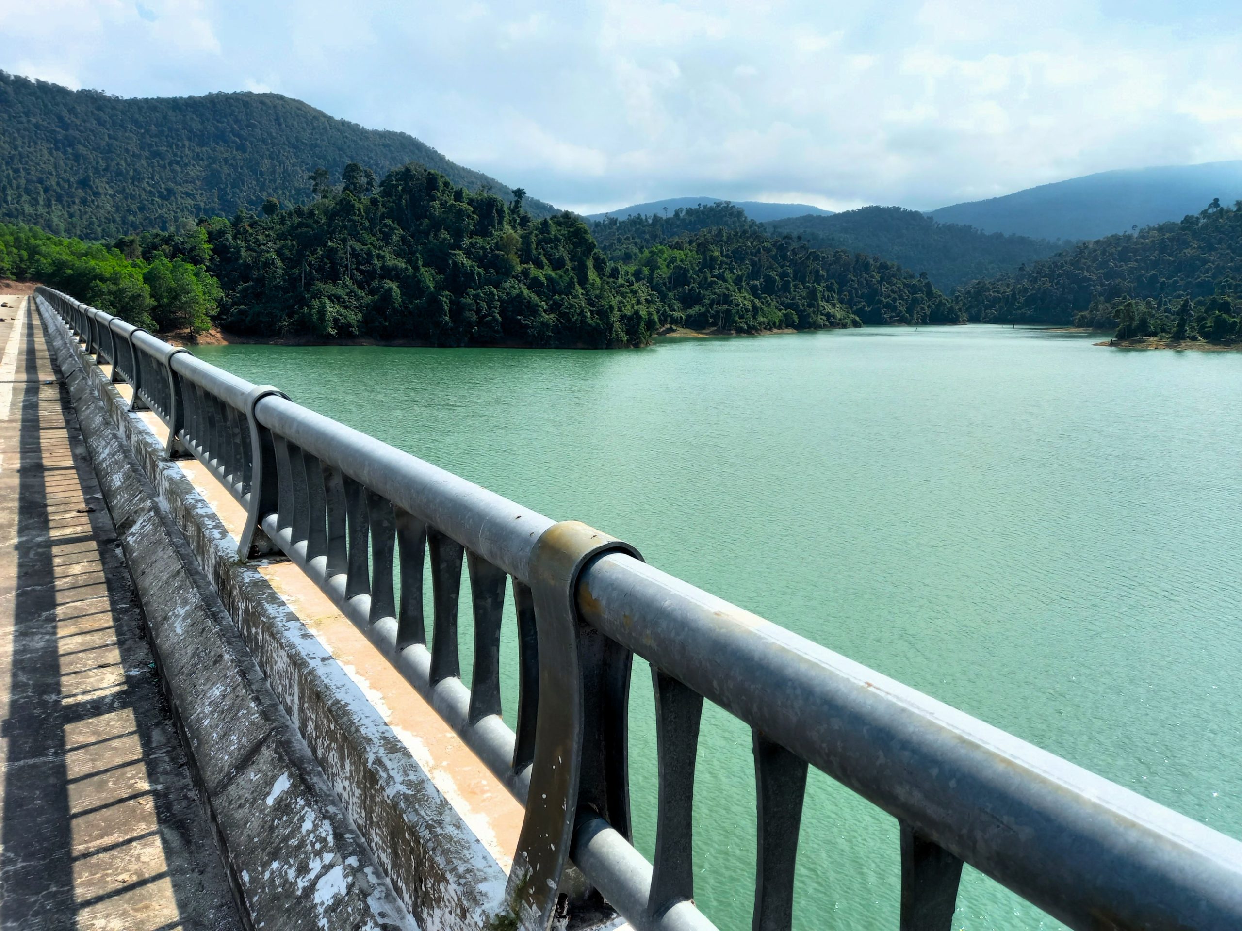
The last section of the Trường Sơn Đông Road begins at the Sông Tranh Bridge. Heading north across the bridge, the road curls around the shores of a large and spectacular reservoir before climbing up a twisting pass and then descending the other side into a long, fertile valley all the way to the Sông Trà intersection with QL14E. Road conditions are excellent, traffic is non-existent, scenery is good and the riding is easy and fun for the entire 40km stretch of road.
Turn due west on QL14E for a few minutes before veering off back onto the Trường Sơn Đông Road heading due northwest all the way to the end point at Thạnh Mỹ. This 50km-long final section is perhaps the best stretch of the entire Trường Sơn Đông Road. Recently laid, the road is smooth and impressive as it slaloms up and down mountains, meanders through valleys and crawls around lakes. The landscape is glorious and the route is completely empty. In fact, there are signs in Vietnamese along the road warning of wild elephants appearing out of the jungle. It’s a great ride, but remember to fill-up with fuel, because there are no petrol stations along the way.
Thạnh Mỹ is a rather forgettable town, albeit in a scenic location, sprawling either side of the main road. There are a handful of decent mini-hotels suitable for a night. Trường Tiên and Hải Dương both offer clean rooms. Rice and noodle eateries (quán cơm phở) line the street as well as a few cafes. From Thạnh Mỹ there are several options to extend your road trip. To get to Danang or Hội An, take QL14B (also labelled CT02) due east for 65km. Alternatively, continue northwest of Thạnh Mỹ on the Ho Chi Minh Road towards Prao and beyond. Or join the Ho Chi Minh Road heading south of Thạnh Mỹ towards Khâm Đức and beyond. Thạnh Mỹ is also a stop on the Golden Loop, a scenic circuit connecting Hội An, Danang and Huế via the coast and the mountains. For more route suggestions, see Related Routes below.
*Disclosure: I never receive payment for anything I write: my content is always free and independent. I’ve written this guide because I want to: I like this route and I want my readers to know about it. For more details, see my Disclosure & Disclaimer statements and my About Page


Was about to embark on this ride and just curious about the condition of the road from bidoup-nui ba national park to Yangmao. Would I be able to ride to Yangmao? I have a proper bike for it but a little nervous about getting caught halfway through and having to turn around. Any specific would be greatly appreciated. Thank you for all the energy, effort, and passion you have put into these legendary routes.
-Robert
Hi Robert,
I’m not sure exactly which section on road you’re referring to. If you read through Section 1, you will find details about road conditions in that area. It should be accurate, because I have recently ridden and updated this guide.
If you can give me a clearer idea of where you mean, I can give you a clearer answer.
Best,
Tom
Hey !
Im currently going south to north with my touring bicycle and bumped into your awesome looking route. Do you think its doable on a bicycle ? In general im worries about very extreme height diffrences, crazy up and downs like all the time. Im fit and not afraid of the mountains, just needs to make a bit of sense.
Enough food spots for a much slower rider compared
to motorcycles/scooters ?
Would be nice to have your input
Aaron
Hi Aaron,
Yes, it should be fine to ride this route on a bicycle as long as you are pretty fit and used to long rides and plan accordingly.
Food, drink and accommodation is relatively limited, but you can find out more about that in the About this Route section and by reading each individual section of the guide and also referring to the map.
Best,
Tom
Just got back from doing a short section of TSD from Đắk Pơ crossroads to Yang Mao. The TSD road south of the airfield at M’Drak is now complete and open. It passes right next to the river a lot of the way and reminded me a lot of parts of the Thakek route in Laos, especially the flooded forest river area around Thalang. It then joins up with DT12 near to Tách Kai 1. Rough and red muddy conditions travelling to the west to Yang Mao and then TSD still ends half way up the mountain in Chu Yang Sin area. No progress in this section since 2018. By my reckoning it’s just this part between DT722 and here to build now and the whole TSD will be finished.
Hi Jonny,
Thanks for this useful update. It’s good to know the road now continues south of the airstrip near M’Drak. I am planning on doing a complete update of this guide in the next couple of months.
Best,
Tom
Tom, thanks for the guide. I just traveled the road from north to south, starting in Hue and down along the HCM (recommended) and then along the TSD. The road was great most of the way, the stretch just north of M’Drak was the roughest, lots of potholes and rough patches. South of M’Drak I rode past the “airstrip” until they turned me around at a checkpoint. Still lots of construction going on down there. I took the road east of there to Dalat, which has a beautiful pass.
Hi Chase,
Great to hear you enjoyed this route and thanks for sharing your experience of it. I’m looking to get back up there later this year and write a full update.
Best,
Tom
Hi Tom!
I’m currently in Quy Nhon, planning to head north to Da Nang, Hue and then further.
Was wondering if you’d recommend taking the coastal road, Truong Son Don or the Ho Chi Minh Road for this section? Which has the most impressive views / most enjoyable riding? Perhaps a combination of two or three would be the best option.
Cheers!
Joe
Hi Joe,
Of those three routes for that section, the best for scenery and traffic is the Truong Son Dong Road. According to reports and comments, that entire section (between the Dak Po crossroads all the way to Thanh My) is now in good condition.
I hope you enjoy it.
Best,
Tom
Brilliant, thank you. Your website has guided most of the 3500km I’ve ridden so far and taken me to some brilliant places. Probably also part of the reason it’s taken 2 months to cross just 1/3 of the country. Will certainly be making a donation as thanks when I eventually reach the north, whenever that may be!
Hey Tom,
Chúc mừng năm mới!
I have just driven the TSD from Sông Trà to K’Bang and it was absolute magic.
I’d like to recommend a homestay – Dak Drinh Lodge – along the route, just west of Sơn Tây town. It’s possibly the most beautiful, natural and peaceful homestay I have ever visited in Vietnam, and it’s run by an incredibly kind guy called Dzung who lives in this paradise with his super friendly dogs and a cat. All you can hear at night is insects. The ride to the homestay from Sơn Tây is a little sketchy in parts (especially the last 500m or so where part of the road has fallen away and it turns to rocky track shortly after) but it’s still passable carefully and everyone should be aware of this section if arriving at night.
Dak Drinh Lodge can be found online (search on Google maps) and Dzung is contactable via Zalo. Really cannot recommend this place enough to anyone travelling the TSD and who want to experience the real essence of authentic Vietnam.
Thanks Tom for all you do to help people see the magic!
Best wishes
Danny
Hi Danny,
I’m glad you enjoyed the ride. The lodge sounds fantastic – thank you for the recommendation.
Best,
Tom
February 8th,2024
Just arrived in Thanh My..
Coming from M’drak .on the Truong Son Dong Road.
The whole road is super fine. Smooth surface from the beginning (maybe some rough patches between An Khe and K’bang but nothing to worry about)
Sectiion 5 and Section 6 have no problems at all, i would say that, starting from Ho Chi Minh, this is the best surface we rode.
No works, no traffic, amazing scenary, amazing people.
About petrol station….not so many….but you can always find villages with some gasoline bottles on sale at an honest price..
A Message for Tom that has made and is updating this wonderful website……”i think iit is time to remove from the map the black icon signaling the road works. It could generate apprehension when there is no need at all”
Thank you Tom
Andrea Fattoretti
Hi Andrea,
Thank you for your useful updates. It’s great to hear that the road is in good condition all the way to Thanh My. I intend to ride the whole road again later this year and write a full update to this guide. But until then, I will rely on helpful comments like yours to keep other riders updated and informed 🙂
Best,
Tom
Just rode DT722 west from Dung K’No and wanted to report back:
It’s unpaved the whole way to Da Long hot spring (not just the black section on the map.)
Actively under construction; it will probably be a full on paved road before long.
Wide enough for cars, definitely not singletrack.
Mostly loose dirt until the western end where it gets more rocky.
Much more elevation gain than I expected — it’s not all downhill as it appears on google maps.
Overall, it was pretty easy for me on a bicycle — Trek FX city/hybrid bike with 35mm tires — and it was a super rewarding ride with lots of great views. I faced hairier roads just getting around in the outskirts of Dalat. Another guy at my guesthouse that night had done it by motorbike the same day, and he didn’t seem like an off road pro. Of course this would be different in the rainy season, but if it’s dry I’d say go for it.
I stayed at Zen Cafe Countryside, which was great, and one of the owners (Axel) confirmed road conditions in the morning before I left. If you’re on the fence about taking this route, it might be a good idea to plan on staying there and get advice from him.
And thanks Tom for all of your amazing writing!
Hi Cole,
Thank you for this important update on road DT722. It’s great to hear that it’s passable in dry conditions. I’m sure it won’t be too much longer before it is paved – perhaps a year or two.
I’ve been meaning to get to Zen Cafe Countryside for a while now, but haven’t found the time.
Best,
Tom
There probably isn’t anyone as stupid as me to be a complete novice and attempt this but I’ll just say make sure you know how to fix bikes yourself instead of being 4 hours in the rain looking for a mechanic 😂
Appreciate this. I rented a Honda CFR250 in DaNang and was going to ride the HCMR South to Dalat and race back to Da Nang along coast and overnight in Quy Nhon, but it sounds like the TSD might be more fun. Any resource to locate some detour dirt roads along the way? Also do you need to make reservations for lodging in these towns along he way for January or do you think I am safe just seeing how far I want to ride each day? All the best
Hi Darren,
You’ll find dirt roads in the highlands if you’re looking for them, although there’s no guarantee they’ll led anywhere in particular – just fun detours.
Assuming you’re not travelling during the Christmas/New Year or Tet holidays, then there shouldn’t be too much problem just turning up at accommodation on this route.
Best,
Tom
Great. Appreciate all you have done
Hello!
Thanks for this great itinerary!
I drove from Thanh My to Xa Hieu crossroad 3 days ago and the road was beautiful (section 6 and a part of section 5).
There was a really small part with road construction (close to Son Tay) about 300 meters with mud, but other then that, there was no problem. I haven’t even notice if I took the detour or not, as I was just following the road!
In the middle of the section 6, there is now a gas station, I was relieved, cause I don’t think I would have made it to Son Tay with my full thank…
Enjoy the road
Thanks
Marie-France
Hi Marie-France,
Thank you very much for these useful updates! I’m happy to hear you enjoyed the ride and that the road conditions are good.
Best,
Tom
Marie-France, how was the road north of Sơn Tay/ south of Trà My? I have a big bike and on a couple of trips I had to turn around because very muddy conditions in the high mountains.
I just done that stretch today 21/12/23 in the rain didn’t have much of a problem at all have to cancel trip though I rented a semi auto after never driving a motorbike before bit off more than I could chew.
Hey guys,
I did the Truong son road quite recently and I just want to tell you that the community dormitory house at the Kon chu rang natural reserve is abandoned or at least it was the case when we’ve been there (it was quite in the season, beginning of march). We kind of relied to much on it what caused us some trouble cause it got late, dark and cold soon after we arrived there. Also no connection up there. Just make sure you arrive there early enough to reach a second option in case it’s closed. We made it in the end to Mang den which is not worth a visit but saved us at least from sleeping in the jungle.
Take care friends and thanks to Tom for doing all this 🙂
Hi Finn,
Thank you for this update. I’m sorry to hear it wasn’t open when you arrived and had to find other accommodation. But I’m glad you didn’t have to sleep out in the jungle 🙂
Best,
Tom
Hi Tom,
A few updates for you. We have ridden some of the route by bicycle (11/03/23 – 13/03/23).
Da Lat heading north:
We followed the Pine Tree road north. It’s very beautiful but didn’t try to see if we could pass through at the end, though there are KM markers for a village beyond where the supposed end would be.
The DT722, heading west towards Lak Lake I would say is abolutely not passable. It is rocky, muddy, and has zero paved sections for 20 km. It also starts with a steep downhill section which I think would make it difficult to get back up if you changed your mind.
M’Drak
The Yen Nhi guesthouse, perhaps has had a change in maangement. It was not particularly welcoming and was possibly one of the most basic guesthouses I’ve seen. The manager also insisted on keeping our passports because of the district’s rules. However, we went back onto the main road and stayed Van Long Thi Tran Nha Nghi (https://goo.gl/maps/5RTbm6sWKy3bNLRW9). It was a bit more expensive, but the 100k more seemed worthwhile and they did not insist on keeping our passports.
There’s an excellent banh bao shop to be had on the main street. They are homemade.
M’Drak to An Khe:
This was all very good. Save for the first 30 km, there were ample places to stop and buy food and drink.
We deviated slightly, taking the DT674 instead of the DT662 (the DT674 is east of thhe 662). This was a nice road along a river.
A note for the cyclists: Ca Liec A at around 138km on that route is a good place to stop for Nuoc Mia. It’s the last spot before it gets hilly and windy. Also, the lady gave us ours for free.
M’Drak to Mang Den:
This was fantastic cycling.
An Coffee in K’Bang is a good place to stop for coffee: https://goo.gl/maps/XtWb9v4mmjVqj21Y8
From K’Bang there is not much. There are a few places for petrol. 30km from K’Bang is there is a small village with a spot for drinks and nuoc mia. From this village there is nothing for the next 50km, when the DT669 intersects with the AH132. There is a small minority village a couple of KMs before the AH132 where this a tap hoa with friendly folk.
Mang Den was a good place to break up the journey. Though it was actually hard to find a place to get a bed and is more expensive than most places (most places were starting around 600k but you could probably find less if you really wanted)
Mang Den to Son Tay
We headed back up the same way to go to Son Tay. The roads there were all excellent and the scenery incredible. Again, once you turn off the AH132 there are few places to buy anything. There is a bridge around 54km on the route above and after that a small shop which had nuoc mia. There were some friendly local children here too.
Guest house wise, perhaps there’s been a change in managment again. The guest house in the main Son Tay village seemed very unkeen to house us (Nha Nghi Sinh Ha). But 2.5 km down the hill, there was a more accommodating guest house (Son Ca) (https://goo.gl/maps/CKW3TfWmLSrgyYbT9). The family were friendly and the rooms quiet and comfortable.
After this, we deviated. Went back over the hill and towards the coast.
Thanks
Sean
Hi Sean,
Thanks for sharing your trip report on this route.
The KM markers you saw were most likely to Yang Mao which is where the road will eventually lead, but not until they build a bridge across the river. Yes, perhaps the environmental concerns are slowing the construction process – however, it hasn’t stopped them building roads in many other parts of the country that are environmentally sensitive 🙂
That’s interesting you think the road from Dung K’No isn’t passable. You were on bicycles so perhaps your experience was a little different from Benjamin’s in the comment below, who was on an automatic motorbike. Certainly, if it’s been raining, I wouldn’t suggest riding that route, but in dry conditions it should be OK. I suppose it’s subjective according to each rider (and their bikes).
Thanks for the updates on guest houses – yes, I’m sure some of the places I stayed at are now either out of business or there are better options available.
I’m glad you enjoyed the cycling and the scenery.
Best,
Tom
has or Tom ridden this recently, the road from dalat after the pine tree road to the TSD how much of this is unpaved? planning on cycling this tomorrow. thanks
Hi Stuart,
If you’re referring to the road due west of Dung K’No over to join QL27, please see Benjamin’s comment below – it should be fine as long as it hasn’t rained recently.
Best,
Tom
I have just ridden on the TSD. I did the Pine Tree Rd bit and then after a foray to Cam Lap rejoined at M’drak up to the QL14E then heading down to Hoi An. The whole route was basically in good condition bar a few bits of damaged road and a rough potholed section a bit before the big reservoir (the bit that is the DT616 I think).
It was all very enjoyable riding. Section 3 is busier with lots of farm traffic, animals etc but I found it all interesting. From K’bang it is very remote with little traffic and relatively obstruction free so you can concentrate more on the riding itself. I deviated west to Mang Deng for accommodation. That road (the highway to Kon Tum) is insane if you want to go fast. It looks like it has just been built and is in fantastic condition and well surveyed with lots of sweeping corners.
The weather for the last day from Mang Deng to Hoi An was appalling. Basically low clouds and drizzle. At a few points I could barely see the road 20 feet in front of me due to the mist and had to crawl along.
Overall a fantastic experience. I rode the HCM Rd in 2019 from Phong Nha to Hue and in my opinion at this stage I think the TSD is more fun. I am heading north up to Hanoi on the HCM Rd now so will see if that is still my impression by the end of the trip.
The TSD felt very remote and I only saw two other foreigners on the whole trip. So it is still great for giving you a sense of adventure. If you have the experience I would recommend renting a manual bike such as an XR150 which I did this time. I normally use semi automatics but they are much more tiring and tedious on routes like this with a lot of steep hills to climb and long daily distances.
Hi Tim,
Thanks for the trip report and updates on the Truong Son Dong Road. It’s great to hear that most of the route is in acceptable condition now and that you enjoyed the ride.
Best,
Tom
Hi Tom!
We are in Dalat right now and tomorrow we will follow Benjamin’s Tracks to Buon Ma Thout.
I have one question: from Buon Ma Thout to Kon Tum in one day, should we rather take the AH17 or the Truong Son Dong Road + QL27?
Love the site!
Hi Max,
From Buon Ma Thuot to Kon Tum the more scenic and less busy route is the Truong Son Dong Road, but it’s much longer in distance and time, so if you want to get to Kon Tum in one day, you should take the Ho Chi Minh Road (AH17) – parts of it are quite interesting and scenic, but parts are quite busy with trucks. I wrote an overview of it here.
Best,
Tom
I’m very happy to report that there has been much progress with road construction on DT722 from Đưng K’Nớ to Đạ Long, making it possible to shorten the journey north from Dalat to Dak Lak via the scenic Pine Tree Road! I rode it yesterday, January 1, 2023, on a Honda SH Mode 125cc loaded with gear and encountered no major obstacles. Except for maybe the first km from Đung K’Nớ which is a bit rocky and steep downhill, it’s an even single lane dirt track. I passed several locals, including even one small car, while traveling west. My average speed was about 20kph and it took me one hour from end to end. For riders heading towards Dak Lak this can save about an hour since it’s no longer necessary to go south to QL27. It’s also some of the most spectacular scenery I’ve seen in Vietnam. In rainy conditions it would still be unadvisable as with any dirt road, but in general it’s absolutely doable for most riders/bikes now!
Hi Ben,
Thanks for this update – that’s really great news and fantastic information for anyone who’s riding this route.
Best,
Tom
Perhaps the road has changed in the last few months or my tolerance for a passable road is lower, but I wouldn’t say the DT722 west of Dun K’No was particularly passable. The steep rocky section is more like 3-4km and while there are some sections of compact dirt you could drive on, much of it is quite lose. It is entirely unpaved for 20km.
Perhaps if you are experienced with such roads it will be OK, but I’d be cautious if you aren’t so confident on the bike.
But there is indeed some fantastic scenery, particularly as the sun starts to set.
Hi Sean,
Thank you for your trip report on this section of road.
I’ll pass it on to Ben, but I know that he generally sticks to paved roads (like me) and that he rode this section on an automatic bike that’s not suitable for properly rough roads. So perhaps conditions have changed a bit. And certainly it’s still wise to avoid in wet conditions.
Best,
Tom
Dear Tom,
very many thanks for the Guide! it is going to be of soo much help! i just have a few questions if you do not mind.
i am planning to go from Hoi An to Cam Ranh via this Trail… how should i approach it? is it possible to do it in 2,3 days? like:
– day 1: Hoi an to Mang Den
– day 2: Mang Den to Ayun pa
– day 3: Ayun pa to Cam Ranh
Do you think it will be possible? we are going to be travelling on Honda XR150 and willing to drive up to 5,6 hours a day!
if not possible, what alternatives would you recommend? i am asking as we willl be on a timeline, and cannot really afford to stay an extra day!
Thank you so much!
Hi Arturo,
Yes, it’s possible, but it’s a lot of riding each day so you need to make sure you start at a decent time in the morning.
The main issue you might have is whether or not any sections of road are experiencing works: in particular, between Bac Tra My and Son Tay. See the previous comments for more on that.
However, with Honda XRs you should be OK even on sections of bad road. Also, if any section turns out to be impassable, you can always just take the nearest intersection and head due west to link up with the Ho Chi Minh Road (AH17) instead.
To get to Cam Ranh from Ayunpa, you’re best taking QL26 down to Nha Trang, and not going via Dalat.
I hope this helps,
Tom
I managed to pass through the “impassable” stretch of road north of Son Tay that Rick talked about. As I approached that stretch of road, I kept stopping to ask locals if there were any obstructions on the road ahead, to which they said no.
I wish I took a picture but it’s pretty much as Rick described it: a steep, muddy, and treacherous-looking construction site. I had no idea if I was going to manage to make it until I saw a local kid do it by following a little trail made by other motorbikes. It was uphill (and rainy) for me since I was headed South towards Saigon. I managed to do it but I wouldn’t recommend it to anybody that has little experience in riding. Great roads though!
Hi Chris,
Thanks for the update. That’s a shame it’s still in bad condition. I’m glad you made it OK and that the rest of the ride was good.
Thanks again,
Tom
I found the stretch of road north of Sơn Tây about at the Quảng Ngãi/Quảng Nam border impassable on a large bike during Tết holiday 2022, and I just went back this Reunification Day holiday to check the situation out. If anything the situation is worse now, perhaps due to the heavy rains we just had. Rode south from Thạnh Mỹ to the Trà My area without incident, but on that older, high altitude stretch leading down to Sơn Tây the road appeared to have been washed out near the provincial border, and a steep, muddy treacherous-looking detour had been bulldozed. Working as a team I saw some minority folk negotiate the detour, but I’m pretty sure that my big highway cruiser all weighted down with myself and provisions wouldn’t have made it. So I high-tailed it back to Bắc Trà My.
Hi Rick,
Thanks for the update.
That’s a shame. I hope it gets cleared and fixed soon so we can all enjoy riding that section again. There are often issues with landslides after bad weather on new mountainous roads that have only recently been laid.
Thanks again,
Tom
Thanks, Tom,
Yes, I’m with Viettel, so that’s good to hear. It looks like a long ride alright, but a real beauty!
Cheers, Magnus
Hi Tom,
Thanks a million for this incredible guide! I’m setting off tomorrow to do this route from Buon Ma Thuot up to Thanh My by bicycle. Just wondering how reliable a phone signal you had, especially on the very northern section? I’ll be as prepared as possible, but it would good to have an idea of how contactable I’ll be.
Cheers, Magnus
Hi Magnus,
I think I had phone signal most of the way. It’ll probably depend on which network you are with – Viettel generally gets best coverage in the mountains.
Good luck – that’s a long ride on a bicycle.
Tom